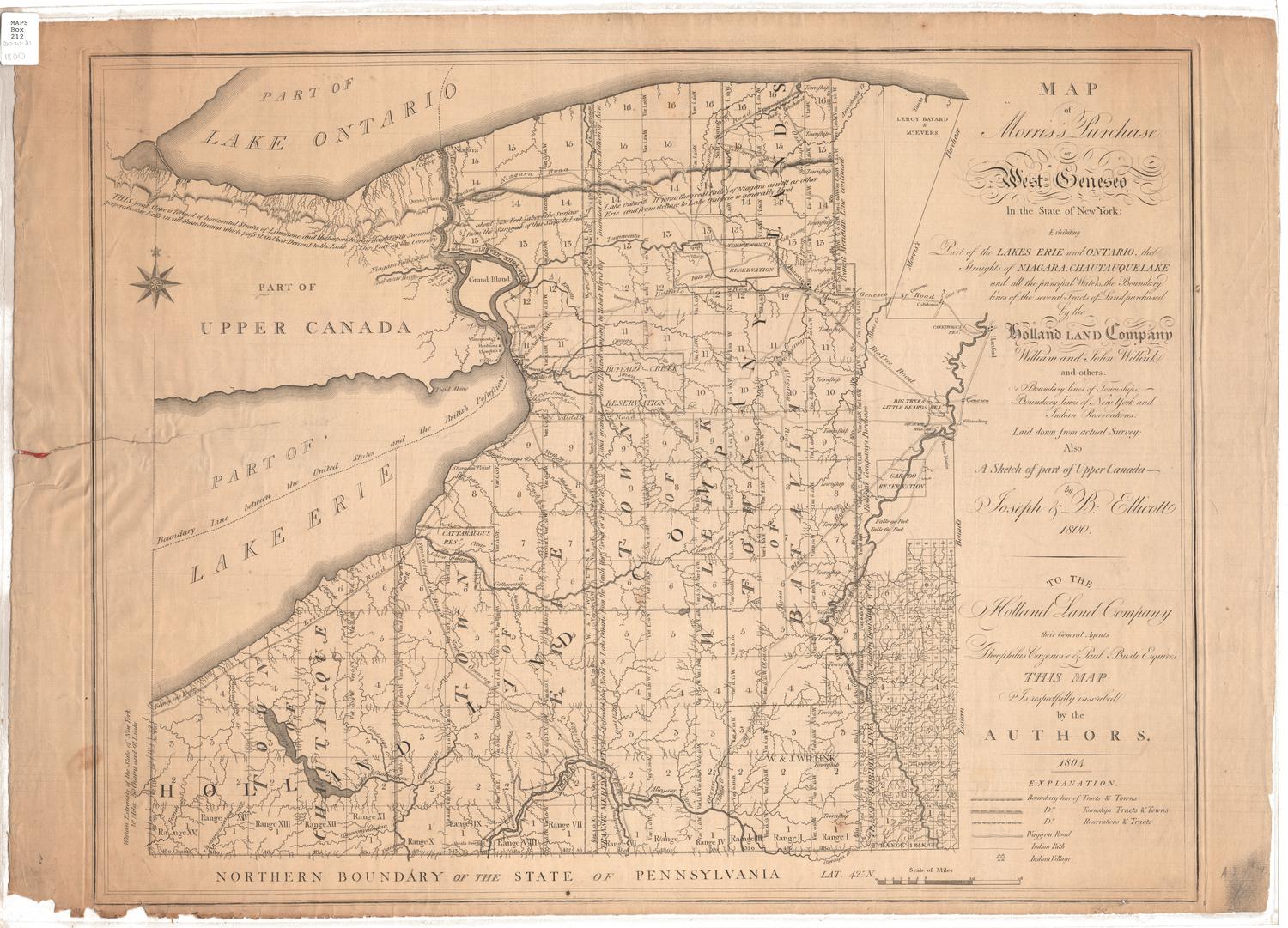
North West Pennsylvania
DraftsmanDrawn by
Moses Warren Jr.
(1762 - 1835)
DateProbably 1796 or 1797
MediumDrawing; black ink and watercolor on paper, backed with Japanese paper
DimensionsPrimary Dimensions (image height x width): 12 1/2 x 14 1/2in. (31.8 x 36.8cm)
Sheet (height x width): 20 5/8 x 16in. (52.4 x 40.6cm)
ClassificationsGraphics
Credit LineGift of Sarah S. Sherman
Object number1964.64.0
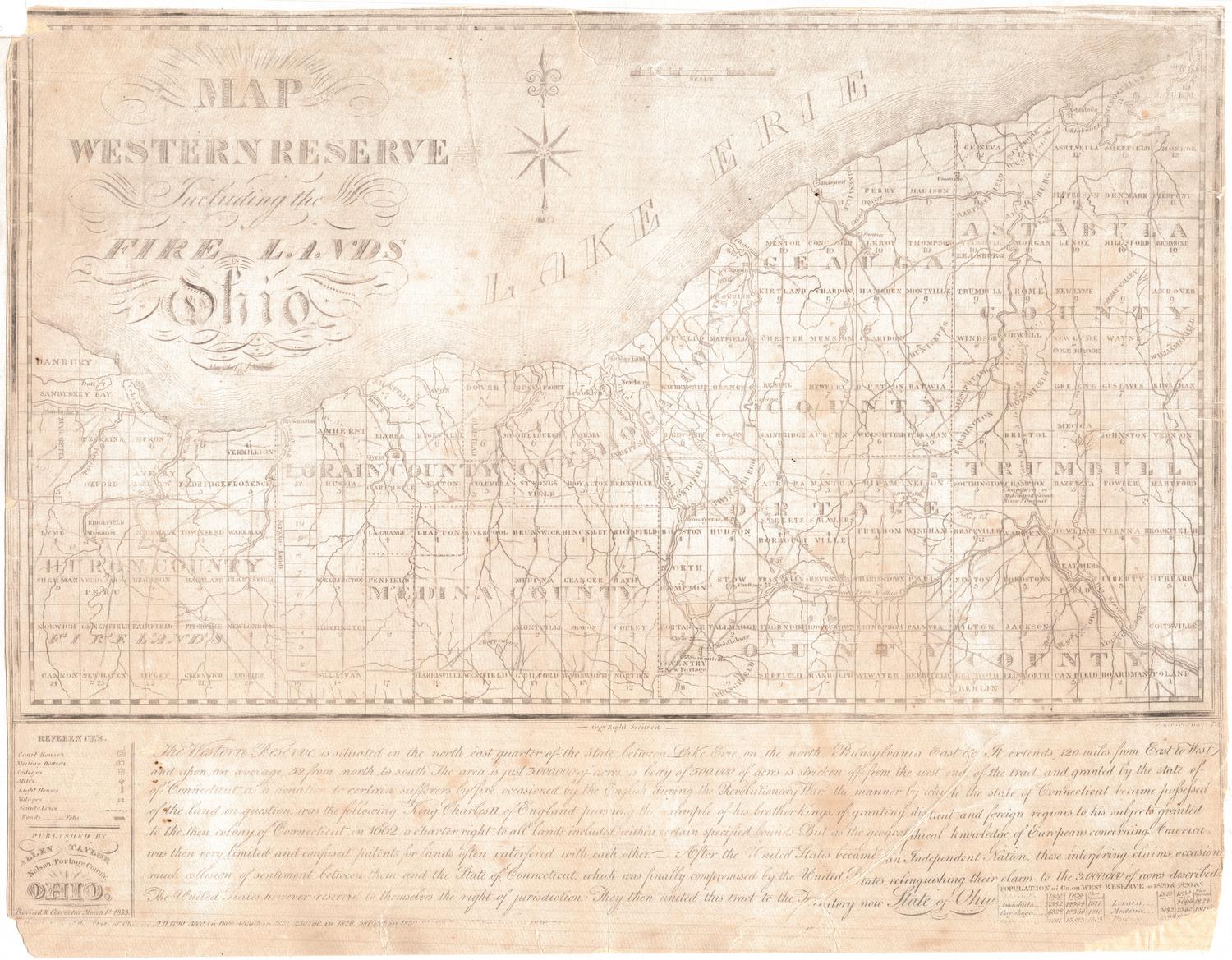
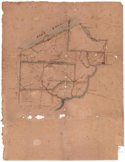
DescriptionMap of northwest Pennsylvania, with Lake Erie to the north, Warren County to the east, the Allegheny River (spelled "Allegany" on the map) to the south, and the Ohio state line and "New Connecticut" to the west. The land is divided into the counties of Erie, Warren, Crawford, Venango and part of Mercer. The towns of Warren, Hartford, Sackettsburgh, Waterford, Erie, Meadville and Franklin are marked with clusters of varying numbers of squares and the town's name. Natural features include the Pennsylania Harbor in Lake Erie, Chataughue Lake, the Allegheny River, French Creek and Connowango Creek. Several roads are depicted, although only a few are labeled: the road to "Buffaloe," a turnpike, the road to Pittsburgh (90 miles, as stated on the map) from Meadville and one from Franklin, and the state road to Philadelphia. In the lower left corner, there is an incomplete legend. It provides the symbols for gristmills, roads and county lines, but not the ones for sawmills, powder mills, fulling mills or curding machines. Along the left edge is a small square circumscribed with a dotted line, labeled "Lebanon."
Label TextThe Connecticut surveyor Moses Warren made two trips west in the 1790s and produced the first maps of the area known as the Western Reserve, then part of Connecticut and later part of Ohio. On one of these trips, he evidently surveyed nearby portions of northwestern Pennsylvania as well. The reason for this survey is not clear. At one time, Connecticut had claimed this territory, basing its claims on its colonial charter, but it had given up these claims in 1786.
NotesCartographic note: 3 1/8 inches equals 20 milesStatus
Not on view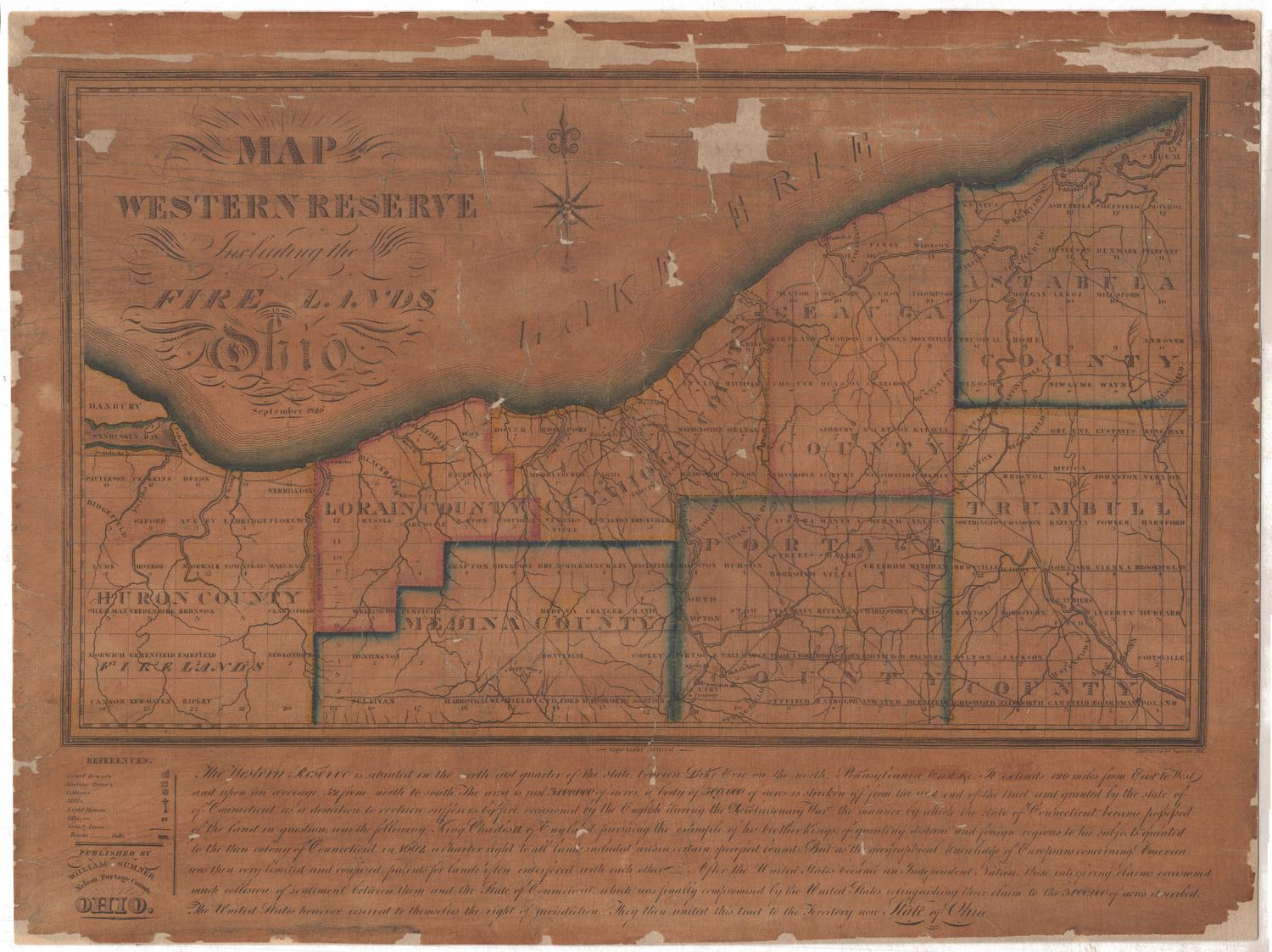

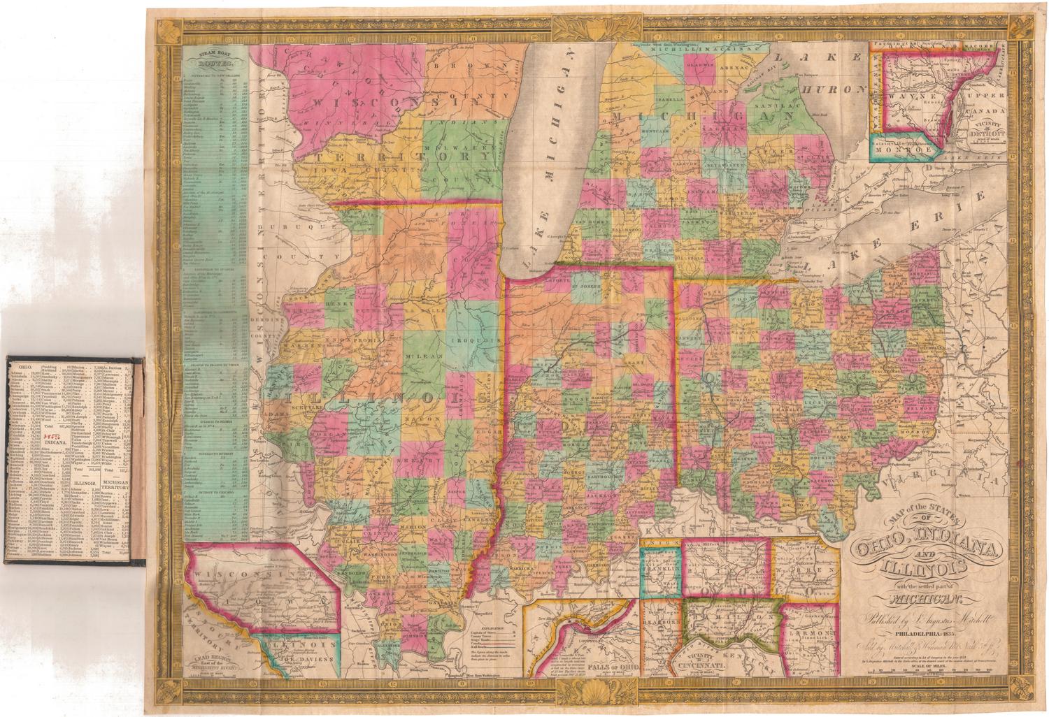
Samuel Augustus Mitchell
1834
Samuel Augustus Mitchell
1835