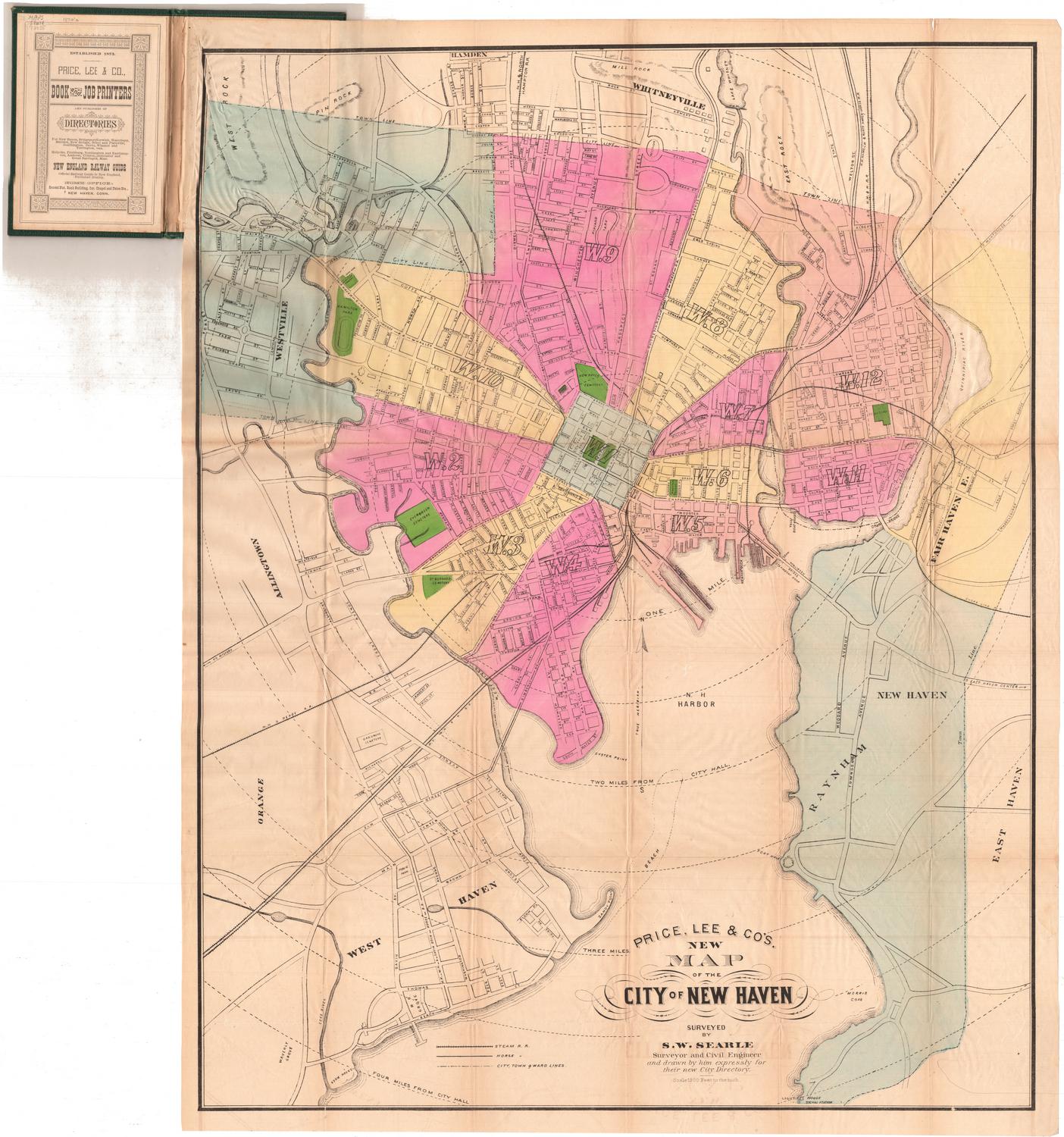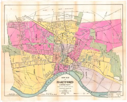
New map of Hartford, Connecticut
PublisherPublished by
L. J. Richards & Co.
(American, founded before 1886)
Date1902
MediumLithograph; black printer's ink and watercolor on wove paper
DimensionsPrimary Dimensions (image height x width): 24 3/4 x 32 1/4in. (62.9 x 81.9cm)
Sheet (height x width): 26 3/4 x 34in. (67.9 x 86.4cm)
Sheet (height x width): 26 3/4 x 34in. (67.9 x 86.4cm)
ClassificationsGraphics
Credit LineConnecticut Museum of Culture and History collection
DescriptionMap of Hartford, Connecticut, with Keney Park to the north, the Connecticut River to the east, Goodwin Park to the south, and the town line of West Hartford to the west. The city is divided into ten wards, each labeled and colored. Parks and cemeteries are colored green. Concentric circles in half-mile increments radiate out from City Hall. Streets are labeled and numbers inscribed in circles indicate the location of fire boxes. Police patrols are denoted by stars and numbers. The New York, New Haven and Hartford; Philadelphia, Reading and New England; and New England Railroad lines are depicted. A variety of street-railroad lines are also included.
Object number2012.312.159
NotesCartographic Note: Scale: 1 inch equals 1000 feetOn View
Not on view