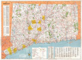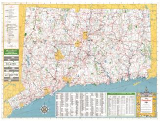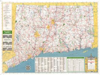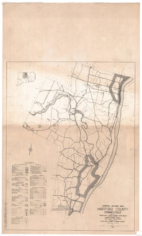
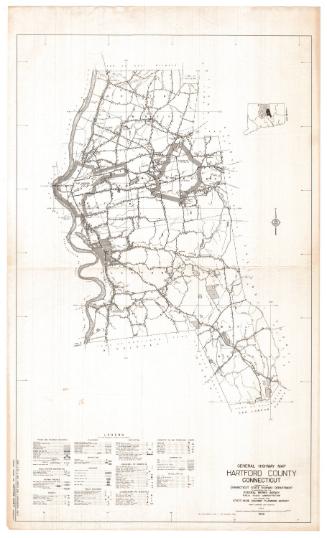
General Highway Map, Hartford County, Connecticut
PublisherPublished by
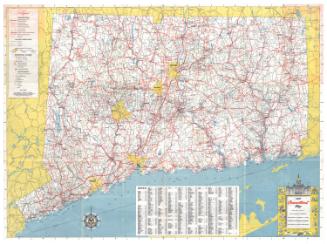
Connecticut State Highway Department
(American, 1895 - 1969)
PublisherPublished by
Federal Works Agency
(American, 1939 - 1949)
Date1938
MediumLithography; black printer's ink on wove paper
DimensionsPrimary Dimensions (image height x width): 22 5/8 x 17 3/8in. (57.5 x 44.1cm)
Sheet (height x width): 31 x 18 1/2in. (78.7 x 47cm)
ClassificationsGraphics
Credit LineConnecticut Museum of Culture and History collection
Object number2012.312.156
DescriptionMap of Windsor and Windsor Locks, in Hartford County, Connecticut, from the town lines of East Granby and Suffield to the north, the Connecticut River to the east, the town line of Hartford to the south, and the town line of Bloomfield and East Granby to the west. Landmarks include Keney Park, the Farmington River and the New York, New Haven and Hartford Railroad line. Highways and roads of various surfaces are prominently featured, with bridges; airways; railroads; drainage systems (streams, rivers, marshes, reservoirs, lakes, etc.); public, private and industrial buildings; and conservation and recreation areas also depicted. The symbols and lines used to denote these features are explained on the legend, located to the left of the map.
Label TextThe state highway system in Windsor and Windsor Locks remains basically unchanged in the twenty-first century, but otherwise these two Connecticut towns have seen enormous changes since this map was produced in 1938. Perhaps the biggest change was due to the construction of the airfield that was later to become Bradley International Airport in Windsor Locks, beginning in 1941. The airport attracted both commercial and residential development, and the open land which appears in the 1938, much of it tobacco fields, became increasingly fragmented. The trolley line, which in 1938 still provided transportation into Hartford, would close in 1940. Interstate-91 would reach Windsor in 1956, providing commuters with a new quick and easy to reach the city and spurring further population growth.
NotesCartographic Note: Scale: 1 inch equals 1/2 mileStatus
Not on view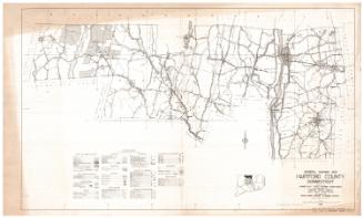

Connecticut State Highway Department
1916