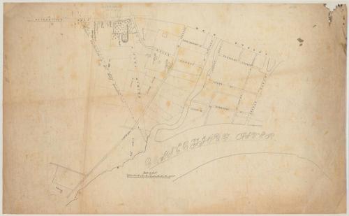
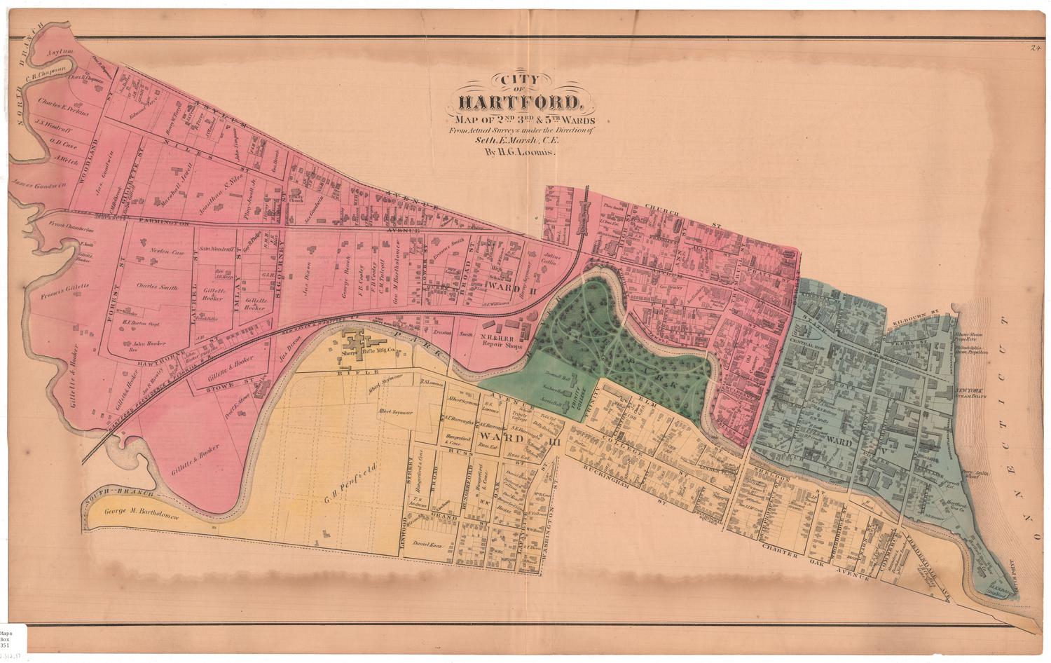
Proposed Extension of the City Limits of Hartford
After a work byAfter a work by
Marcus Smith
(possibly British, born about 1810)
MakerCopied by
Unknown
Dateabout 1854
MediumDrawing; ink and graphite on tracing paper
DimensionsPrimary Dimensions (image height x width): 17 1/2 x 26 1/2in. (44.5 x 67.3cm)
Sheet (height x width): 18 1/8 x 29 3/8in. (46 x 74.6cm)
Sheet (height x width): 18 1/8 x 29 3/8in. (46 x 74.6cm)
ClassificationsGraphics
Credit LineGift of Mrs. E. Sanderson Cushman
DescriptionStreet map of part of Hartford, Connecticut, oriented east-west, with the Connecticut River appearing at the bottom of the sheet. State Street is to the north, the Connecticut River to the east, the proposed extension of the city limits to the south, and Main Street to the west. There are no buildings marked on the streets above Charter; Michael Chauncey's buildings are included south of Charter Street and east of Coles, but most of the buildings included on the map are along Wethersfield Road, near what is now South Green. Solomon Porter's house and estate are presented in greater detail than any of the other structures. Other named residences and businesses that appear on the map are Peter B. Stillman's house, James Ward, a powder house, J.W. Camp, a carpenter's shop, the South Ecclesiastical Society, and H. Barnard's house.
Object number1959.113.1
NotesCartographic Note: Scale: 3 5/8 inches = 1000 feet
Date Note: The map must date from after 1851, when Thatcher's Passway became South Prospect Street, and before 1857, when Armsmear was constructed. It probably dates to the very early 1850s.
Subject Note: Colonel Solomon Porter was was a trader, grocer and banker. His Italianate mansion was constructed around 1850 on Wethersfield Avenue (then Wethersfield Road) and what is now Wyllys Street (then Coles Street). It has since been demolished. Colonel Samuel Colt was one of Porter's neighbors; he built Armsmear in 1857. This area of Hartford was quite fashionable in the mid-nineteenth century, and is now considered the South Green Historic District.
From http://www.livingplaces.com/CT/Hartford_County/Hartford_City/South_Green_Historic_District.html
On View
Not on view


Object/Object