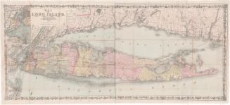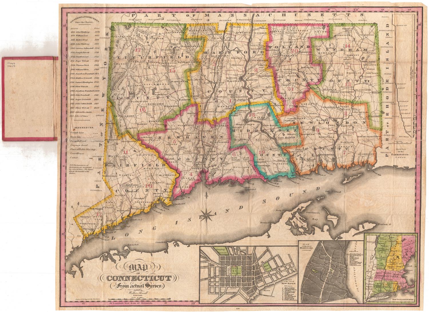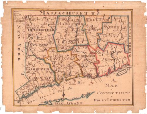
A Map of Connecticut
DraftsmanDrawn by
Polly Ludington
(American, born 1799)
Dateabout 1813
MediumDrawing; black ink and watercolor on wove paper
DimensionsPrimary Dimensions (image height x width): 13 x 16in. (33 x 40.6cm)
Sheet (height x width): 15 x 19 3/8in. (38.1 x 49.2cm)
Mount (height x width): 15 x 19 3/8in. (38.1 x 49.2cm)
ClassificationsGraphics
Credit LineGift of Mrs. George Potter
Object number1954.33.0
DescriptionA map of the state of Connecticut, divided into eight counties, with the border of Massachusetts to the north, Rhode Island to the east, the Long Island Sound to the south, and New York to the west. The legend in the top left provides explanations for the depictions of cities, court houses, meeting houses, roads, mountains and "remarkable hills," and county lines. Towns, cities, rivers, and islands are labeled. Meeting houses and court houses are represented by small building symbols. Elevation is conveyed with hachure marks.
Label TextThe study of geography played an important part in the education of children during the nineteenth century. The copying of printed maps was one way that Connecticut schoolgirls and schoolboys learned about the physical features of the earth, the North American continent, and their own state. Polly Ludington's map of Connecticut is closely based on an engraved map of Connecticut by the New Haven artist Amos Doolittle, first published in 1795. Like Doolittle, she indicated the location of courthouses, churches ("and other houses of public worship"), roads, hills, and mountains. Copying this map would have taught Polly a lot about her state.
A woman named Polly Ludington was born in Bethlehem, Connecticut on August 21, 1799. She married Colonel Seymour Knapp in January 1818, when she was nineteen years old. Colonel Knapp had previously been married to her older sister Betsey, who died in September 1817, after three years of marriage. It is not certain that this Polly Ludington drew the map, but the name is not common and the dates seem appropriate.
NotesCartographic Note: No scaleA woman named Polly Ludington was born in Bethlehem, Connecticut on August 21, 1799. She married Colonel Seymour Knapp in January 1818, when she was nineteen years old. Colonel Knapp had previously been married to her older sister Betsey, who died in September 1817, after three years of marriage. It is not certain that this Polly Ludington drew the map, but the name is not common and the dates seem appropriate.
Status
Not on view