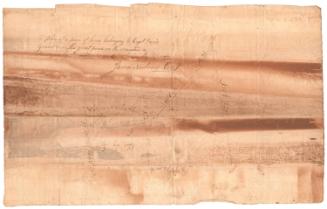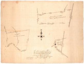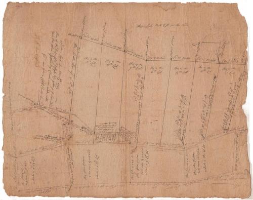
Land in Windham County, probably owned by Captain Joseph Kingsbury
SurveyorSurveyed by
Gideon Cobb
(American, active 1763)
Date1763
MediumDrawing; black ink on paper
DimensionsPrimary Dimensions (image height x width): 25 3/4 x 20 5/8in. (65.4 x 52.4cm)
Sheet (height x width): 25 3/4 x 20 5/8in. (65.4 x 52.4cm)
ClassificationsGraphics
Credit LineMuseum purchase
Object number1952.96.0
DescriptionMap of a number of lots of land in Windham County, Connecticut, with distance measurements in rods and area in acres. Several trees are depicted with little sketches and notes about what species of tree they were. The West Brook is shown on the left side of the map.
Label TextThe Kingsbury family settled in Ipswich and Haverhill, Massachusetts in the seventeenth century. By the early 1700s several family members were living in Connecticut and gained prominence there. At least two Joseph Kingsburys were Captains in the local militia. It's possible that the Joseph Kingsbury referred to on this map was Captain Joseph Kingsbury (1682-1757) of Norwich, Connecticut. That Captain Kingsbury owned land in Windham County that he left to his sons in his will. However, the inscription on the map seems to suggest that Kingsbury was still alive in 1763. when the map was made by Windham County surveyor Gideon Cobb.
NotesCartographic Note: No scaleStatus
Not on view