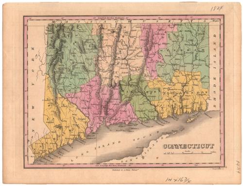
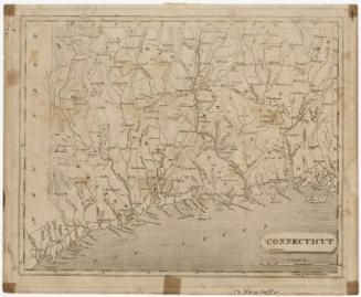
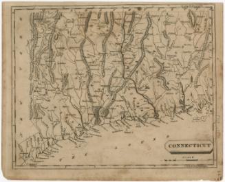
Connecticut
PrintmakerEngraved by
Young & Delleker
(American, 1822 - 1823)
PublisherPublished by
Anthony Finley
(American, 1790 - 1840)
Dateabout 1835
MediumEngraving; black printer's ink and watercolor on paper
DimensionsPrimary Dimensions (image height x width): 8 5/8 x 11 1/4in. (21.9 x 28.6cm)
Platemark (height x width): 9 3/4 x 12 1/4in. (24.8 x 31.1cm)
Sheet (height x width): 10 1/4 x 13 3/8in. (26 x 34cm)
ClassificationsGraphics
Credit LineMuseum purchase
Object number1942.18.0
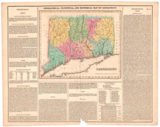
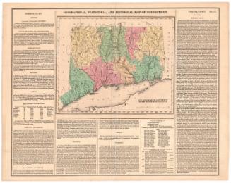
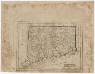
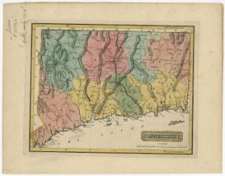
DescriptionMap of Connecticut, with Massachusetts to the north, Rhode Island to the east, part of Long Island and the Long Island Sound to the south, and New York to the west. The state is divided into counties, labeled and delineated with dotted lines. Population centers appear to be denoted with open circles. Elevation is depicted with clusters of peaks. Local roads are shown. Many small rivers are shown in addition to the Connecticut, Housatonic, Thames and Quinebaug Rivers. Harbors, points, islands, reefs, lakes and ponds are also depicted.
Label TextThis map was originally published in Anthony Finley's New General Atlas, issued in Philadelphia in 1824. Though Philadelphia would later become a major center of map production, in the 1820s, many cities were issuing maps and atlases, and competition must have been intense. Finley's Atlas was favorably received, however, and went through numerous later editions.
NotesCartographic Note: Scale: 1/2 inch equals just under 5 milesStatus
Not on view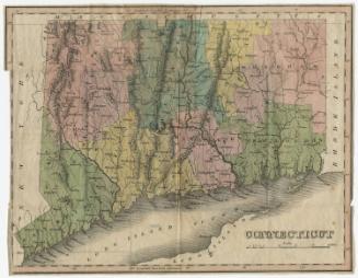


Object/Object