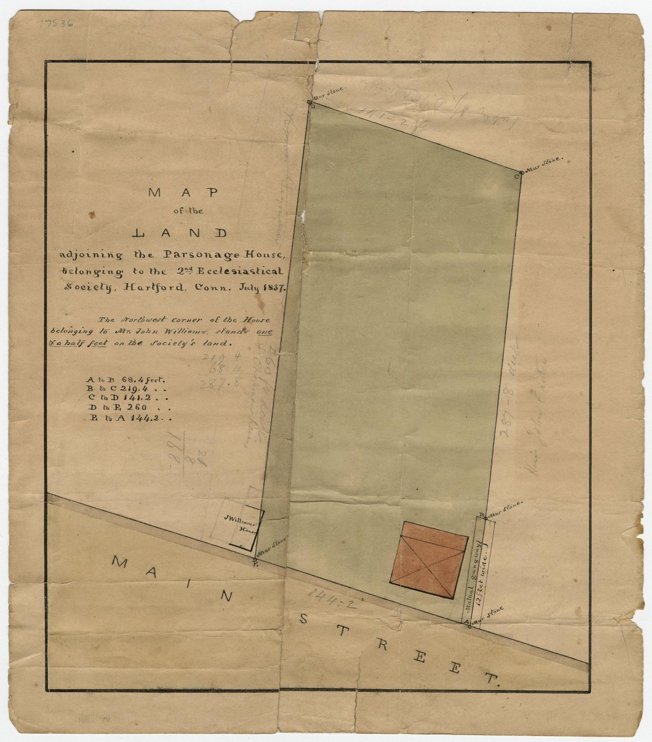
Map of the Land adjoining the Parsonage House belonging to the Second Ecclesiastical Society
SurveyorPossibly surveyed by
Nathaniel Goodwin
(American, 1782 - 1855)
Date1837
MediumDrawing; black ink and watercolor on wove paper
DimensionsPrimary Dimensions (image height x width): 9 15/16 x 8 9/16in. (25.2 x 21.7cm)
Sheet (height x width): 11 3/8 x 10in. (28.9 x 25.4cm)
ClassificationsGraphics
Credit LineGift of Mrs. Flavel S. Luther
Object number1915.6.2
DescriptionPlat of land on Main Street in Hartford, Connecticut, that belonged to the Second Ecclesiastical Society. At the bottom left corner of the land is John Williams' house, which encroaches on the Society's land by one and a half feet, as noted in an inscription. In the bottom right corner is another building, which is not labeled. In each of the corners of the property and the "mutual gangway," there is a square with the inscription "Mur stone" next to it.
Label TextThe house of John Williams, at the left, is clearly shown encroaching on the property of the parsonage of the Second Ecclesiastical Society--the Second Congregational Church--of Hartford, Connecticut. Williams was a cordwainer, or shoemaker; his house was located on the west side Main Street in the South End of Hartford. It seems possible that this map was drawn to help settle a boundary dispute.
NotesCartographic Note: No scaleStatus
Not on view
Erastus Worthington
1907
William C. Stanton
1848