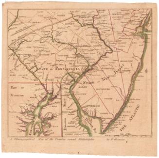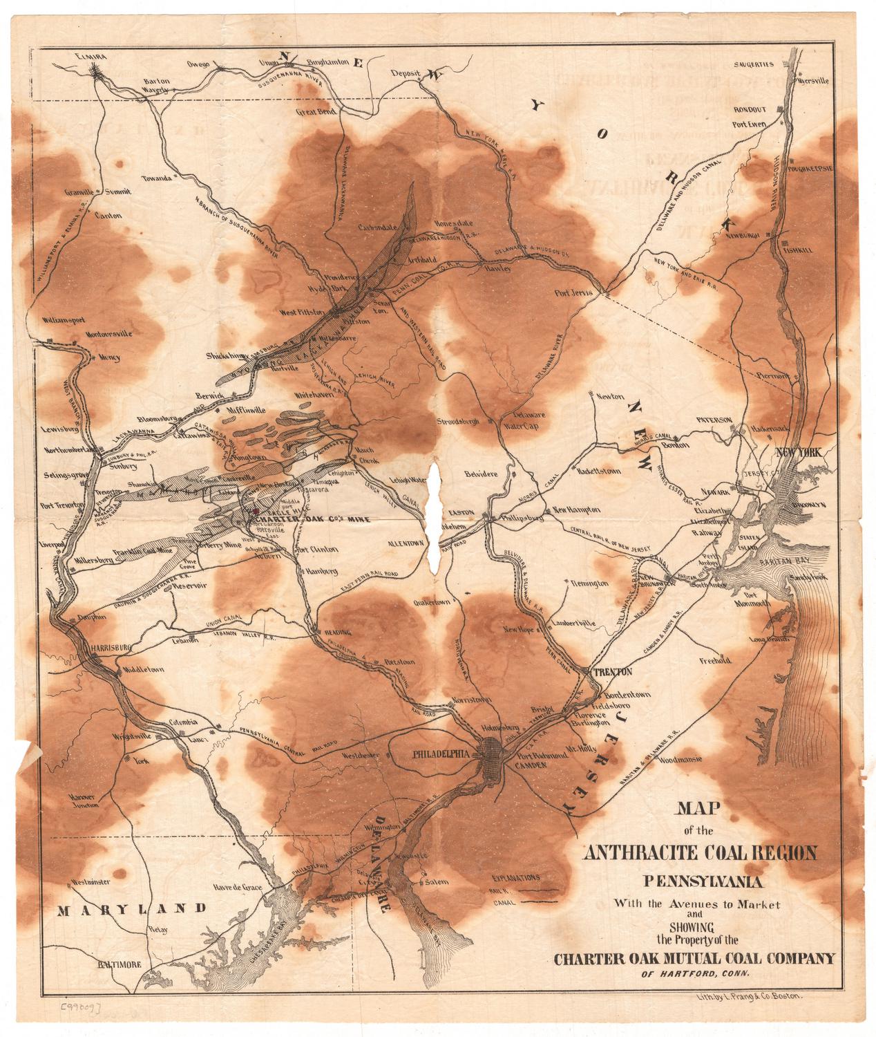
Map of the Anthracite Coal Region, Pennsylvania
PrinterPrinted by
L. Prang & Co.
(American, 1861 - 1899)
PublisherProbably published by
Charter Oak Mutual Coal Company
(American, 1865 - 1866)
Date1865
MediumLithography; black pritner's ink on wove paper
DimensionsPrimary Dimensions (image height x width): 15 7/8 x 13 1/2in. (40.3 x 34.3cm)
Sheet (height x width): 16 7/8 x 14 1/4in. (42.9 x 36.2cm)
Sheet (height x width): 16 7/8 x 14 1/4in. (42.9 x 36.2cm)
ClassificationsGraphics
Credit LineConnecticut Museum of Culture and History collection
DescriptionMap of northeastern Pennsylvania's coal region, from the border of New York to the north, New Jersey to the east, Delaware to the south, and the Susquehanna Canal to the west. Local coal mines are shown, particularly the location of the Charter Oak Mutual Company's mine, which is marked with a red box. The Sunbury and Philadelphia; Dauphin and Susquehanna; Philadelphia and Reading; Philadelphia, Wilmington and Baltimore; East Pennsylvania; North Pennsylvania; Belvidere and Delaware; Philadelphia and Trenton; Raritan and Delaware; Camden and Amboy; Centrail Roalroad of New Jersey; Delaware, Lackawanna and Western; and the New York and Erie Railroads are all shown. The Susquehanna River and Canal, the Chesapeake and Raritan Bays and the Delaware Bay and River are shown, as well.
Object number2005.183.0
NotesCartographic Note: No scaleOn View
Not on view