Rail Road Map of New England, Canada & Eastern N.Y. Compiled from the most authentic sources
DraftsmanDrawn by
J. H. Goldthwait
(American)
PublisherPublished by
Redding & Co.
(American, founded before1843)
Date1850
MediumLithography; black printer's ink and watercolor on paper
DimensionsPrimary Dimensions (image height x width): 24 x 19 3/4in. (61 x 50.2cm)
Sheet (height x width): 26 5/8 x 20 5/8in. (67.6 x 52.4cm)
ClassificationsGraphics
Credit LineConnecticut Museum of Culture and History collection
Object number2012.312.147
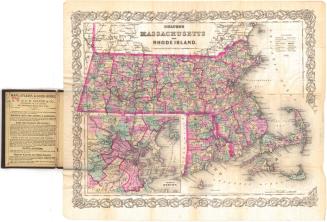
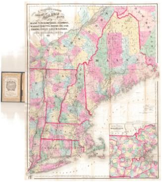
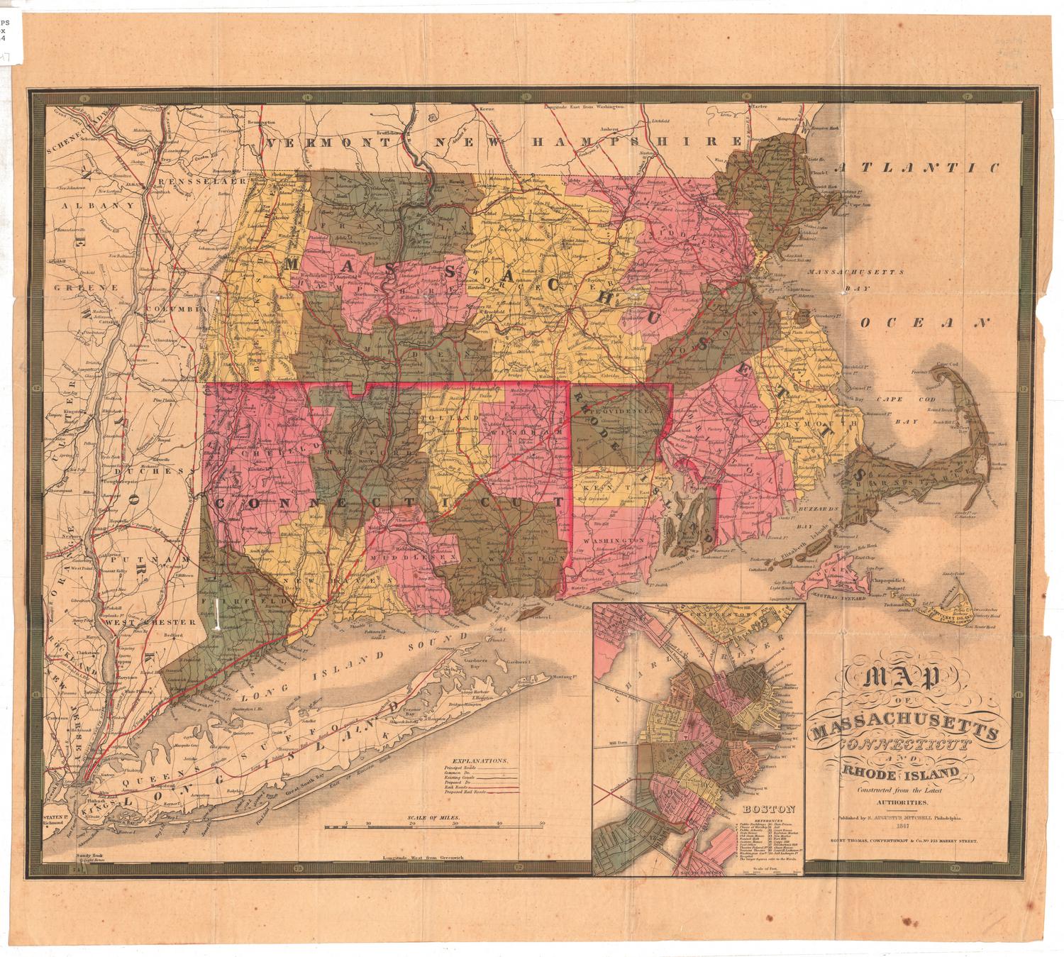
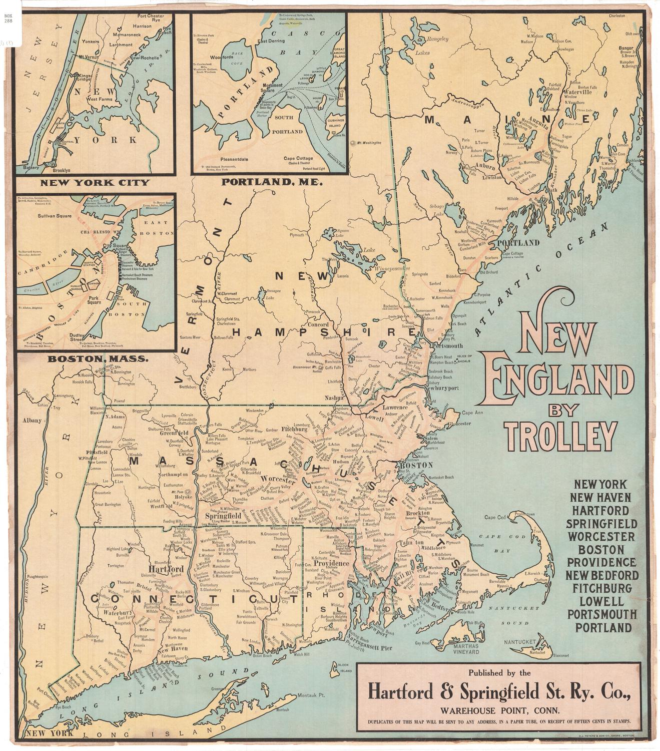
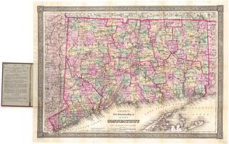
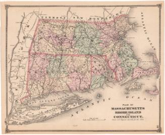
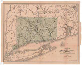
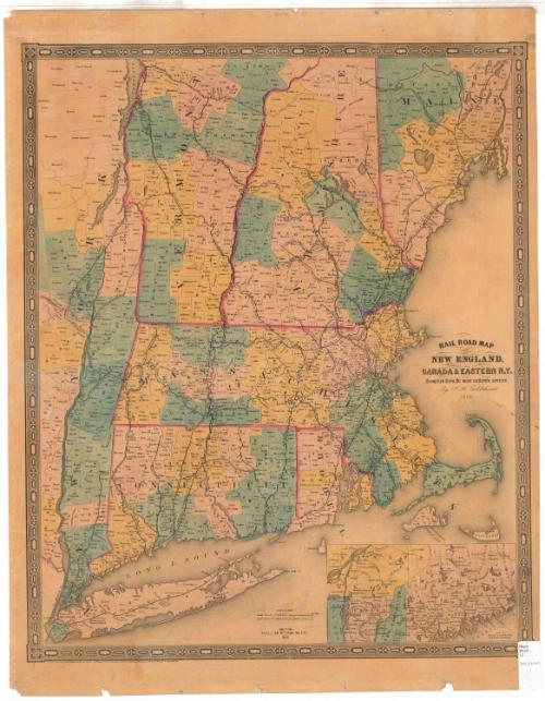
DescriptionMap of the New England states and part of New York State along the Hudson River. An inset map in the lower right corner depicts northern New England and part of Quebec. The state borders are outlined in pink and are further divided into counties, labeled and colored pink, blue or yellow; and towns, labeled and outlined in solid lines. The railroad lines depicted on the map include the Long Island; New York and New Haven; New Haven and Hartford; Canal; Housatonic; Naugatuck; Norwich and Worcester; Stonington; Harlem; Berkshire; Western; Connecticut River; Massachusetts; Providence and Worcester; Bedford and Taunton; Boston and Worcester; Fitchburg; Boston and Lowell; New Hampshire Central; Rutland; Portland, Saco and Portsmouth; St. Lawrence and Atlantic; Vermont Central; and Washington and Saratoga Railroads.
Label TextThe earliest commercial railroad in New England was a tramroad constructed in Quincy, Massachusetts in 1826. It used horse power to haul cars loaded with granite four miles from the quarry to a nearby river. Experimentation with steam locomotion also began in the 1820s, but the first railroads with steam locomotives were not built until the 1830s. These included the Hartford & New Haven, the Norwich & Worcester, and the Stonington Railroads, all chartered in 1832 and completed by the end of the decade. This 1850 map shows the extraordinary growth of New England's railroads during the next twenty years. The impact of this new means of transportation was enormous, facilitating the movement of people and goods, improving commmunications, and opening up new markets.
NotesCartographic Note: Scale: About 1 inch equals 10 milesBibliographic Note: An 1849 edition of this map is illustrated in DavidRumsey.com. That map is a folding pocket map, a format that would have been especially useful to railroad travelers.
Status
Not on view