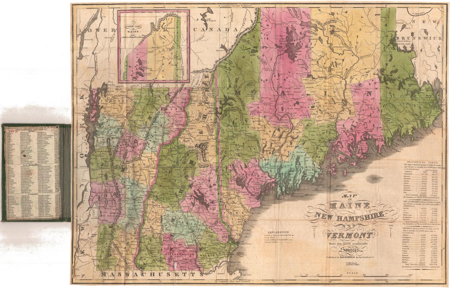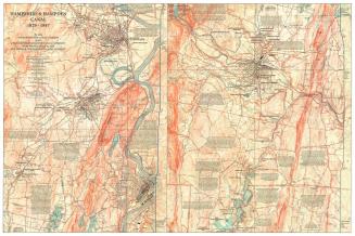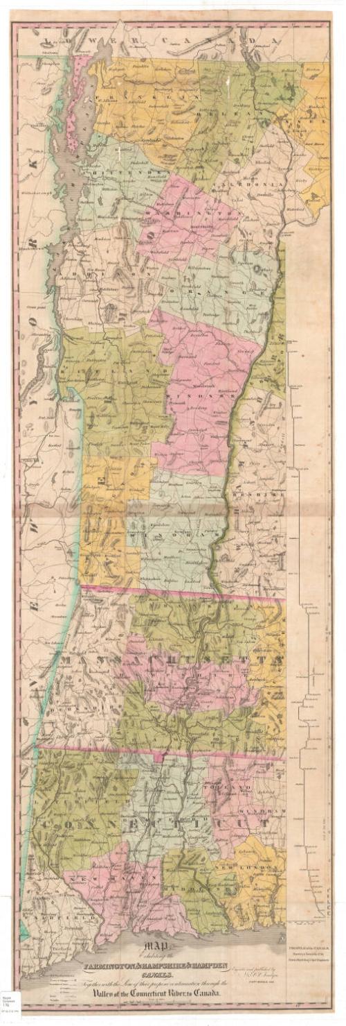
Map Exhibiting the Farmington & Hampshire & Hampden Canals, Together with the Line of their proposed continuation through the Valley of the Connecticut River, to Canada.
SurveyorSurveyed by
Davis Hurd
(American, 1788 - 1868)
PrintmakerEngraved by
N. & S. S. Jocelyn
(American, founded 1818)
PublisherPublished by
N. & S. S. Jocelyn
(American, founded 1818)
Date1828
MediumEngraving; black printer's ink and watercolor on wove paper
DimensionsPrimary Dimensions (image height x width): 48 1/4 x 15 5/8in. (122.6 x 39.7cm)
Sheet (height x width): 49 1/8 x 15 7/8in. (124.8 x 40.3cm)
ClassificationsGraphics
Credit LineConnecticut Museum of Culture and History collection
Object number2012.312.144
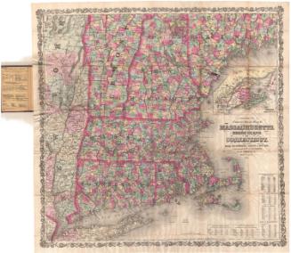
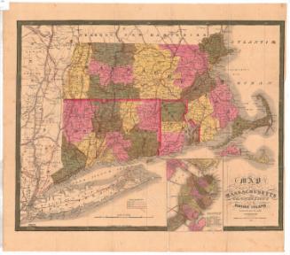
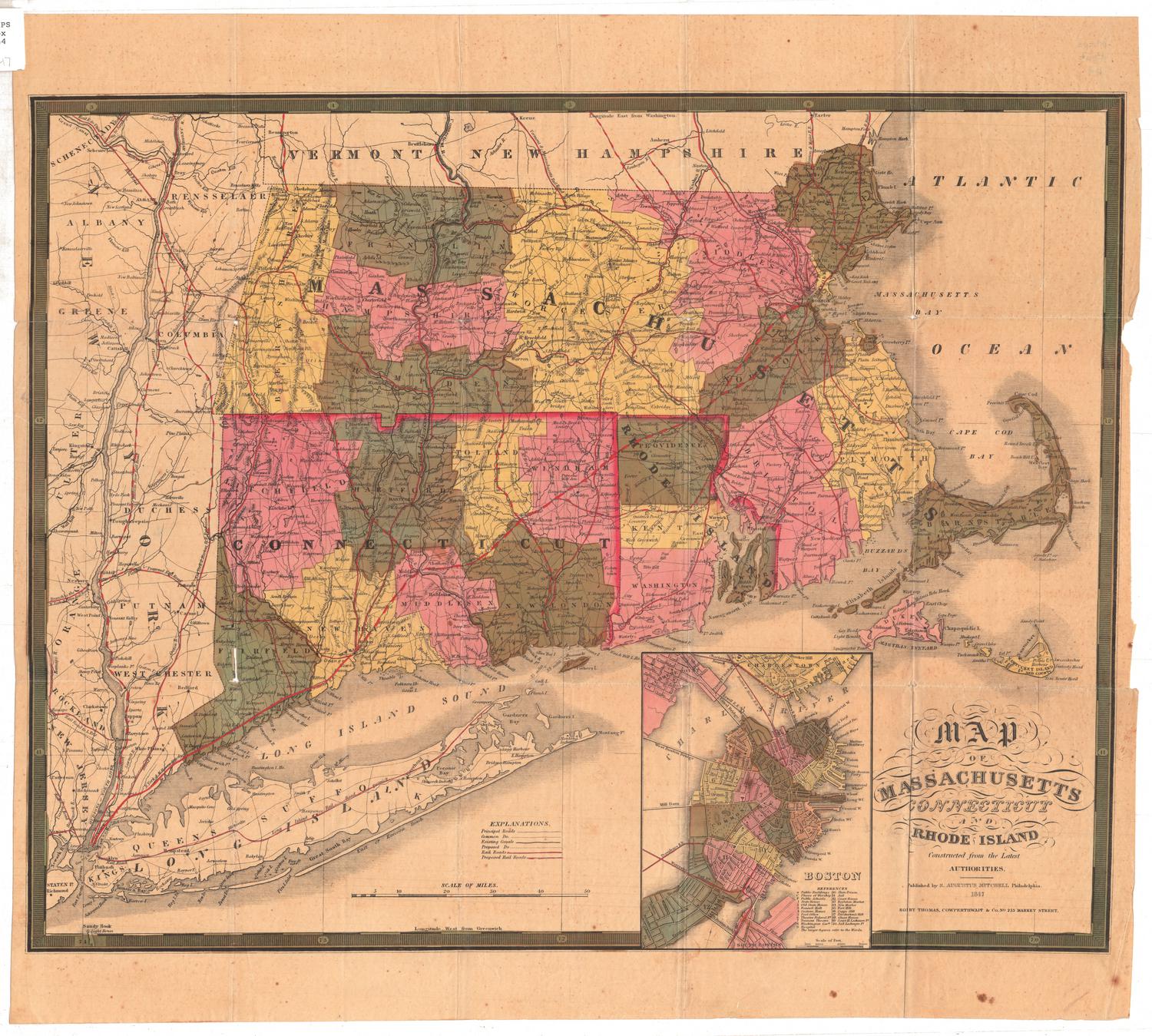
DescriptionMap of the western New England states, from the Vermont-Canada border to the north, the border of New Hampshire to the east, the Long Island Sound to the south, and New York State to the west. The Farmington Canal and Hampshire and Hampden Canal are shown running through Connecticut and Massachusetts, with their proposed continuation through New Hampshire and Vermont to the border with Canada. To the right of the map there is an elevation profile of the canals. Other waterways, such as the Connecticut River, are shown, as are mountains, conveyed through hachure marks, and lakes. The states are divided into counties and towns, both delineated with lines that are defined in the Explanation list. Population centers are shown as clusters of small closed squares, and turnpikes and local roads are also depicted.
Label TextIn 1828 when this map was issued, the Farmington Canal was still a work in progress, open from New Haven only as far as Farmington, Connecticut. Contruction on the canal began in 1825, and the canal was completed all the way to Northampton, Massachusetts ten years later, in 1835. In the period just before the railroads, canals seemed to promise an efficient means for transporting good and people in areas where there were no navigable rivers. The Erie Canal, which opened to great acclaim in 1825, ran for over three hundred miles from Albany to Buffalo, New York. Davis Hurd, the chief engineer on the Farmington Canal, had previously worked on the Erie Canal, and would return to work on that canal after the Farmington Canal was completed. Never a financial success, the Farmington Canal was replaced by a railroad in 1848.
NotesCartographic Note: Scale: About 1/2 inches equals 3 milesStatus
Not on view