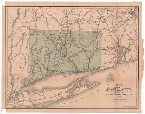
Map of the railroads of Connecticut to accompany the report of the Railroad Commissioners
MakerMade by
Samuel D. Tilden
(American, 1828 - 1893)
PrintmakerLithographed by
Bingham & Dodd
(1860 - 1878)
PublisherPublished by the
Board of Railroad Commissioners
(American, 1854 - 1911)
Date1879
MediumLithography; black and green printer's inks on wove paper
DimensionsPrimary Dimensions (image height x width): 21 1/8 x 27in. (53.7 x 68.6cm)
Sheet (height x width): 22 3/4 x 28 1/4in. (57.8 x 71.8cm)
ClassificationsGraphics
Credit LineConnecticut Museum of Culture and History collection
Object number2012.312.139
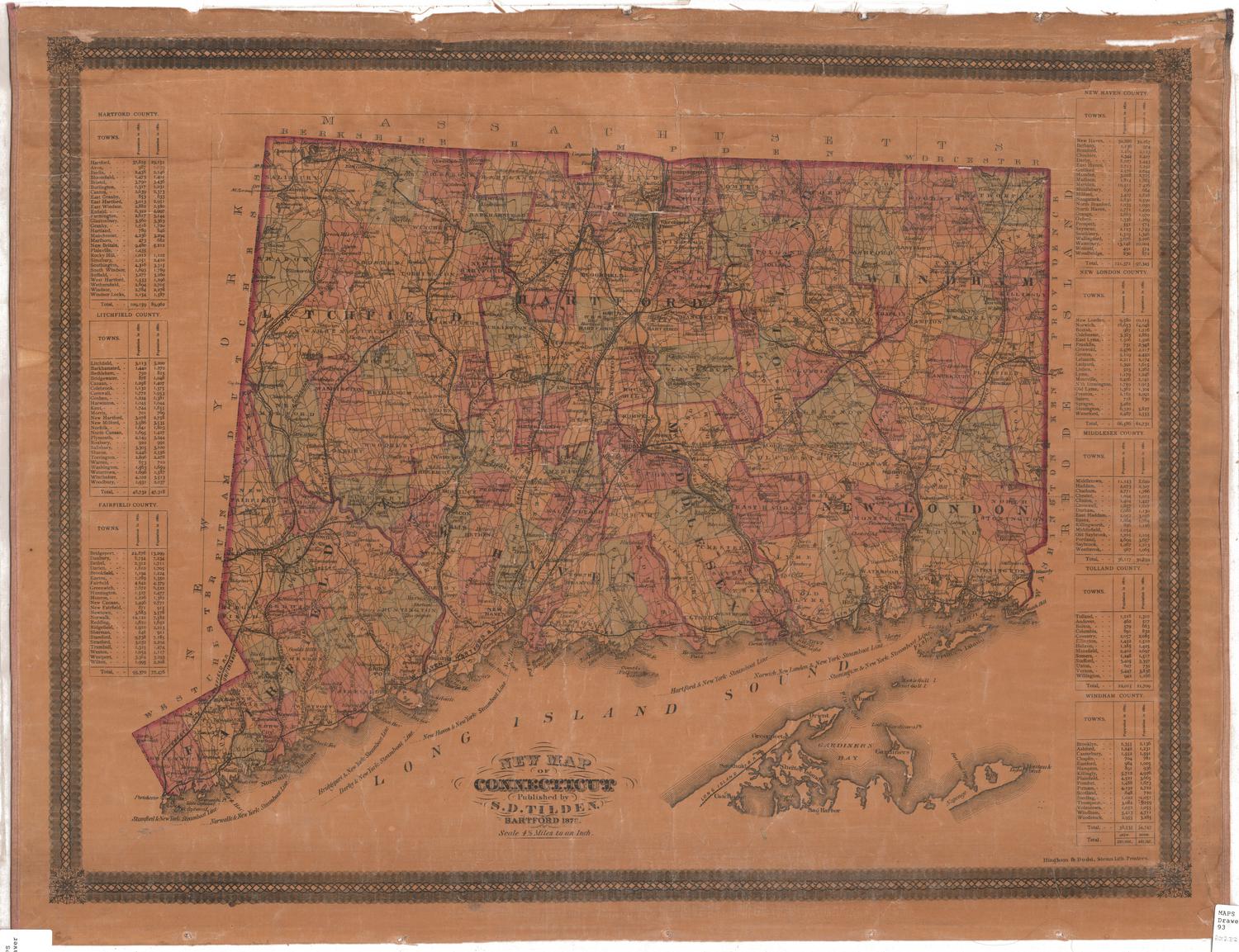
DescriptionMap of Connecticut, from Massachusetts to the north, Rhode Island to the east, Long Island and the Long Island Sound to the south, and New York to the west. It shows the railroad lines in the state: New York, New Haven and Hartford; Danbury and Norwalk; Housatonic; New Haven and Northampton; Boston and New York Air Line; Naugatuck; Connecticut Western; Connecticut Central; Connecticut Valley; New London Northern; Norwich and Worcester; New York and New England; and New York, Providence and Boston Railroads. Most of the railroads are denoted with solid black lines, but some have broken solid lines, which might indicate lines not yet built. The railroads in the surrounding states are also labeled.
Label TextThe Railroad Commissioners issued regular reports on the state of Connecticut's railroads to the Connecticut State Legislature. This map, which accompanied their 1879 report, appears to be identical with the map that accompanied the 1878 report, except that the tint block is a differnt color, so that Connecticut appears green rather than tan. Apparently the maps were intended simply to show the locations of the different railroad lines, both existing and projected. For example, the Ridgefield & New York Railroad, which appears on both maps, connecting Ridgefield, Connecticut with New York City, was never completed. The company was organized in 1867 and granted a charter that same year, but though considerable work was done and nearly $300,000 was spent, the project was ultimately abandoned.
NotesCartographic Note: Scale: 1 inch equals 6 milesStatus
Not on view


Kellogg & Bulkeley
1910-1915