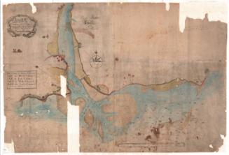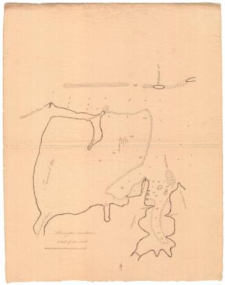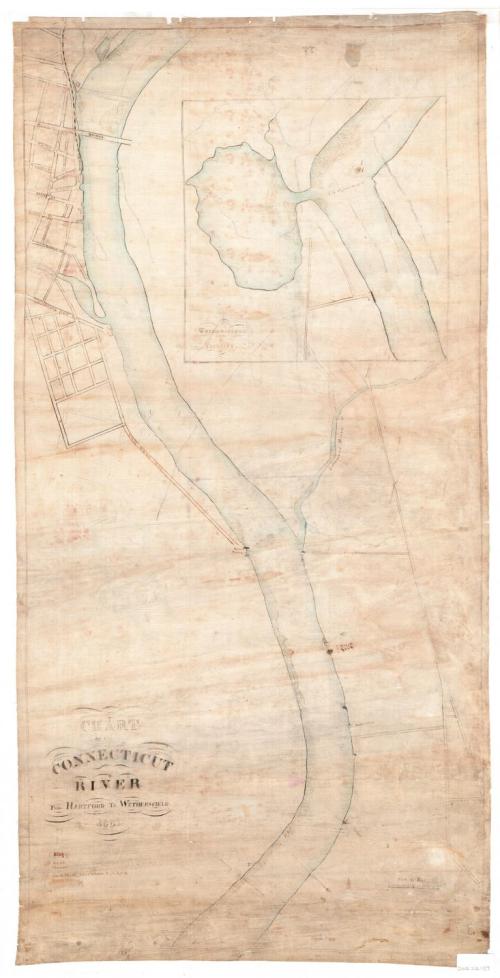
Chart of the Connecticut River from Hartford to Wethersfield
SurveyorSurveyed by
Unknown
DraftsmanDrawn by
Unknown
Date1867
MediumDrawing; black ink and watercolor on linen
DimensionsPrimary Dimensions (image height x width): 36 1/2 x 18 1/8in. (92.7 x 46cm)
Sheet (height x width): 37 1/4 x 18 7/8in. (94.6 x 47.9cm)
Sheet (height x width): 37 1/4 x 18 7/8in. (94.6 x 47.9cm)
ClassificationsGraphics
Credit LineConnecticut Museum of Culture and History collection
DescriptionChart of the Connecticut River and the rocks, shoals and channels in it, from Hartford to Wethersfield, Connecticut. The streets of Hartford near the river are delineated and some of them are labeled. The Morgan Street bridge is also depicted. To the right of the map at the top, there is an inset showing Wethersfield Cove and the adjoining river. Below the title is a references list explaining the symbols used to depict rocks, shoals and channels.
Object number2012.312.137
NotesCartographic Note: Scale: 1 inch equals 500 feet
Subject Note: The river identified on this map as "Solomon's River," is--and was--more commonly known as the Hockanum River. Both names were in use during the nineteenth century, but the name "Hockanum River" was used more frequently.On View
Not on view