
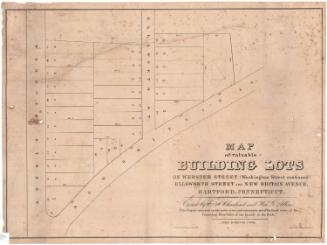
Town of West Hartford, West Hartford Center Section
PublisherPublished by
Frederick C. Rockwell
(American, 1855 - 1928)
Dateafter 1891
MediumLithography; black printer's ink and watercolor on wove paper
DimensionsPrimary Dimensions (image height x width): 20 x 30in. (50.8 x 76.2cm)
Sheet (height x width): 22 3/4 x 32 1/2in. (57.8 x 82.6cm)
Sheet (height x width): 22 3/4 x 32 1/2in. (57.8 x 82.6cm)
ClassificationsGraphics
Credit LineConnecticut Museum of Culture and History collection
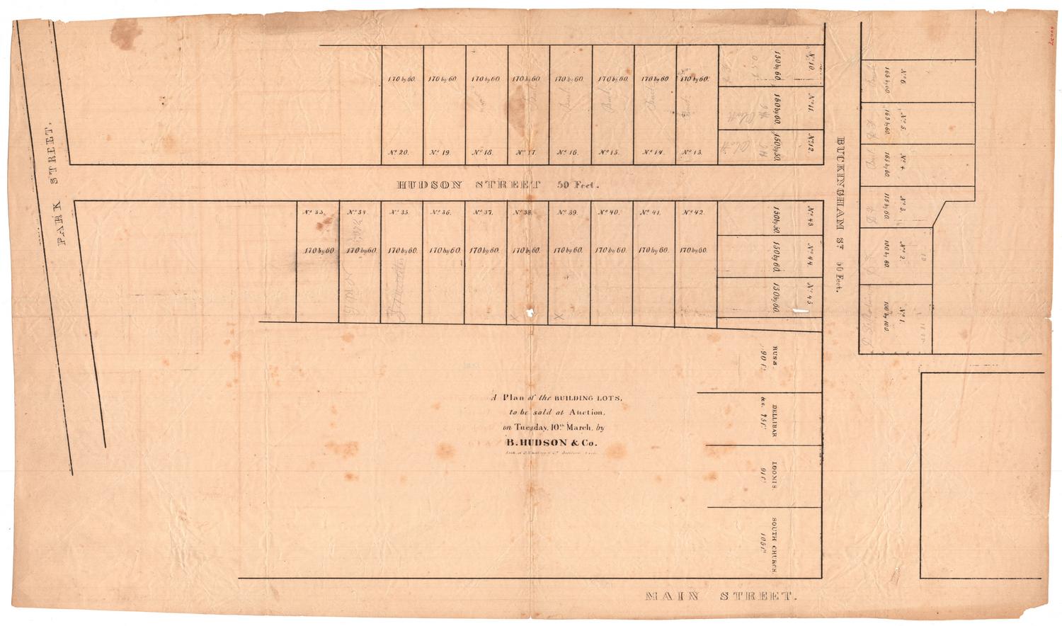
DescriptionMap of part of West Hartford, Connecticut, from Fern Street to the north, Quaker Lane to the east, Park Street to the south, and Fairview Cemetery to the west. Trout Brook runs through it. Real estate is shown, with lots of land labeled with the owners names and showing buildings of various materials and uses. Two plats, subdivided into numbered lots that Fred C. Rockwell was selling, are depicted at the bottom. There is a street railroad on Farmington Avenue.
Object number2012.312.130
NotesCartographic Note: 1 inch equals 300 feet
Date Note: The notations "estate of Erastus Gilbert" and "Gilbert Heirs" appear on the map. Erastus Gilbert died in 1891, leaving extensive real estate holdings.On View
Not on view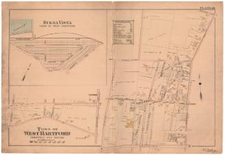
The Connecticut Company
D. W. Kellogg & Co.
1830-1840