Ridgefield, Connecticut
PrinterPrinted by
Unknown
Dateafter 1882
MediumLithography; black printer's ink on laid paper, on Japanese paper
DimensionsPrimary Dimensions (image height x width): 19 7/8 x 24 1/8in. (50.5 x 61.3cm)
Sheet (height x width): 19 7/8 x 24 1/8in. (50.5 x 61.3cm)
Mount (height x width): 19 7/8 x 24 1/8in. (50.5 x 61.3cm)
Sheet (height x width): 19 7/8 x 24 1/8in. (50.5 x 61.3cm)
Mount (height x width): 19 7/8 x 24 1/8in. (50.5 x 61.3cm)
ClassificationsGraphics
Credit LineConnecticut Museum of Culture and History collection
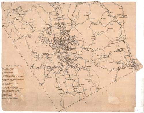
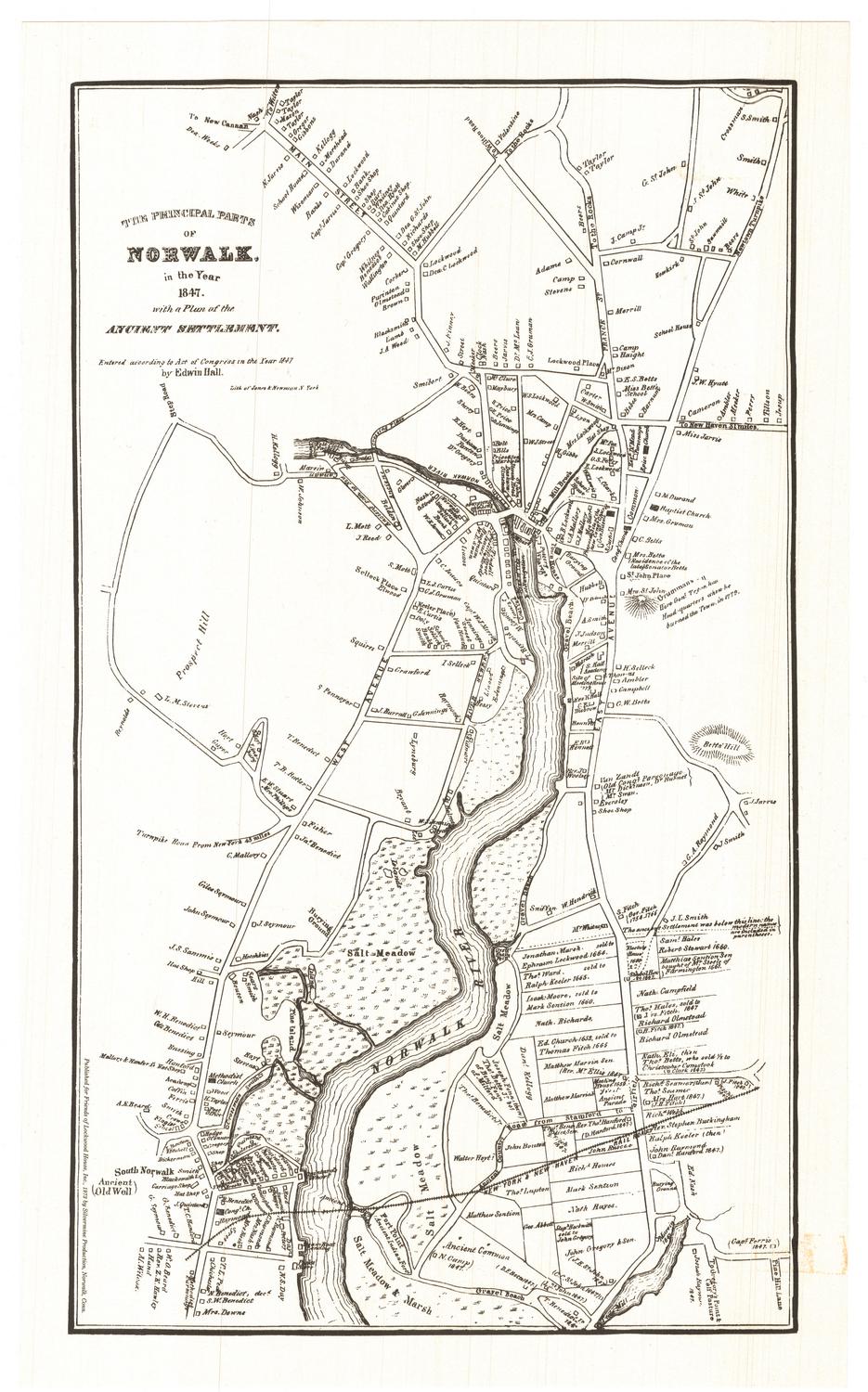
DescriptionMap of part of Ridgefield, Connecticut, extending from Round Pond to the north, Branchville to the east, the town line of Wilton to the south, and the state border of New York to the west. Residences and businesses are marked on the map with black squares, next to which are the owners' names. Some, but not all, of the roads are labeled. The Ridgefield branch of the New York, New Haven and Hartford Railroad runs east-west to the station in Branchville, and the Norwalk River runs north-south through Branchville.
Object number2012.312.129
NotesCartographic Note: No scale
On View
Not on view
Silvermine Production
1973