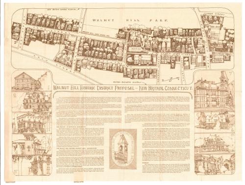
Walnut Hill Historic District Proposed - New Britain, Connecticut
DraftsmanProbably drawn by
Kenneth A. Larson
(American, 1947 - 1994)
Date1974
MediumOffset lithography; brown ink on wove paper
DimensionsPrimary Dimensions (image height x width): 17 3/4 x 23 1/2in. (45.1 x 59.7cm)
Sheet (height x width): 19 x 25in. (48.3 x 63.5cm)
Sheet (height x width): 19 x 25in. (48.3 x 63.5cm)
ClassificationsGraphics
Credit LineConnecticut Museum of Culture and History collection
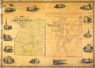
DescriptionProposal for the Walnut Hill Historic District of New Britain, Connecticut, including a map extending from West Main Street to the north, Arch Street to the east, Hart Street to the south, and Walnut Hill Park to the east. There are nine vignettes below the map on either side of the text area that show off the architecture of the area in sketches depicting various buildings, labeled with numbers and found on the map. These buildiings include the Smith-Flagg-Middlemas House (25 South High Street), the Timothy Wadsworth Stanley Residence (1 Hillside Place), 9 and 10 Camp Street, 18 Hart Street, the State Normal School, 130 West Main Street, and 8 High Street. Descriptions of the buildings are included in the text, which also explains what the Walnut Hill District is and briefly recounts New Britain's history. In the center of the text block, there is a "seal" depicting the tower of the State Normal School with the phrase, "Walnut Hill Historic District, New Britain, Connecticut" inscribed around it.
Object number2012.312.128
NotesCartographic Note: No scaleOn View
Not on view