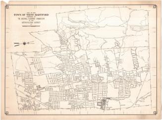
Map of Town and City of Stamford, Connecticut
PublisherPublished by
Dolph & Stewart
(American, 1931 - 1939)
SurveyorBased on an aerial survey by
W. L. Britton
(American, active 1936)
Date1936
MediumLithography; black printer's ink on wove paper
DimensionsPrimary Dimensions (image height x width): 21 x 41 3/8in. (53.3 x 105.1cm)
Sheet (height x width): 21 7/8 x 42 3/4in. (55.6 x 108.6cm)
ClassificationsGraphics
Credit LineConnecticut Museum of Culture and History collection
Object number2012.312.127
DescriptionMap of the town and city of Stamford, Connecticut, oriented on the map with north pointing toward the bottom right corner, so that the Long Island Sound appears on the left side and Greenwich appears at the top. Local streets and land plots are depicted, some labeled with the owner's name and acreage. Parks, country clubs, cemeteries, rivers, reservoirs and ponds are labeled. The New York, New Haven and Hartford Railroad runs through Stamford from Greenwich.
Label TextIn the twentieth century, the airplane provided an important new tool for the gathering of geographical data. Maps have always presented a view of the earth as if seen from above. Now, for the first time, it became possible for human beings to actually see the earth from this perspective and to capture its appearance in photographs, which could serve as maps or as the basis for maps. In 1934, the State of Connecticut contracted with Fairchild Aerial Surveys, Inc. to create a photographic map of Connecticut composed of a mosaic of photographs of the entire state, taken from an altitude of 12,000 feet. This Map of the Town and City of Stamford looks very much like earlier maps, but it is based on data compiled by W. L. Britton, who specialized in "Deeds and Aerial Surveys," suggesting that he utilized both traditional land records and pictures taken from airplanes in plotting his maps.
NotesCartographic Note: 1 inch equals 800 feetStatus
Not on view