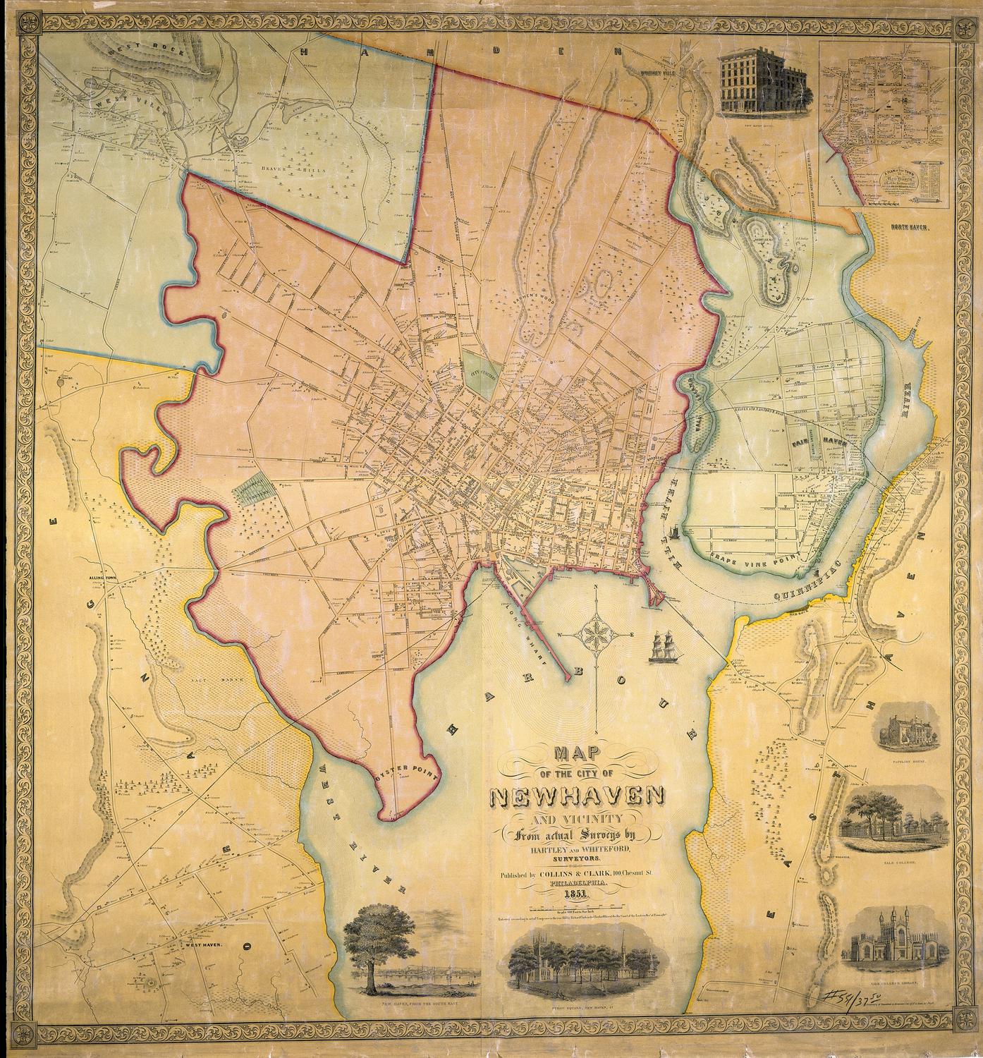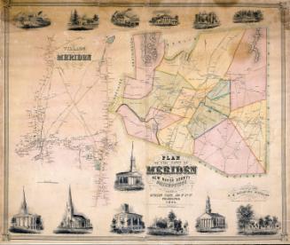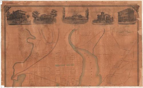
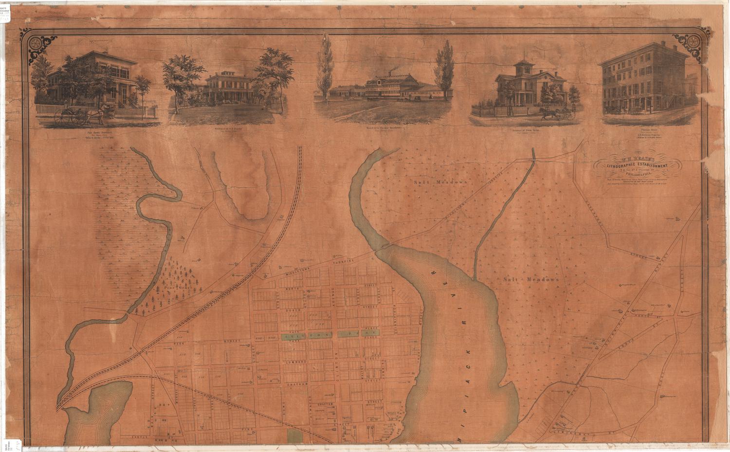
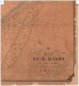
Map of Fair Haven, New Haven County, Connecticut
SurveyorSurveyed by
H. E. Van Zandt
(American)
DraftsmanDrawn by
H. E. Van Zandt
(American)
PrinterPrinted by
William H. Rease
(American, 1818 - after 1860)
PublisherPublished by
Eneas Smith
(American)
Date1859
MediumLithography; colored printer's ink on paper
DimensionsPrimary Dimensions (image .a height x width): 27 1/2 x 45 1/8in. (69.9 x 114.6cm)
Sheet (.a height x width): 28 7/8 x 47 1/2in. (73.3 x 120.7cm)
Primary Dimensions (image .b height x width): 22 7/8 x 24 3/8in. (58.1 x 61.9cm)
Sheet (.b height x width): 23 3/4 x 25 1/2in. (60.3 x 64.8cm)
Primary Dimensions (image .c height x width): 22 7/8 x 21 1/8in. (58.1 x 53.7cm)
Sheet (.c height x width): 23 3/4 x 21 3/4in. (60.3 x 55.2cm)
ClassificationsGraphics
Credit LineMuseum purchase
Object number1976.132.0a-c
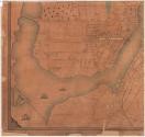
DescriptionStreet map of Fair Haven, Connecticut, in three parts, .a, .b, and .c. The map extends from Middletown Turnpike and a salt meadow to the north, to East Street to the east, the Quinnipiac River to the south and west, and the Mill River to the west. In the lower left corner of the map, three ships - a stemboat and two different sailing vessels - appear in the river near the steamboat wharf, freight depot and Tomlinson's Bridge. The New London and Hartford and New Haven Railroads run through the town, and Clinton Park and a cemetery are colored green. Buildings are marked and include the names of business and residence owners; the heaviest concentration of buildings and names appears below pine street.
At the top of part .a, there are five vignettes, all of them scenes of houses, educational institutions or business, that run across the top of the map. At the far left, the image depicted is a two-story building in what appears to be the Italian villa style. It is identified as the Fair Haven Seminary, of which Thomas G. Sloan was the principal. A figure in a horse-drawn cart sits outside the fence, while a little girl enters or exits the gate. Second from the left, a large, two-story house, trees and a front lawn comprise the vignette of O.E. Thaltby's residence. The center image is of an industrial building, flanked by two trees. Several horse-drawn carts and buggies appear in front of the buildings, which are labeled "F.B. Plumb Carriage Factory" and "S.M. Wiswell & Co." The name of the factory is Wiswell & Co. Carriage Manufactory. The fourth vignette is another multi-story house with a fence, belonging to Edwin Barnes. A horse-drawn cart is passing by the house. The fifth and final image is a four-story commercial building with shops (a "cash shop" and the names G.D. Nettleton and Brown & Ford are visible) on the first floor, located on a corner. Another building is visible behind it, and there are two carriages parked in front. The building is identified as the "Phoenix House," and G.D. Nettleton was the proprietor and S.M. Brown and E.K. Bradley were the owners.
At the top of part .a, there are five vignettes, all of them scenes of houses, educational institutions or business, that run across the top of the map. At the far left, the image depicted is a two-story building in what appears to be the Italian villa style. It is identified as the Fair Haven Seminary, of which Thomas G. Sloan was the principal. A figure in a horse-drawn cart sits outside the fence, while a little girl enters or exits the gate. Second from the left, a large, two-story house, trees and a front lawn comprise the vignette of O.E. Thaltby's residence. The center image is of an industrial building, flanked by two trees. Several horse-drawn carts and buggies appear in front of the buildings, which are labeled "F.B. Plumb Carriage Factory" and "S.M. Wiswell & Co." The name of the factory is Wiswell & Co. Carriage Manufactory. The fourth vignette is another multi-story house with a fence, belonging to Edwin Barnes. A horse-drawn cart is passing by the house. The fifth and final image is a four-story commercial building with shops (a "cash shop" and the names G.D. Nettleton and Brown & Ford are visible) on the first floor, located on a corner. Another building is visible behind it, and there are two carriages parked in front. The building is identified as the "Phoenix House," and G.D. Nettleton was the proprietor and S.M. Brown and E.K. Bradley were the owners.
Label TextThe village of Fair Haven was settled as early as 1658, but it remains part of the town of New Haven to this day. "Haven" is another word for harbor, and Fair Haven is said to have been named by Captain Richard Russell in 1639, because he was so impressed with fine harbor. During the 1800s Fair Haven was an important center of the oyster industry and the site of three shipyards. These shipyards are fully evident on this 1859 and together with a sail loft and coal shed suggest the town's close connections to the sea, though the vignettes, with pictures of the F.B. Plumb Carriage Factory and the Wiswell & Co. Carriage Manufactory emphasize its industrial prosperity. The proprietors of these businesses would have paid to have their factories so prominently represented on the map.
NotesCartographic Note: Scale: 1 inch equals 250 feetStatus
Not on view