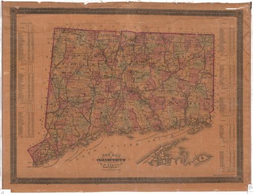
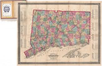
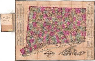
New Map of Connecticut
PublisherPublished by
Samuel D. Tilden
(American, 1828 - 1893)
PrintmakerLithographed by
Bingham & Dodd
(1860 - 1878)
Date1878
MediumLithography; black printer's ink and watercolor on paper, lined with linen
DimensionsPrimary Dimensions (image height x width): 20 7/8 x 27 1/4in. (53 x 69.2cm)
Sheet (height x width): 22 1/4 x 29 1/8in. (56.5 x 74cm)
Mount (height x width): 22 1/4 x 29 1/8in. (56.5 x 74cm)
ClassificationsGraphics
Credit LineGift of Allyn Seymour
Object number1979.100.2
DescriptionMap of Connecticut, from Massachusetts to the north, Rhode Island to the east, part of Long Island and the Long Island Sound to the south, and New York to the west. The state is divided into counties and towns, outlined and colored pink, green, or yellow. Natural features include lakes, rivers and islands, and roads are depicted. Railroad lines shown on the map include Portchester and Ridgefield; New York, New Haven and Hartford; Housatonic; Boston, Hartford and Erie; Connecticut Valley; Boston and New York Air Line; New London Northern; Connecticut Western; and Shore Line Railroads. On the left and right sides of the map are population tables for towns in each of the counties.
Label TextLike many other maps, Samuel D. Tilden's New Map of Connecticut was tied to a specific timeframe and meant to become outdated. Nineteenth-century maps of Connecticut tended to become outdated rather quickly as new towns were incorporated and new roads and railroads were constructed. Tilden further assured that his map would be out-of-date within a few years by including population statistics from the 1860 and 1870 Federal Census. Tilden no doubt hoped that owners of this map would feel compelled to buy a newer updated version once statistics from the 1880 Census became available. Aside from the up-to-date information it contains, there is nothing espcially new about the format of this map. It is similar in layout to other Connecticut state maps going back to the early part of the nineteenth century.
NotesCartographic Note: Scale: 1 inch equals 4 1/2 milesStatus
Not on view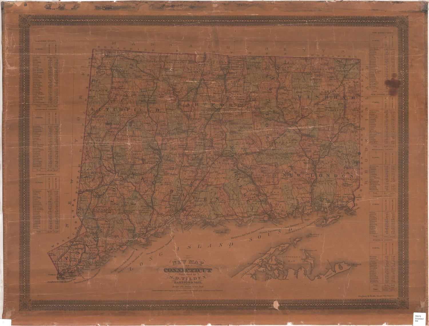


Kellogg & Bulkeley
1910-1915