Official Map of Connecticut
PublisherPublished by
Connecticut State Highway Department
(American, 1895 - 1969)
PublisherPublished by
State Park and Forest Commission
(American, 1921 - 1971)
PublisherPublished by
State Board of Fisheries and Game
(American, 1913 - 1971)
Date1953
MediumLithography; black and colored printer's inks on wove paper
Halftone; black printer's ink on wove paper
DimensionsPrimary Dimensions (image height x width): 23 x 31in. (58.4 x 78.7cm)
Sheet (height x width): 23 5/8 x 31 1/2in. (60 x 80cm)
ClassificationsGraphics
Credit LineConnecticut Museum of Culture and History collection
Object number2012.312.113
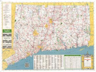
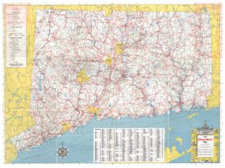
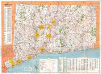
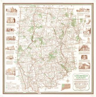
DescriptionMap of the state of Connecticut, with the border of Massachusetts to the north, the border of Rhode Island to the east, the Long Island Sound to the south, and the border of New York to the west. To the left of the map, the legend provides explanations for the depiction of roads, railroads and hiking trails; population centers; state, county and town boundaries; state parks and forests, hunting, fishing and skiing areas; and various elements of infrastructure. Below the legend is a short, illustrated guide to the marking of Connecticut highways. A place name index and list of public recreation areas appear below the map. At the bottom left is a 24-point compass rose and north arrow. The cartouche, located in the bottom right corner, shows a variety of Connecticut-related scenes, including the State Capitol building, the state bird and flower, people enjoying the outdoors, and cars on a highway.
On the reverse side, there are eight small maps: one each of New Haven, Bridgeport, Hartford, Waterbury, Danbury, Norwich and New London, and a map of the exits on the Merritt and Wilbur Cross Parkways. To the left of the city maps is a table of approximate mileages from different places in Connecticut, New York, Rhode Island and Massachusetts. The bottom portion of the sheet features nine black-and-white photographs, clockwise from top left: Olin Memorial Library, Wesleyan University; Northam Towers and the Quadrangle, Trinity College; Main Building, Teacher's College of Connecticut; Sterling Memorial Library, Yale University; Willimantic State Teacher's College; Wilbur L. Cross Library, University of Connecticut; Danbury State Teacher's College; New Haven State Teacher's College; and Palmer Auditorium, Connecticut College for Women.
On the reverse side, there are eight small maps: one each of New Haven, Bridgeport, Hartford, Waterbury, Danbury, Norwich and New London, and a map of the exits on the Merritt and Wilbur Cross Parkways. To the left of the city maps is a table of approximate mileages from different places in Connecticut, New York, Rhode Island and Massachusetts. The bottom portion of the sheet features nine black-and-white photographs, clockwise from top left: Olin Memorial Library, Wesleyan University; Northam Towers and the Quadrangle, Trinity College; Main Building, Teacher's College of Connecticut; Sterling Memorial Library, Yale University; Willimantic State Teacher's College; Wilbur L. Cross Library, University of Connecticut; Danbury State Teacher's College; New Haven State Teacher's College; and Palmer Auditorium, Connecticut College for Women.
Label TextDistributed for free by the State Highway Commission and the Forest and Parks Commission, this map clearly was meant to encourage people to get out and enjoy the state. The locations of state parks and forests are all clearly indicated and their facilties for bathing, boating, camping, fishing, and picknicking are all listed. The map also shows historic houses, art galleries, museums, and other attractions.To reach these attractions, most motorists would have had to drive through every town and city along their way. The small city maps provided on the back of the large state map appear to have been provided to help these travelers navigate the city streets. True interstate highways were still a thing of the future, though the Merritt Parkway and the Wilbur Cross Parkway provided a convenient route for those traveling to and from New York. Photographs on the back of the map feature institutions of higher learning throughout the state.
NotesCartographic Note: Scale: 1 inch equals approximately 3.5 milesStatus
Not on view