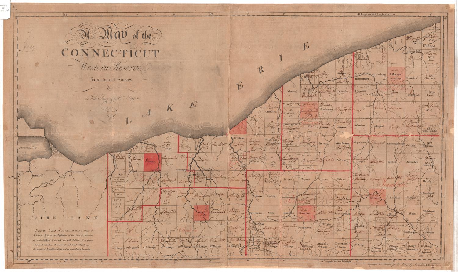
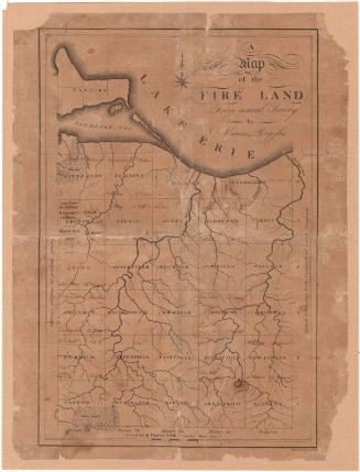
A Map of the Connecticut Western Reserve, from actual Survey
SurveyorSurveyed by
Seth Pease
(American, 1774 - 1819)
MakerUpdated by
Abraham Tappan
(American, 1759 - 1855)
PrintmakerEngraved by
Amos Doolittle
(American, 1754 - 1832)
Date1798
MediumEngraving; black printer's ink and color on paper, lined with paper
DimensionsPrimary Dimensions (image height x width): 19 x 32 1/2in. (48.3 x 82.6cm)
Sheet (height x width): 20 x 33 3/4in. (50.8 x 85.7cm)
Mount (height x width): 20 x 33 3/4in. (50.8 x 85.7cm)
Sheet (height x width): 20 x 33 3/4in. (50.8 x 85.7cm)
Mount (height x width): 20 x 33 3/4in. (50.8 x 85.7cm)
ClassificationsGraphics
Credit LineConnecticut Museum of Culture and History collection
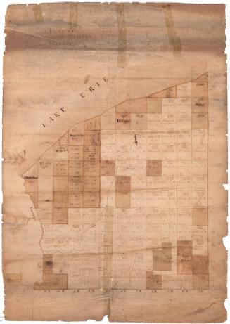
DescriptionMap of the Connecticut Western Reserve in what is now Ohio, from Sandusky Bay and Lake Erie to the north, Ashtabula and Trumbull counties to the east, Medina and Portage counties to the south, and the Fire Land to the west. The other counties depicted are Lorain, Cuyahoga and Geauga. All counties are outlined in red and each county seat is colored red. The land is divided into named townships or numbered ranges. The Fire Land (now Firelands), directly west of the Western Reserve, contains no divisions. Rivers, lakes, bays and paths are also included on the map.
Object number2012.312.99
NotesCartographic Note: No scaleOn View
Not on view


Object/Object