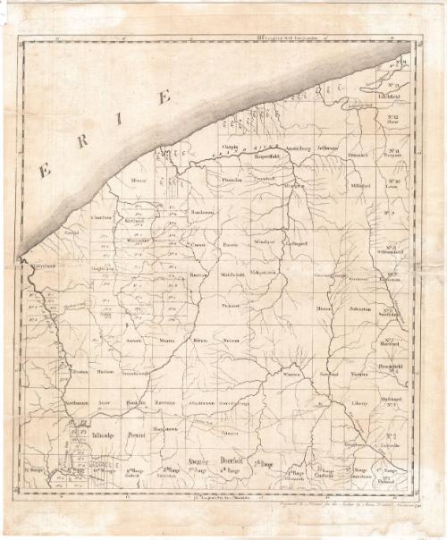
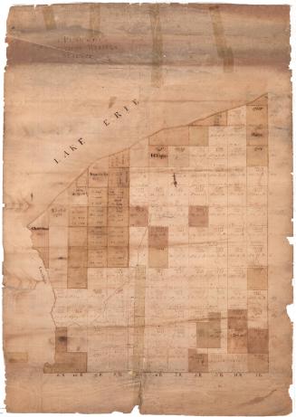
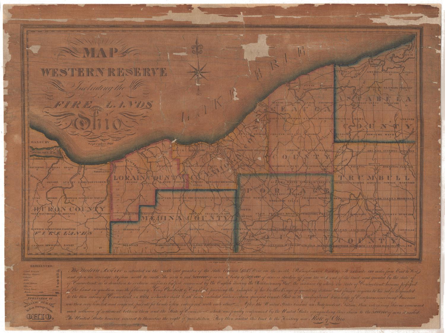
A Map of the Connecticut Western Reserve
SurveyorSurveyed by
Seth Pease
(American, 1774 - 1819)
PrintmakerEngraved by
Amos Doolittle
(American, 1754 - 1832)
PublisherPublished by
Amos Doolittle
(American, 1754 - 1832)
Date1798
MediumEngraving; black printer's ink on laid paper lined with Japanese paper
DimensionsPrimary Dimensions (image height x width): 19 x 16 7/8in. (48.3 x 42.9cm)
Platemark (height x width): 20 3/4 x 17 1/8in. (52.7 x 43.5cm)
Sheet (height x width): 21 3/4 x 18 1/4in. (55.2 x 46.4cm)
ClassificationsGraphics
Credit LineConnecticut Museum of Culture and History collection
Object number2012.312.95
DescriptionMap of the Connecticut Western Reserve in what is now Ohio, from Lake Erie to the north, Venango Creek and Big Beaver River to the west, Tuscarawas Branch of the Muskingum River to the south, and the Cuyahoga River to the west. The land is divided into fourteen rows and twelve columns, all referred to as "ranges." Some of the resulting squares have names and some do not; additionally, some are divided further into numbered sections, divided with dotted lines.
Label TextThe first printed map of the Western Reserve was engraved by Amos Doolittle, an engraver from New Haven, Connecticut, based on a manuscript map by Seth Pease, a surveyor from Suffield. According to Connecticut's original colonial charter, the western boundary of the state reached all the way to the Pacific Ocean. In 1786, the new Federal government granted Connecticut a strip of territory along Lake Erie in return for relinquishing its other western land claims. This area, known as the Western Reserve, later became part of the state of Ohio. Seth Pease was a member of the first surveying expedition sent out to the Western Reserve by the Connecticut Land Company. He engaged Amos Doolittle to produce the map and is "the author" referred to in Doolittle's inscription "Engraved &c Printed for the Author by Amos Doolittle Newhaven 1798". This sheet includes just the right hand (eastern) portion of Pease's map, which was printed in two pieces and then joined together. The fact that the border of this sheet extends all the way around it seems to indicate that the right hand portion was also issued separately.
NotesCartographic Note: No scaleStatus
Not on view


Samuel Augustus Mitchell
1834

Samuel Augustus Mitchell
1835

