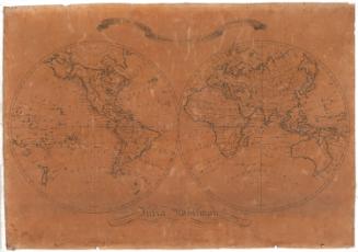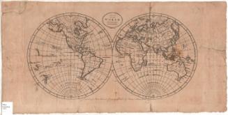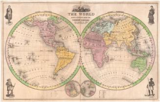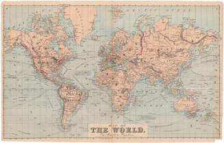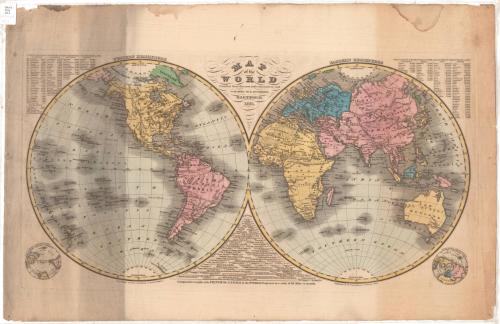
Map of the World Compiled from the most authentic sources
PrinterEngraved by
Eleazer Huntington
(American, 1789 - 1852)
PublisherPublished by
Eleazer Huntington
(American, 1789 - 1852)
Date1831
MediumEngraving; black printer's ink and watercolor on wove paper
DimensionsPrimary Dimensions (image height x width): 13 x 25 1/4in. (33 x 64.1cm)
Platemark (height x width): 13 5/8 x 25 7/8in. (34.6 x 65.7cm)
Sheet (height x width): 18 1/8 x 28in. (46 x 71.1cm)
Platemark (height x width): 13 5/8 x 25 7/8in. (34.6 x 65.7cm)
Sheet (height x width): 18 1/8 x 28in. (46 x 71.1cm)
ClassificationsGraphics
Credit LineConnecticut Museum of Culture and History collection
DescriptionMap of the world, with the western hemisphere on the left side of the map and the eastern hemisphere on the right, both of which are inscribed with lines of latitude and a single line of longitude bisecting each hemisphere. The Equator, Arctic and Antarctic Circles, and the Tropics of Cancer and Capricorn are labeled. Geographic features include mountain ranges, denoted with hachure marks, deserts, rivers, seas and lakes, many of which are labeled. All of the land features are outlined with shading, including islands. The names of settlements are provided, as well. In the upper left corner is a list of the populations of major cities in the western hemisphere in 1830; in the upper right, a similar list for the eastern hemisphere. At the bottom is a chart displaying the lengths of the world's major canals. To the left of the western hemisphere is a small map of the southern hemisphere, and to the right of the eastern hemisphere is a small map of the northern hemisphere.
Object number2012.312.92
NotesCartographic Note: The canals chart is projected at 1 inch equals 68 milesOn View
Not on view