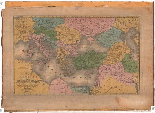
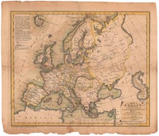
An Ancient or Bible Map
PublisherPublished by
Eleazer Huntington
(American, 1789 - 1852)
Date1831
MediumEngraving; black printer's ink and watercolor on paper, backed with linen
DimensionsPrimary Dimensions (image height x width): 12 11/16 x 19 15/16in. (32.2 x 50.6cm)
Platemark (height x width): 13 1/2 x 20 3/4in. (34.3 x 52.7cm)
Sheet (height x width): 17 1/2 x 24in. (44.5 x 61cm)
ClassificationsGraphics
Credit LineConnecticut Museum of Culture and History collection
Object number2012.312.91
DescriptionMap of Europe, part of Northern Africa and the Middle East, with classical or biblical boundaries and names. The map extends from Germania to the north, the Caspian Sea to the east, Libya to the south, and Gaul to the west. Settlements are marked with circles, some cities are marked with circles inscribed with a dot, possibly indicating important places, and capitals are marked with circles with stars around them. St. Paul's route from Jerusalem to Rome is labeled.
Label TextAn Ancient or Bible Map is one of a number of educational maps issued by Eleazer Huntington in the 1820s and 1830s. Hartford was an important center for the printing and publishing of textbooks and other educational materials during this period. The subtitle of Huntington's map explains that it was "designed for the use of Bible Classes, Sunday Schools, and Private Families," a strong reminder of the importance of religious instruction in the education of children in the early nineteenth century. Though Huntington specified that the map was intended for religious studies, it would have been equally useful to students of ancient history. It seems likely that it was based on a European map showing the Roman Empire at the beginning of the Christian era.
NotesCartographic Note: 1 7/16" equals about 200 milesStatus
Not on view
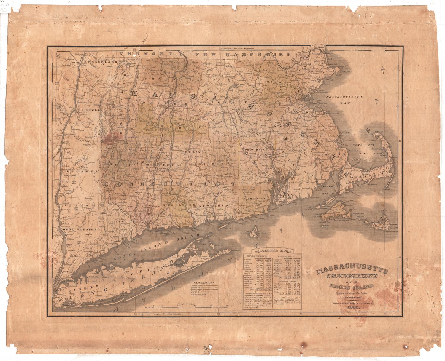
H. F. Sumner & Co.
1833