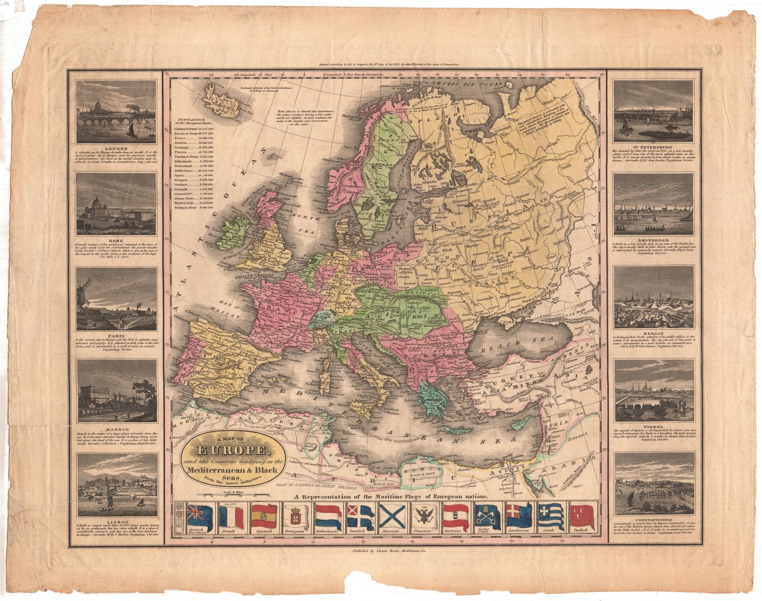
A Map of Europe
PrintmakerEngraved by
Abner Reed
(American, 1771 - 1866)
PrinterPrinted by
Abner Reed
(American, 1771 - 1866)
PublisherPublished by
Abner Reed
(American, 1771 - 1866)
Date1814
MediumEngraving; black printer's ink and watercolor on wove paper
DimensionsPrimary Dimensions (image height x width): 10 3/4 x 12 7/8in. (27.3 x 32.7cm)
Platemark (height x width): 12 1/8 x 13 5/8in. (30.8 x 34.6cm)
Sheet (height x width): 12 1/2 x 14 1/2in. (31.8 x 36.8cm)
ClassificationsGraphics
Credit LineConnecticut Museum of Culture and History collection
Object number2012.312.89
DescriptionMap of Europe, from Iceland to the north, the Caspian Sea to the east, Africa to the south, and the Atlantic Ocean to the west. Through the use of lines to denote various routes, the map depicts Napoleon's route from Paris to Moscow and his retreat from Moscow to Frankfurt, Napoleon's route between Mentz and Breslau in 1813, and Lord Wellington's route in Spain. There are several unexplained dotted lines that appear both on land and in the water, and one solid line tracing St. Paul's journey from Caesarea to Rome. Lines of latitude and longitude appear on the map, and their degree numbers are inscribed in the borders.
Label TextThe campaigns of the French Emperior Napoleon in 1812 and 1813, including the disasterous retreat from Moscow, are depicted in this 1814 map, engraved, printed, and published by Abner Reed, in rural East Windsor, Connecticut. These compelling contemporary events would have been of great interest to Americans. While the Napoleonic Wars had reached something of a hiatus in 1814, with Napoleon in exile on the island of Elba, the United States was still at war with Great Britain. The Treaty of Ghent, which ended the War of 1812, would not be signed until December 24 and news of the Treaty would take some time to reach the actual combattants. Just a year after this map was published, in March 1815, Napoleon would return from Elba in an attempt to regain his empire; his final defeat by the Duke of Wellington at the Battle of Waterloo would take place on June 18, 1815.
NotesCartographic Note: No scaleStatus
Not on view