Map shewing the connection of the Baltimore and Ohio Rail Road with other rail roads executed or in progress throughout the United States
PrinterPrinted by
Edward Weber & Company
(American, 1835 - 1854)
Dateabout 1845
MediumLithography; black printer's ink on wove paper
DimensionsPrimary Dimensions (image height x width): 17 3/4 x 21 1/4in. (45.1 x 54cm)
Sheet (height x width): 19 5/8 x 24 1/8in. (49.8 x 61.3cm)
ClassificationsGraphics
Credit LineConnecticut Museum of Culture and History collection
Object number2012.312.85
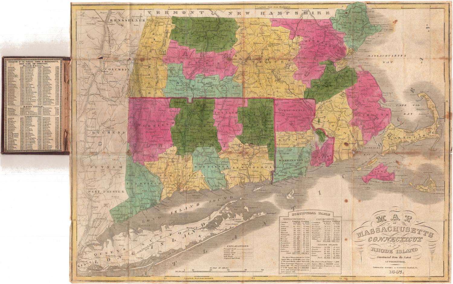
DescriptionMap of the United States, exending from Michigan to the north, the Atlantic Ocean to the east, the Gulf of Mexico to the south and Missouri, Arkansas and Louisiana to the west. The routes of the Baltimore and Ohio Railroad are drawn in solid black lines, with towns on the route labeled. There are other, smaller solid black lines that may represent connections, and double parallel lines or broken solid lines that show the routes of other railroads. The other railroads listed are an unnamed railroad running between Lancaster and Philadelphia, Pennsylvania; an unnamed railroad running along a short stretch of the canal between Pittsburgh and Holidaysburg, Pennsylvania; the Erie Railroad; and an unnamed railroad between the St. Lawrence River and Belfast, Maine. State boundaries are drawn in broken solid and dotted lines, and rivers are labeled.
Label TextThe rapid growth of the nation's railroad network is evident in this map showing the Baltimore and Ohio Rail Road and its connections in 1845. The only Connecticut railroads included on the map are the Stonington railroad, Connecticut's first, which had begun service between Stonington and Providence in 1837 and which which promised a direct route between New York and Boston, and the Hartford and New Haven Railroad, which connected those two cities, but did not yet extend much farther north or south. For some unknown reason, the Norwich and Worcester Railroad, which had been completed in 1840, does not appear. A map like this must have served as an incentive to the Connecticut railroads as they struggled to compete for their share of the trade with alternate routes that bypassed the state..
NotesCartographic Note: No scaleStatus
Not on view

Samuel Augustus Mitchell
1834

Samuel Augustus Mitchell
1835