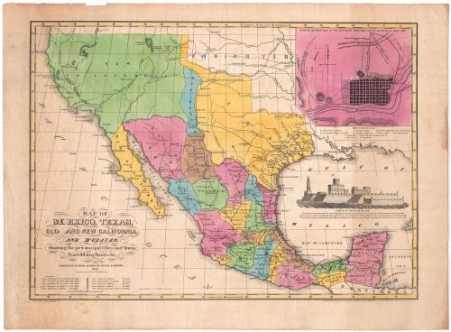
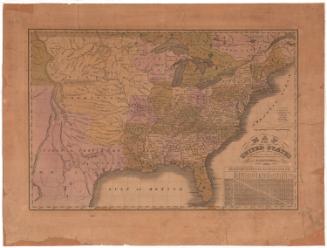
Map of Mexico, Texas, old and new California, and Yucatan.
PrinterPrinted by
E.B. & E.C. Kellogg
(American, 1840 - 1867)
PublisherPublished by
House & Brown
(American, 1847 - 1858)
Date1847
MediumLithography; black printer's ink and watercolors on wove paper
DimensionsPrimary Dimensions (image height x width): 17 3/8 x 23 5/8in. (44.1 x 60cm)
Sheet (height x width): 20 1/4 x 27in. (51.4 x 68.6cm)
Sheet (height x width): 20 1/4 x 27in. (51.4 x 68.6cm)
ClassificationsGraphics
Credit LineConnecticut Museum of Culture and History collection
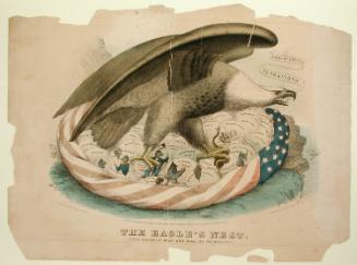
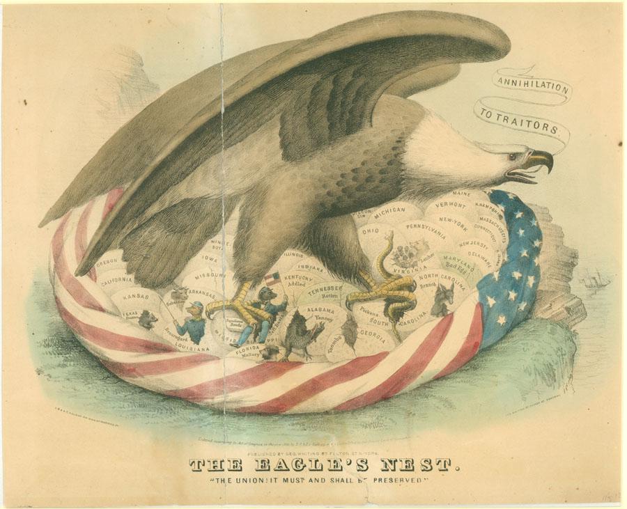
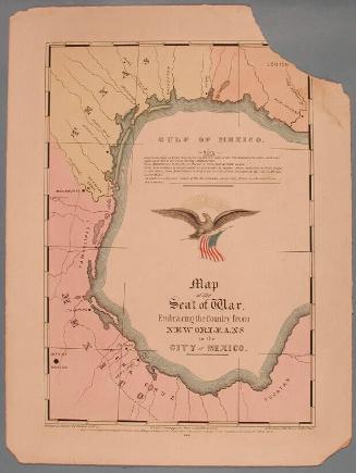
DescriptionMap of what is now California and Baja California, then called "New California" and "Old California;" present-day Texas; and Mexico, including the Yucatan peninsula, during the Mexican-American War. All but "Indian Territory," north of Texas, and Guatemala, are hand-colored. Towns are marked with circles, and what are probably the capital cities of the Mexican states are marked with a circle-within-a-circle. Double parallel lines presumably denote traveling routes, and a broken solid line marks what appears to be the only trade route on the map. Crossed swords are used to denote the locations of battles: San Jacinto, Fannings, Palo Alto, Resaca de la Palma; and Monterrey, Saltillo, Agua Nueva, and Capilleanea, all located in or near Monterrey. In the top right corner, there is an inset, titled, "Plan of Operations at the Battle of Monterey on the 21st, 22nd & 23rd Sept. 1846." It depicts the capital city at war, with the American battery, Cathedral Fort (citadel), Bishop's palace, various forts, the main plaza and cemetery labeled with numbers that correspond to a list below. A vignette on the right side shows the Castle of San Juan D'ulloa, located on the coast in Veracruz and marked with a symbol. Below the title, there is a list of distances in miles between various cities and towns.
Object number2012.312.82
NotesCartographic Note: Scale: 1 3/4" equals 200 milesOn View
Not on view

E.B. & E.C. Kellogg
1846