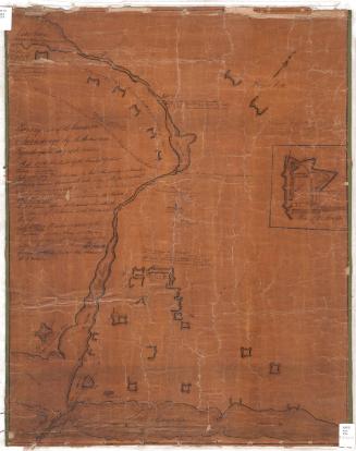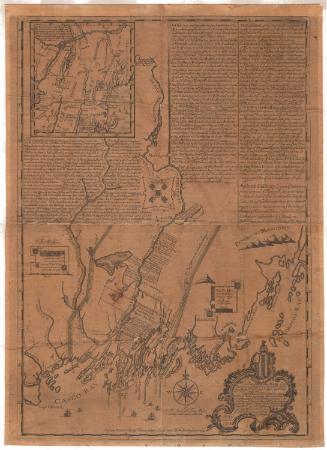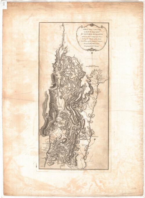
A map of the Country in which the Army under Lt. General Burgoyne acted in the Campaign of 1777, shewing the Marches of the Army & the Places of the principal Actions
DraftsmanDrawn by
Mr. Medcalfe
(British, active 1777)
PublisherPublished by
William Faden
(British, 1750 - 1836)
Date1780
MediumEngraving; black printer's ink on wove paper
DimensionsPrimary Dimensions (image height x width): 22 5/8 x 10 3/4in. (57.5 x 27.3cm)
Platemark (height x width): 23 1/2 x 11 1/2in. (59.7 x 29.2cm)
Sheet (height x width): 29 7/8 x 21 3/4in. (75.9 x 55.2cm)
Platemark (height x width): 23 1/2 x 11 1/2in. (59.7 x 29.2cm)
Sheet (height x width): 29 7/8 x 21 3/4in. (75.9 x 55.2cm)
ClassificationsGraphics
Credit LineConnecticut Museum of Culture and History collection
DescriptionRelief map of parts of New York and Vermont, with Lake Champlain to the north, the Connecticut River to the east, Albany to the south, and Fort William to the west. Relief is conveyed with hachure marks. Routes are marked on the map with dotted and broken parallel lines, and dates that probably refer to "principal actions" are marked with Xs. Farms, mills, towns and forts are labeled. The forts include Fort William Henry/Fort George, Fort Miller, Fort Hardy, Massachusetts Fort, Fort Ticonderoga, Fort Arm, and at least one unnamed fort along Otter Creek.
Object number2012.312.77
NotesCartographic Note: Scale: 1 inch equals 10 statute milesOn View
Not on view