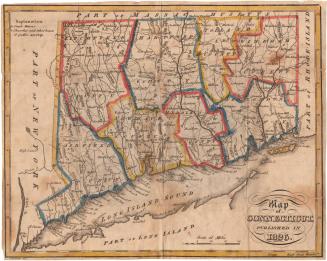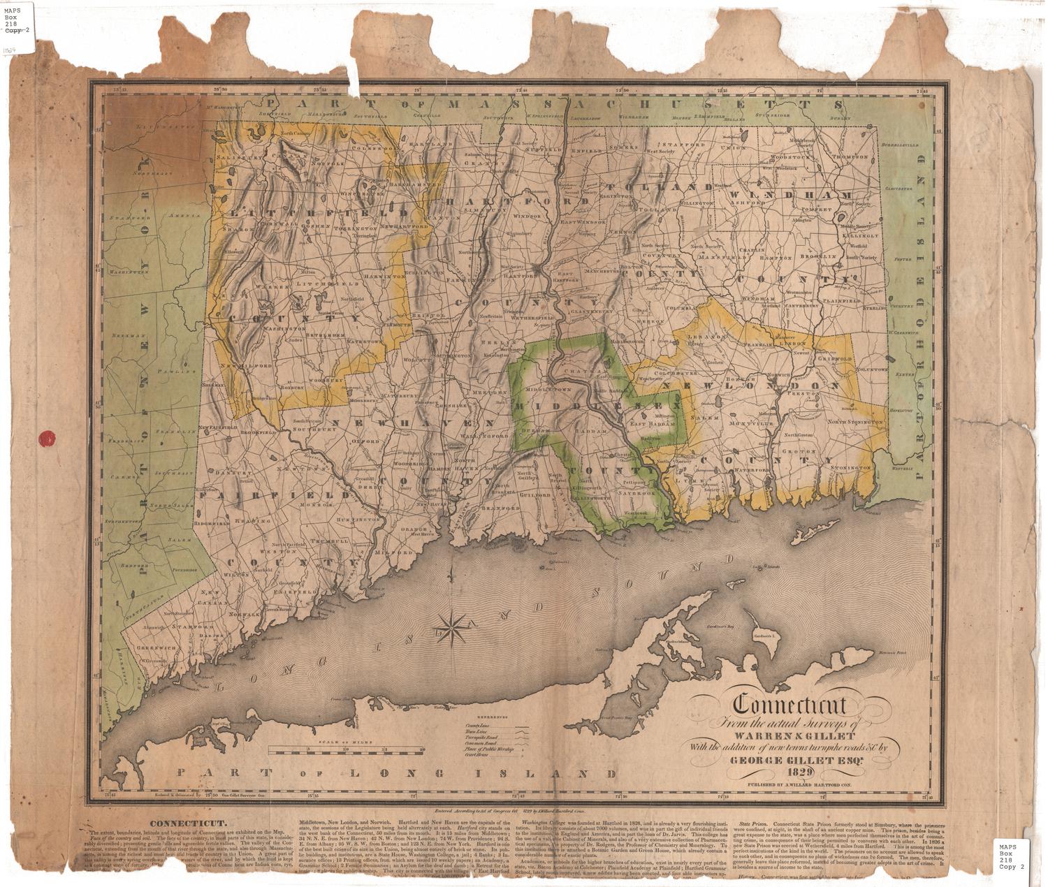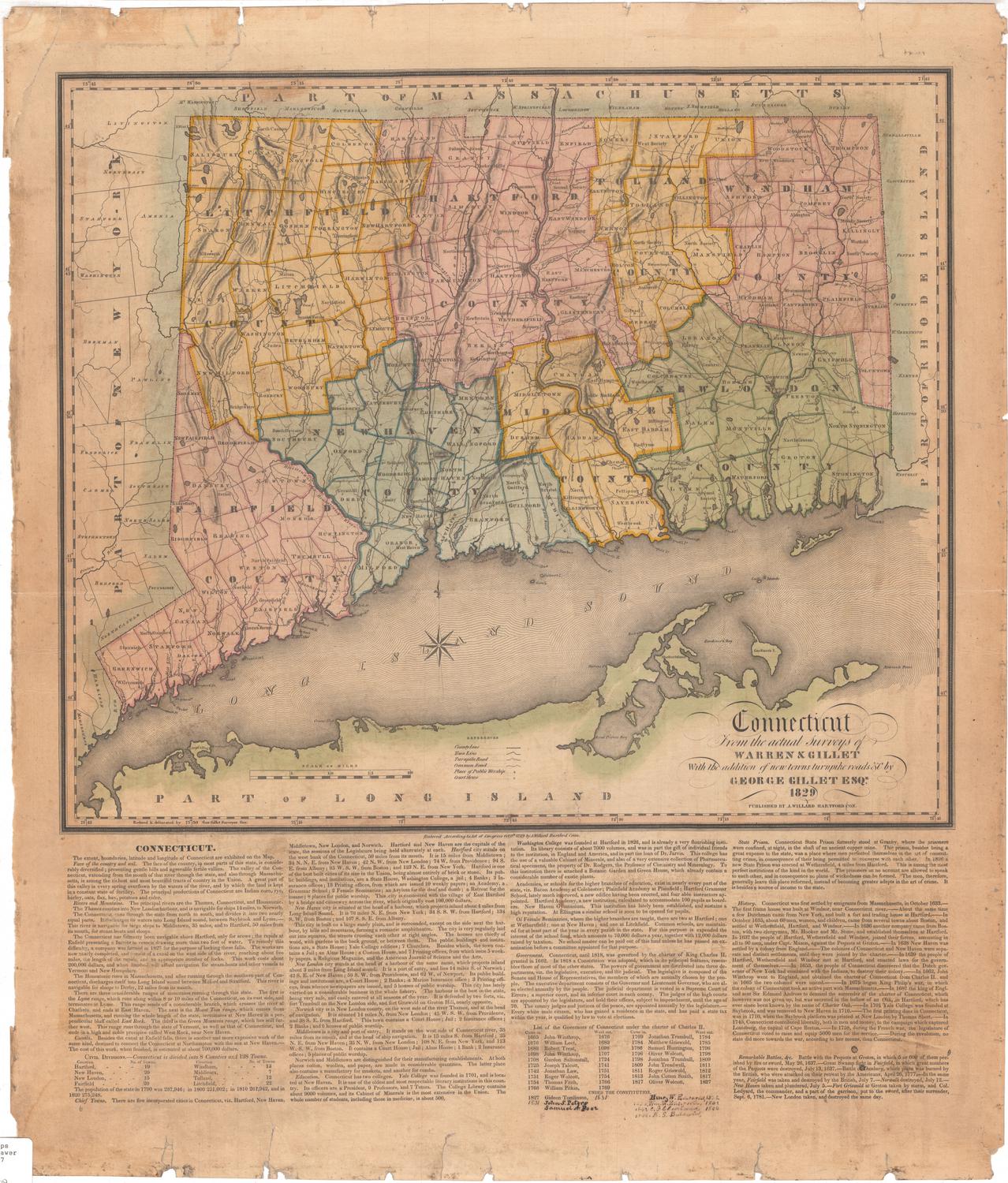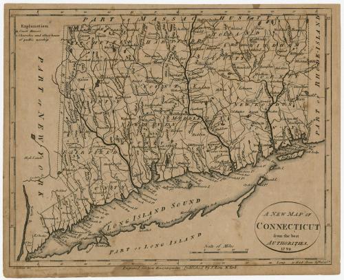
A New Map of Connecticut from the best Authorities
PrintmakerEngraved on wood by
Alexander Anderson
(American, 1775 - 1870)
PublisherPublished by
John Low
(American, 1763 - 1809)
Date1799
MediumEngraving; black printer's ink on laid paper
DimensionsPrimary Dimensions (image height x width): 7 7/16 x 9 1/4in. (18.9 x 23.5cm)
Sheet (height x width): 7 7/8 x 9 3/4in. (20 x 24.8cm)
ClassificationsGraphics
Credit LineConnecticut Museum of Culture and History collection
Object number2012.312.73
DescriptionMap of Connecticut, with the border of Massachusetts to the north, Rhode Island to the east, the Long Island Sound to the south, and New York to the west. Connecticut's counties are labeled and outlined in broken solid lines, while towns, also labeled, are outlined in dotted lines. Between New York and Connecticut, there is a piece of land separated by broken solid lines marked "Oblong." Elevation is conveyed through small triangle-shaped peaks, and many of the bays, harbors and points along the shoreline are labeled. Symbols denote the locations of court houses and churches and other places of public worship, as defined by the Explanation, found in the top left corner.
Label TextA New Map of Connecticut from the best Authorities was published in John Low's New and Complete American Encyclopedia; or Universal Dictionary of Arts and Sciences. It involved no new surveys but was closely based on William Blodget's 1791 map, "the best authorities" alluded to in the map's title. It follows Blodget's map so faithfully that it fails to include most of the new towns that had been incorporated between 1791 and 1799: Sterling, Plymouth, Wolcott, Roxbury, and Trumbull. Oxford, which was formed from parts of Derby and Southbury and incorporated in 1798, does appear on the 1799 map, perhaps because its formation was still recent news at the time this map was created. Inaccuracies such as these are reminders of how rapidly the face of Connecticut was changing in the late 1700s and how quickly maps can become outdated. The New Map of Connecticut was outdated even before it was published.
NotesCartographic Note: 1 5/8" equals 20 milesStatus
Not on view