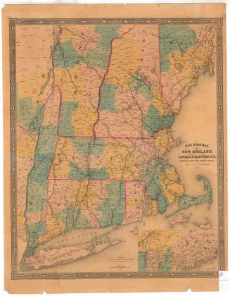
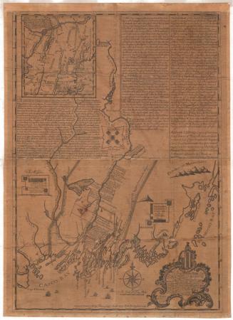
Parts of New England, New York State, and Canada
DraftsmanDrawn by
Unknown
Dateearly 19th century
MediumDrawing; black ink and watercolor on paper, lined with paper
DimensionsPrimary Dimensions (image height x width): 15 1/4 x 8 13/16in. (38.7 x 22.4cm)
Sheet (height x width): 15 1/2 x 9in. (39.4 x 22.9cm)
Mount (height x width): 15 1/2 x 9in. (39.4 x 22.9cm)
ClassificationsGraphics
Credit LineConnecticut Museum of Culture and History collection
Object number2012.312.71
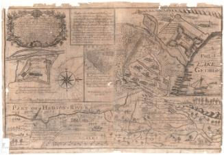
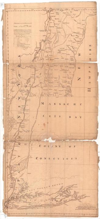
DescriptionManuscript map of parts of Canada around the St. Lawrence River, the part of New York State around the Hudson River, and most of New England. The only boundaries depicted on the map are the one dividing New York State from New England and Massachusetts and New Hampshire from Vermont. Rivers and lakes are quite prominent on the map, with the majority of the towns that are included found near the St. Lawrence River, the Connecticut River, the Hudson River, Lake Champlain and along the coast. The smaller rivers, such as the Merrimack and La Moille (now called the Lamoille) River, are also depicted. In what is now Maine, there are two areas that have been divided into squares, with the squares in the larger area numbered and labeled as “ranges.” Three of the squares in the smaller area have been numbered but not labeled. Below them is a square labeled “East Andover.”
Label TextThere are several striking things about this manuscript map. Neither the boundary between the United States and Canada nor the borders of the individual states are clearly indicated, and the Connecticut River is shown extending substantially north of its actual headwaters. The focus of the map is on the river systems leading up into Canda, and little detail is shown for areas not in close proximity to these watercourses. These rivers played an important role in military campaigns during the French and Indian Wars and the American Revolution. The uncertainty regarding the source of the Connecticut River and the location of the Candian border, and the early form of some of the place names suggest a date in the latter part of the eighteenth century or the early part of the nineteenth century, perhaps around the time of the War of 1812. Some of the early place names include: Rhinebeck on the Hudson River appears as "Rynbeck"; Monomoy Point on Cape Cod appears as "C. Malabar." The Hudson River itself appears as the "North River."
NotesCartographic Note: No scaleStatus
Not on view

Thomas Sedgwick Steele
1881
Matthews-Northrup Company
1913