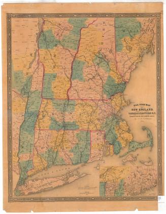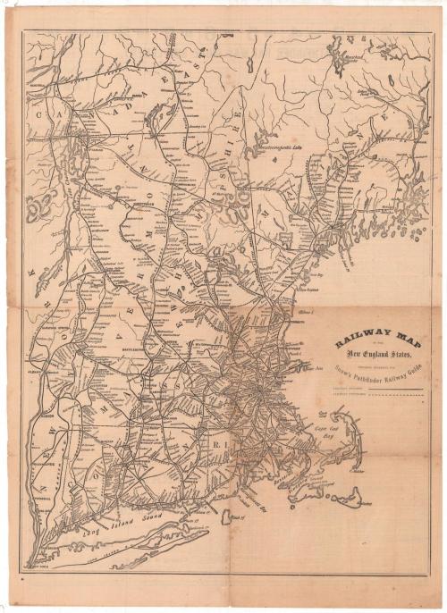
Railway map of the New England States
PublisherPublished by
George K. Snow & Bradlee
(American, founded 1869)
Date1873
MediumLithography; black printer's ink on wove paper
DimensionsPrimary Dimensions (image height x width): 18 3/4 x 14 1/8in. (47.6 x 35.9cm)
Sheet (height x width): 20 3/4 x 15in. (52.7 x 38.1cm)
ClassificationsGraphics
Credit LineConnecticut Museum of Culture and History collection
Object number2012.312.70
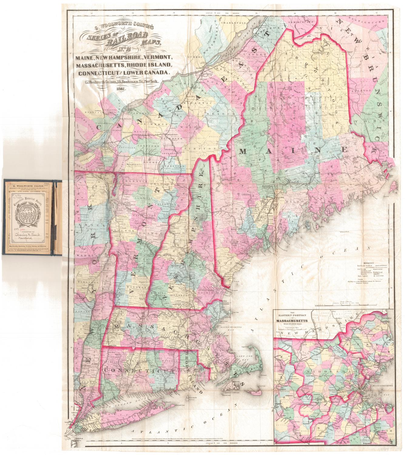
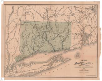
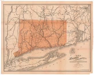
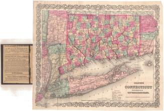
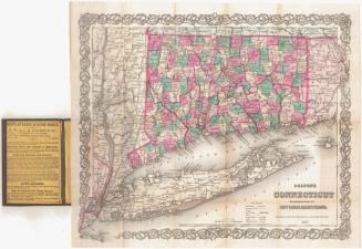
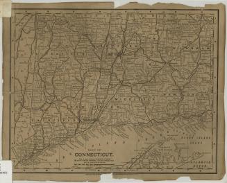
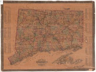
DescriptionMap of the New England states, part of New York State along the Hudson River, and part of Canada, with state and country boundaries delineated with broken solid lines. The focus of the map is the railroads, both finished and unfinished, that are depicted across New England, New York and Canada. In Connecticut, the railroads include the New York and New Haven; New Haven, Hartford and Springfield; Canal; the Housatonic; Danbury and Norwalk; Hartford, Providence and Fishkill; New London and Northern; Connecticut Western; New Haven, New London and Stonington; Stonington and Providence; and Norwich and Worcester. The cities in which the railroads stopped are listed and marked with open circles. On the verso, the timetables for mail, steamers, and passenger and freight trains leaving Boston for the week of June 2-8, 1873. At the bottom of the page are five advertisements for businesses in Boston.
Label TextIf you were planning a trip in the early 1870s, Snow's Railway Map of the New England States would have been a useful resource. It provided maps and timetables for all of the different railroad lines serving New England and the Hudson River Valley between New York and Montreal, with information on connections with steamboat lines in the major ports. This extensive transportation network not only provided easy access to small towns and large cities; it also served all of the popular tourist destinations, from Connecticut's Litchfield Hills and Massachusetts's Berkshires through Cape Cod, the White Mountains, and the Maine coast. Only a very few of these many railroad lines survived into the twenty-first century. Some of the old rail beds now serve as bicycle or hiking trails.
NotesCartographic Note: No scaleStatus
Not on view