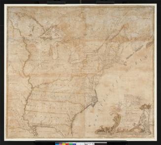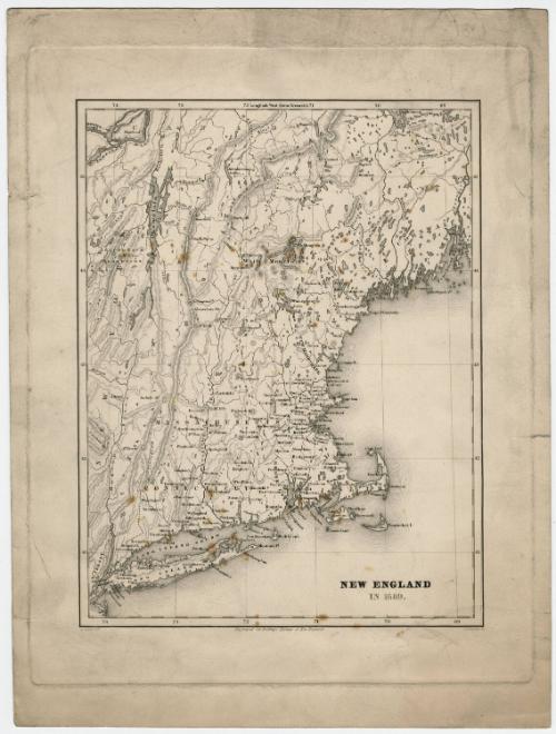
New England in 1689
DraftsmanDrawn by
Arnold Guyot
(American, 1807 - 1884)
PrintmakerEngraved by
George W. Boynton
(1809 - 1884)
Date1858
MediumEngraving; black printer's ink on wove paper
DimensionsPrimary Dimensions (image height x width): 10 3/16 x 7 13/16in. (25.9 x 19.8cm)
Platemark (height x width): 12 3/8 x 9 5/8in. (31.4 x 24.4cm)
Sheet (height x width): 13 7/8 x 10 3/8in. (35.2 x 26.4cm)
Platemark (height x width): 12 3/8 x 9 5/8in. (31.4 x 24.4cm)
Sheet (height x width): 13 7/8 x 10 3/8in. (35.2 x 26.4cm)
ClassificationsGraphics
Credit LineConnecticut Museum of Culture and History collection
DescriptionMap of the eastern United States and Canada, from Montreal to the north, the Atlantic Ocean to the east and south, and the Hudson River to the west. Connecticut, Massachusetts, Rhode Island, Plimouth, New Hampshire, Maine and Cornwall are the regions in New England that are labeled on the map, along with New York and New Jersey. Towns and settlements are marked with circles and labeled, and natural features include rivers, lakes, islands and mountains.
Object number2012.312.68
NotesCartographic note: No scaleOn View
Not on view


H. F. Sumner & Co.
1833