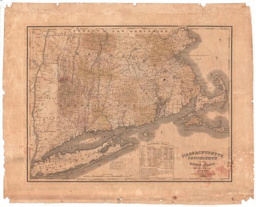
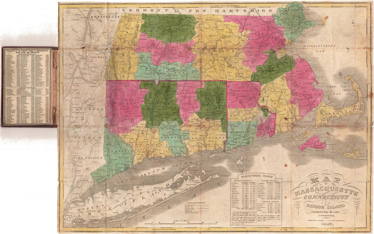
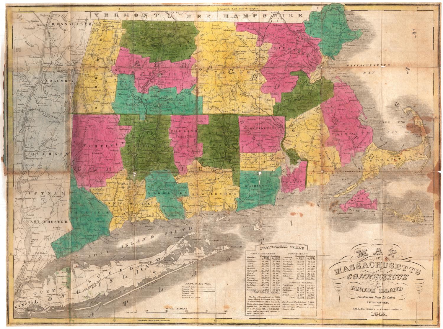
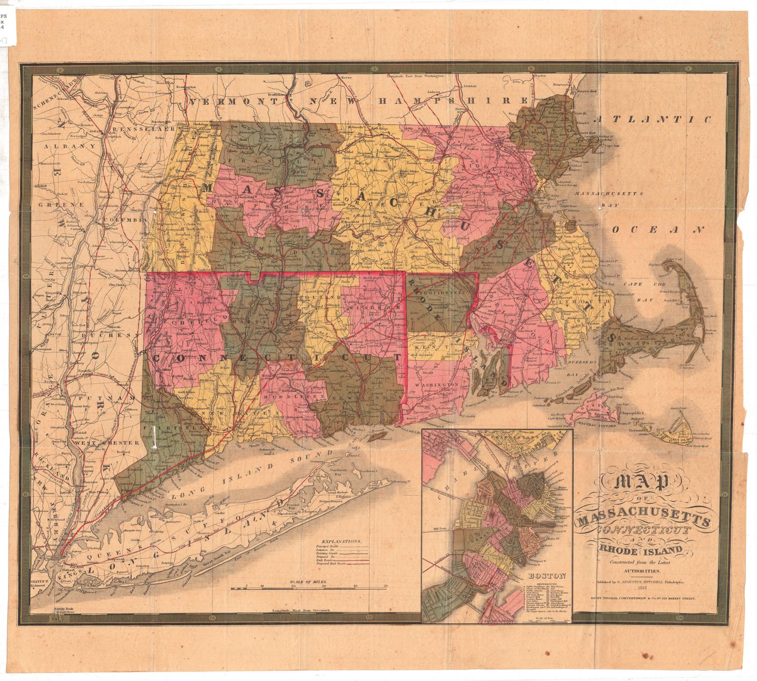
Massachusetts, Connecticut and Rhode Island Constructed from the Latest Authorities
PublisherPublished by
H. F. Sumner & Co.
(American, active 1832 - 1848)
Date1833
MediumEngraving; black printer's ink and watercolor on wove paper
DimensionsPrimary Dimensions (image height x width): 15 1/8 x 19 5/8in. (38.4 x 49.8cm)
Platemark (height x width): 15 3/4 x 20 3/8in. (40 x 51.8cm)
Sheet (height x width): 19 3/8 x 24in. (49.2 x 61cm)
ClassificationsGraphics
Credit LineConnecticut Museum of Culture and History collection
Object number2012.312.67
DescriptionMap of the states of Massachusetts, Connecticut and Rhode Island, from the borders of Vermont and New Hampshire to the north, Massachusetts Bay to the east, Long Island and the Atlantic Ocean to the south, and the Hudson River to the west. State boundaries are delineated with broken solid lines, counties with broken solid lines, and towns by dotted lines. Cities and settlements are indicated with circles and are labeled. The map emphasizes transportation, with main and common roads, existing and proposed canals, and existing and proposed railroads all depicted using different types of lines. Below the map is a statistical table listing the counties of the three states and their population numbers in 1820 and 1830. Elevation is conveyed through hachure marks.
Label TextDuring the early nineteenth century, maps were being printed and published in many different American cities. H. F. Sumner & Co. was a printer, publisher, and bookseller active in Hartford, Connecticut from 1832 to about 1836. Sumner was one of several Hartford firms publishing maps as well as prints and books at this time. As time went on, and maps got larger, map printing grew more specialized, and most of the work of printing and publishing them was done by large companies, many of them located in Philadelphia.
NotesCartographic Note: Scale: 4 1/2 inches equals 50 milesStatus
Not on view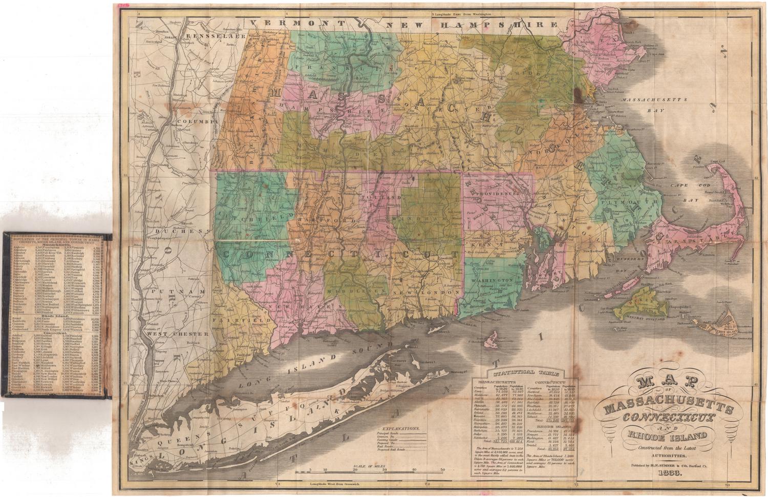
Lucius Stebbins & Co.
1859