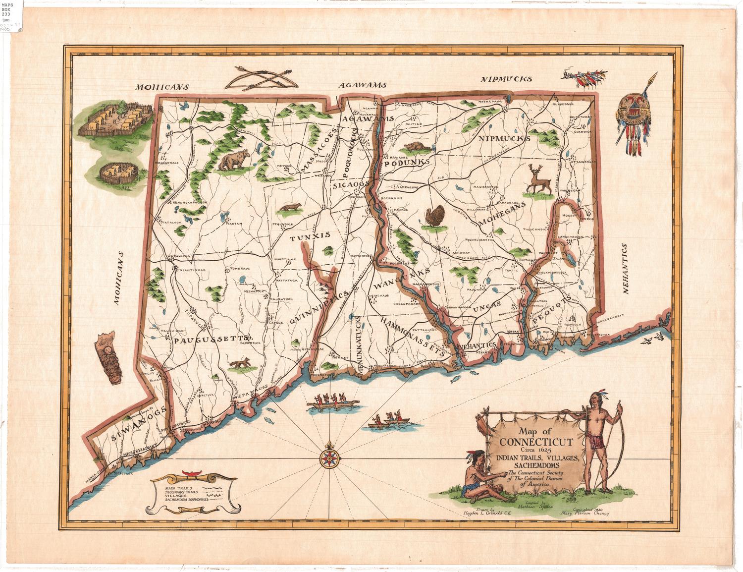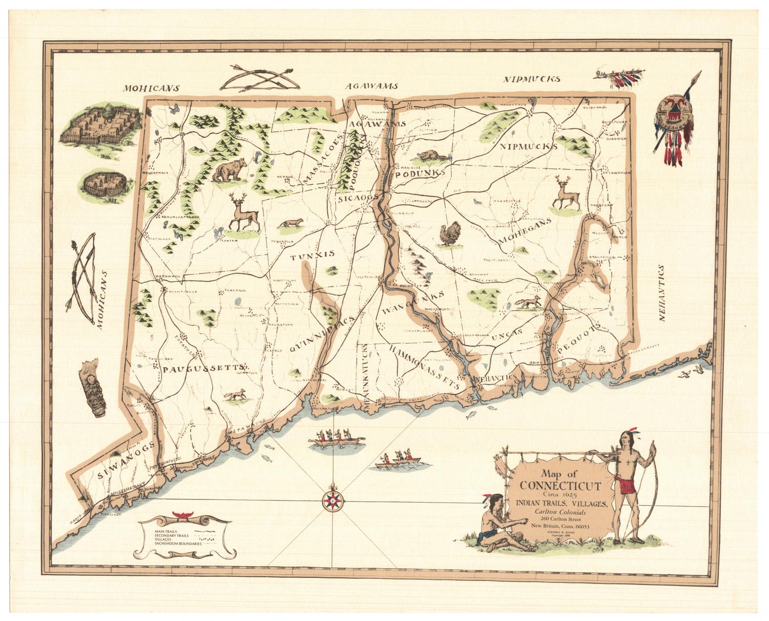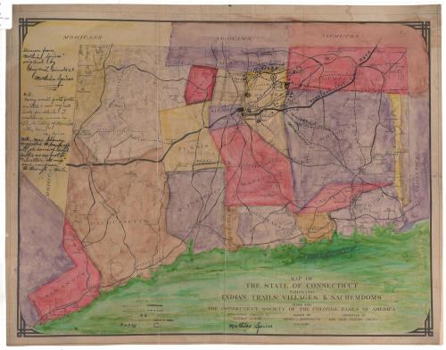
Map of the State of Connecticut showing Indian Trails, Villages, & Sachemdoms
MakerCompiled by
Mathias Spiess
(American, 1873 - 1959)
DraftsmanDrawn by
Hayden L. Griswold
(American, 1892 - 1985)
Date1930
MediumPhotography and drawing; photostat, ink and watercolor on paper, lined with Japanese paper
DimensionsPrimary Dimensions (image height x width): 15 1/8 x 20in. (38.4 x 50.8cm)
Sheet (height x width): 16 3/8 x 21in. (41.6 x 53.3cm)
ClassificationsGraphics
Credit LineConnecticut Museum of Culture and History collection
Object number2012.312.66
DescriptionMap of Connecticut depicting the sachemdoms of the Siwanog, Paugussett, Massacoe, Tunxis, Quinnipiac, Agawam, Poquonock, Sicaog, Podunk, Wangunk, Menunkatuck, Hammonasset, Nipmuck, Mohegan, Unca, Nehantic and Pequot tribes. The sachemdoms are distinguished by boundary lines and different colors. Main trails, secondary trails, villages and forts are also shown on the map. Elevation is conveyed through hachure marks.
Label TextIn 1930, Mary Pierson Cheney, president of the Colonial Dames of America, asked Mathias Spiess, a tobacco broker and the unofficial historian of the town of Manchester, to compile a map based on his extensive research on the Indians of Connecticut. This preliminary version, which includes manuscript notes and additions, apparently by Spiess, over a reproduction of a still earlier version drawn by Hayden L. Griswold. Mary Cheney found the detailed maze of local trails confusing, and on her advice, Spiess and Griswold omitted them from the final version of the map.
NotesCartographic note: No scaleStatus
Not on view