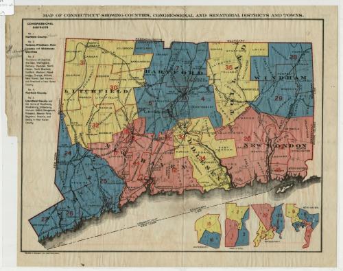
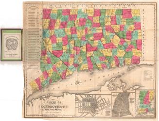
Map of Connecticut showing counties, congressional and senatorial districts and towns.
PrinterPrinted by
Kellogg & Bulkeley
(American, 1867 - 1990)
Date1910-1915
MediumLithography; black and colored printer's inks on wove paper
DimensionsPrimary Dimensions (image height x width): 10 7/16 x 13 1/2in. (26.5 x 34.3cm)
Sheet (height x width): 11 5/8 x 14 7/8in. (29.5 x 37.8cm)
ClassificationsGraphics
Credit LineConnecticut Museum of Culture and History collection
Object number2012.312.60
DescriptionMap of the state of Connecticut, with Massachusetts to the north, Rhode Island to the east, the Long Island Sound and the boundary line between Connecticut and New York to the south, and New York to the west. The state is divided into towns, counties and senatorial districts, with towns doubling as congressional districts and denoted with solid lines, while county divisions are represented by the use of pink, yellow or blue color. The 35 state senatorial districts are outlined in red and are numbered. To the left of the map is a list of the five (federal) congressional districts, with the county and, in some cases, the towns that make up the district. Below the main map are four inset maps of Waterbury, Hartford, Bridgeport and New Haven, divided into wards and state senatorial districts. The following railroad lines are delineated on the map: New York, New Haven and Hartford; Ridgefield; Shepaug, Central New England; Western; Philadelphia Reading; New London Northern; Northern; and Boston and Hartford Air Line Railroads.
Label TextIn the early twentieth century, Connecticut's state electoral system was deeply flawed with gross inequalities in representation between those living in its teeming cities and its sparsely populated small towns. The red numbers and outlines on the map indicate the thirty-five state senatorial districts. These had been reapportioned in 1903 according to population, so that large and populous cities such as Waterbury, Hartford, Bridgeport, and New Haven wound up with two, three, or even four state senators. The towns themselves continued to serve as congressional districts, however, with each town electing one or two representatives to the lower house, no matter if the town had fewer than one thousand residents or more than one hundred thousand residents. This problem was not corrected until 1965. Counties were still political units in Connecticut in the 1910s; county government in the state was abolished in 1960, though the traditional counties endure as geographical units, each with its own marked identity.
NotesCartographic Note: No scaleDate Note: While the exact date of this map is unknown, the presence of the town of Chatham indicates that it was made sometime before 1915, as in that year Chatham became East Hampton.
Status
Not on view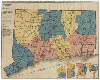
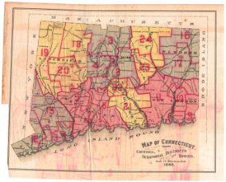
Kellogg & Bulkeley
1915-1920
Lucius Stebbins & Co.
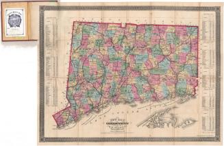
1859