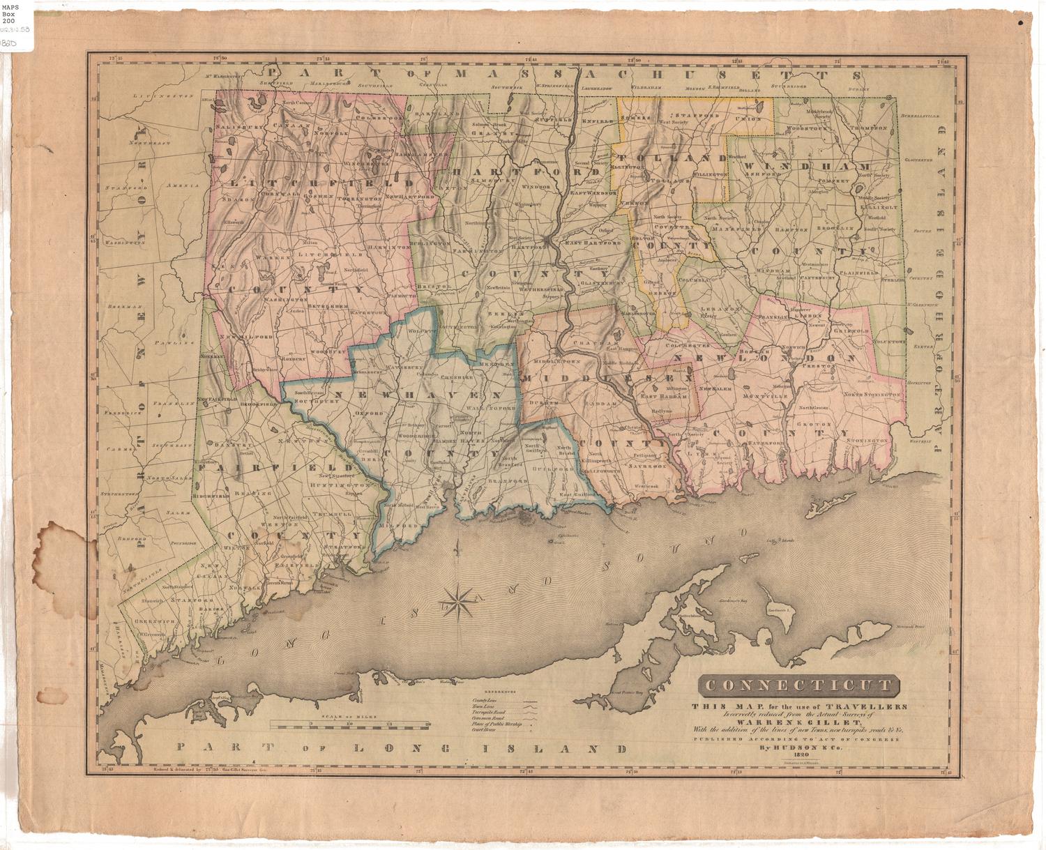
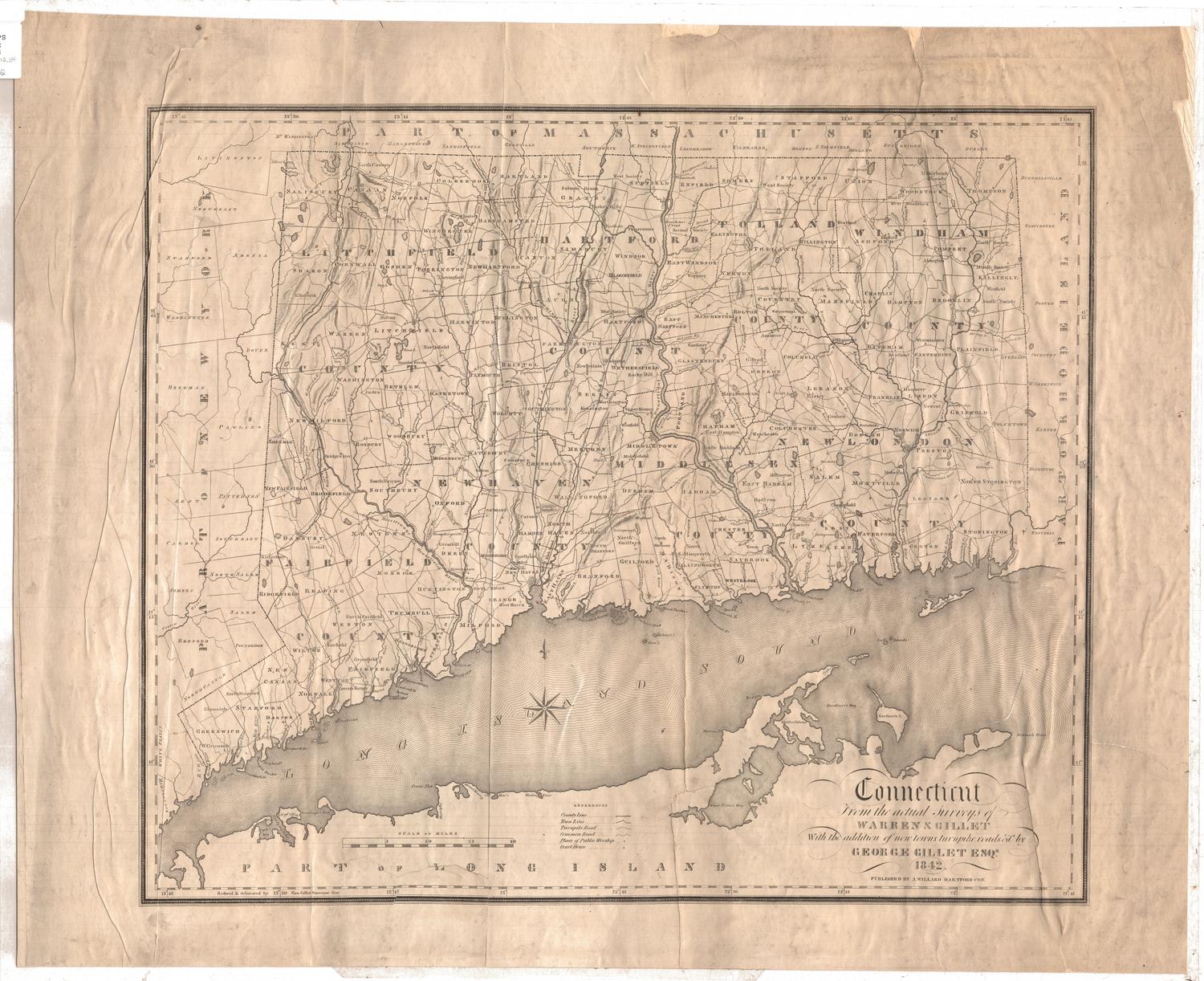
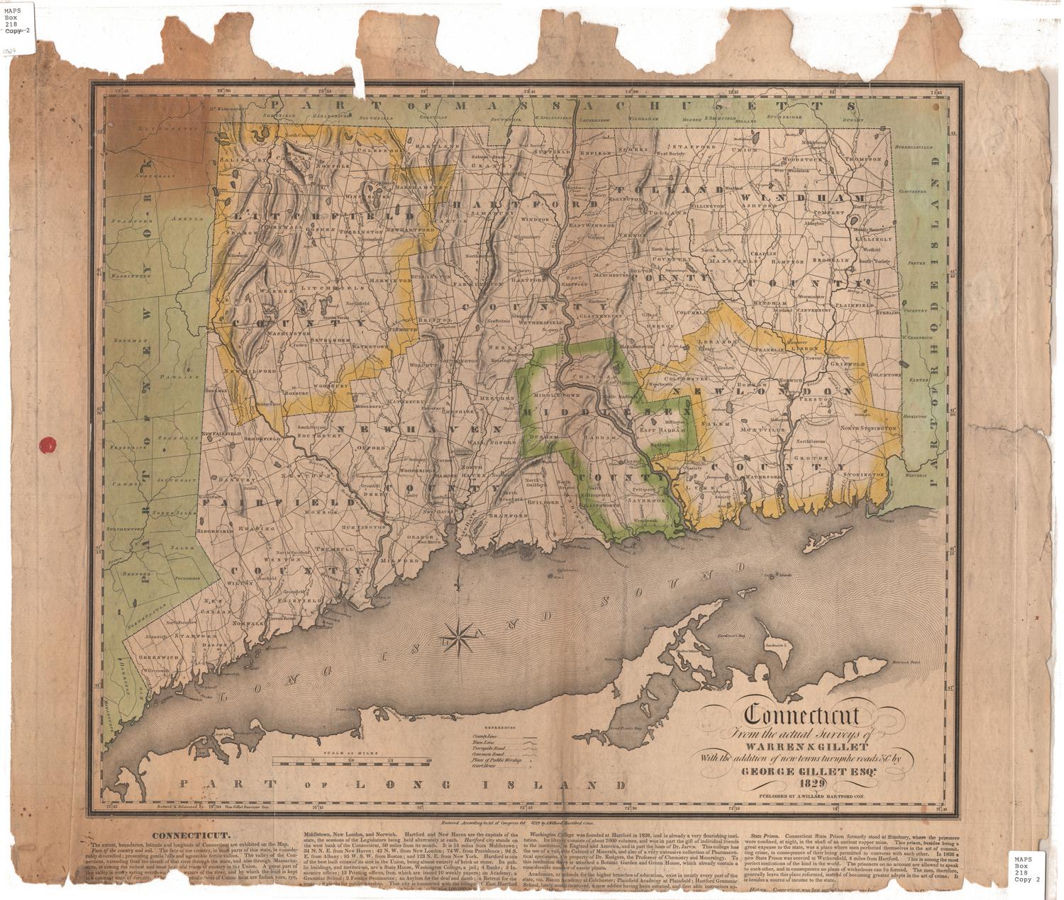
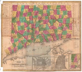
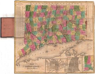
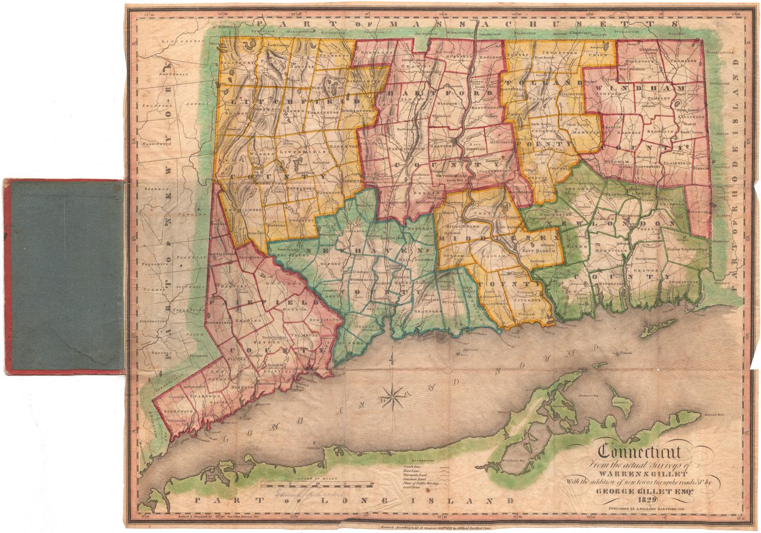
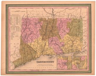
Connecticut
SurveyorSurveyed by
Moses Warren Jr.
(1762 - 1835)
SurveyorSurveyed by
George Gillet
(American, 1771 - 1853)
DraftsmanDrawn by
George Gillet
(American, 1771 - 1853)
MakerEngraved by
Asaph Willard
(1786 - 1880)
PublisherPublished by
Hudson & Co.
(American, active 1819 - 1820)
Date1820
MediumEngraving; black printer's ink and watercolor on laid paper
DimensionsPrimary Dimensions (image height x width): 17 3/4 x 21 3/8in. (45.1 x 54.3cm)
Platemark (width): 24in. (61cm)
Sheet (height x width): 20 1/8 x 24 3/4in. (51.1 x 62.9cm)
ClassificationsGraphics
Credit LineConnecticut Museum of Culture and History collection
Object number2012.312.59
DescriptionMap of Connecticut, with Massachusetts to the north, Rhode Island to the east, the Long Island Sound and Long Island to the south, and New York to the west. Connecticut is divided into towns, marked by solid lines, and counties, marked by broken solid and dotted lines. Turnpikes are marked with solid parallel lines, and "common" roads with dotted lines. Places of public worship and courthouses are also marked, with small circles. The lines and symbols are explained in the "References" list below the map. Elevation is depicted with hachure marks.
Label TextDuring the 1820s, 30s, and 40s, updated versions of the map of Connecticut that he and Moses Warren had surveyed in 1811 continued to be published. While large versions of the map hung on walls of local businesses, reduced versions were advertised as suitable for home use. According to an article that appeared in the Connecticut Courant, recommended the purchase of this map, stating that "every person ought to have a map of his own State."
NotesCartographic Note: About 3 3/4" equals 20 milesStatus
Not on view