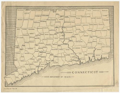
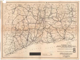
Connecticut
MakerMade by
State Department of Health
(American, 1919 - 1979)
Dateafter 1921
MediumLithography; black printer's ink on wove paper
DimensionsPrimary Dimensions (image height x width): 7 1/2 x 10 1/8in. (19.1 x 25.7cm)
Sheet (height x width): 8 1/2 x 11in. (21.6 x 27.9cm)
ClassificationsGraphics
Credit LineConnecticut Museum of Culture and History collection
Object number2012.312.57
DescriptionMap of Connecticut, with Massachusetts to the north, Rhode Island to the east, the Long Island Sound to the south, and New York to the west. The state is divided into towns, each one labeled with its name. No physical features are identified.
Label TextThis map of Connecticut was apparently a blank form issued by the State Department of Health to use in tracking the spread of disease. A similar map which appeared in the Hartford Courant in 1923 was used to trace an outbreak of smallpox that centered in Bridgeport the previous year.
NotesCartographic note: No scaleDate Note: The last town in Connecticut to be incorporated was West Haven, which separated from Orange in 1921. Since West Haven appears on this map, it date from 1921 or later.
Status
Not on view


Connecticut State Highway Department
1916
Connecticut State Highway Department
1923