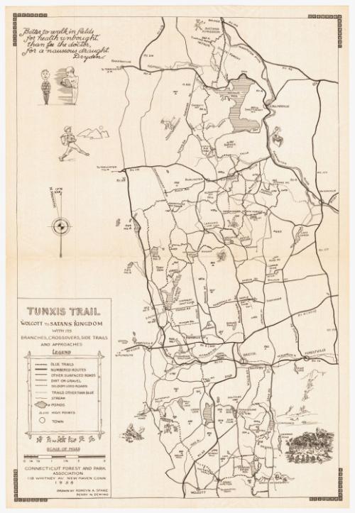
Tunxis Trail
DraftsmanDrawn by
Romeyn A. Spare
(American, 1885 - 1968)
DraftsmanDrawn by
Perry N. Deming
(American, 1888 - 1962)
PublisherPublished by
Connecticut Forest and Park Association
(American, founded 1895)
Date1955
MediumLithography; black printer's ink on wove paper
DimensionsPrimary Dimensions (image height x width): 18 x 12in. (45.7 x 30.5cm)
Sheet (height x width): 18 3/4 x 12 7/8in. (47.6 x 32.7cm)
Sheet (height x width): 18 3/4 x 12 7/8in. (47.6 x 32.7cm)
ClassificationsGraphics
Credit LineConnecticut Museum of Culture and History collection
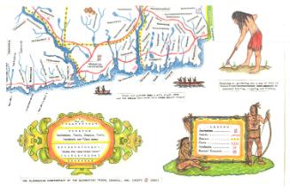
DescriptionMap of the Tunxis Trail in Connecticut, with Satans Kingdom to the north, Unionville to the east, Wolcott to the south, and Route 72 to the west. The legend, located in the bottom left corner, contains an explanation of the various lines and symbols found on the map. Not mentioned in the legend are the little pictures that appear on the map, many of them of people engaged in outdoor pursuits such as swimming, camping, rock climbing, and skiing, and also of a dinosaur two Native Americans in traditional dress, and the devil with a pitchfork. The New York, New Haven and Hartford Railroad runs east-west across the map. At the top left corner is a quote from Dryden: "Better to walk in fields / for health unbrought, / than fee the doctor, / for a nauseous draught" below which is a drawing of a doctor doling out medicine on a spoon to a main in a plaid shirt.
Object number2012.312.50
NotesCartographic Note: Scale: 1 inch equals 1 mileOn View
Not on view