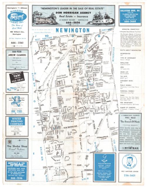
Newington, Connecticut street map and directory
PublisherPublished by
Town Maps, Inc.
(American, founded 1968)
Dateabout 1968
MediumOffset lithography; black and blue printer's inks on wove paper
DimensionsPrimary Dimensions (image height x width): 17 3/4 x 10 3/8in. (45.1 x 26.4cm)
Sheet (height x width): 22 x 17in. (55.9 x 43.2cm)
ClassificationsGraphics
Credit LineConnecticut Museum of Culture and History collection
Object number2012.312.47
DescriptionDouble-sided map and street directory of Newington, Connecticut. The map, which is on a grid, extends from the town lines of West Hartford and Hartford to the north, the town line of Wethersfield to the east, the town line of Berlin to the south, and the town line of New Britain to the west. Streets, schools, hospitals and parks and the Waterbury and New Haven lines of the New York, New Haven and Hartford Railroad are labeled on the map. There are several blue stars at various locations on the map that correspond to the advertisements that appear around it. To the right of the map is a list containing facts about the town. On the verso is the street index and more advertisements.
Label TextThe advertisements on maps often provide a snapshot of their time period. The businesses advertising on this 1960s map of Newington include Grody Chevrolet, an automobile dealership, and the Newington Taxi Service. Miano & Sons Service Station was not just a place to put gas in your car; it also offered general repairs, road service, and tune ups--and it would definitely not have been self-serve. An attendant would have checked your oil and water as well as filling your gas tank. "Newington's #1 Milkman," Mohawk Farms, offered 24-hour telephone service, and still provided home delivery. The locations of all advertisers were shown on the map, together with other local attractions. This form of advertising went back to the late nineteenth century and may ultimately have been derived from the vignettes featuring local businesses that surrounded early maps and city views.
NotesCartographic Note: No scaleStatus
Not on view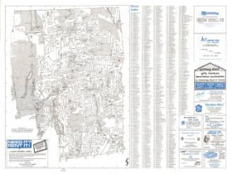
Blum's Commercial Map Publishing Company
1927-1928
R. A. Welcke Offset Co.
probably 1967

