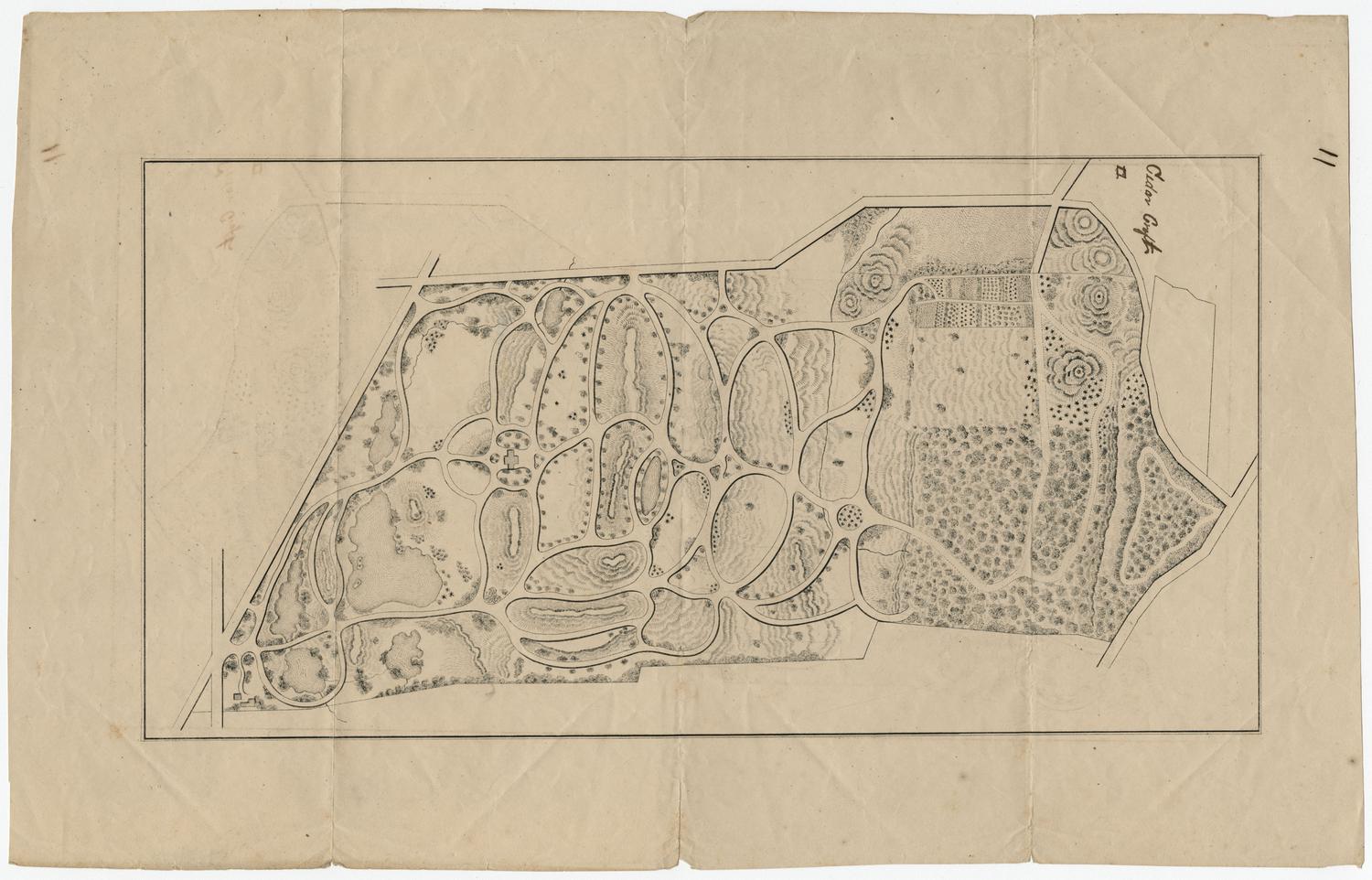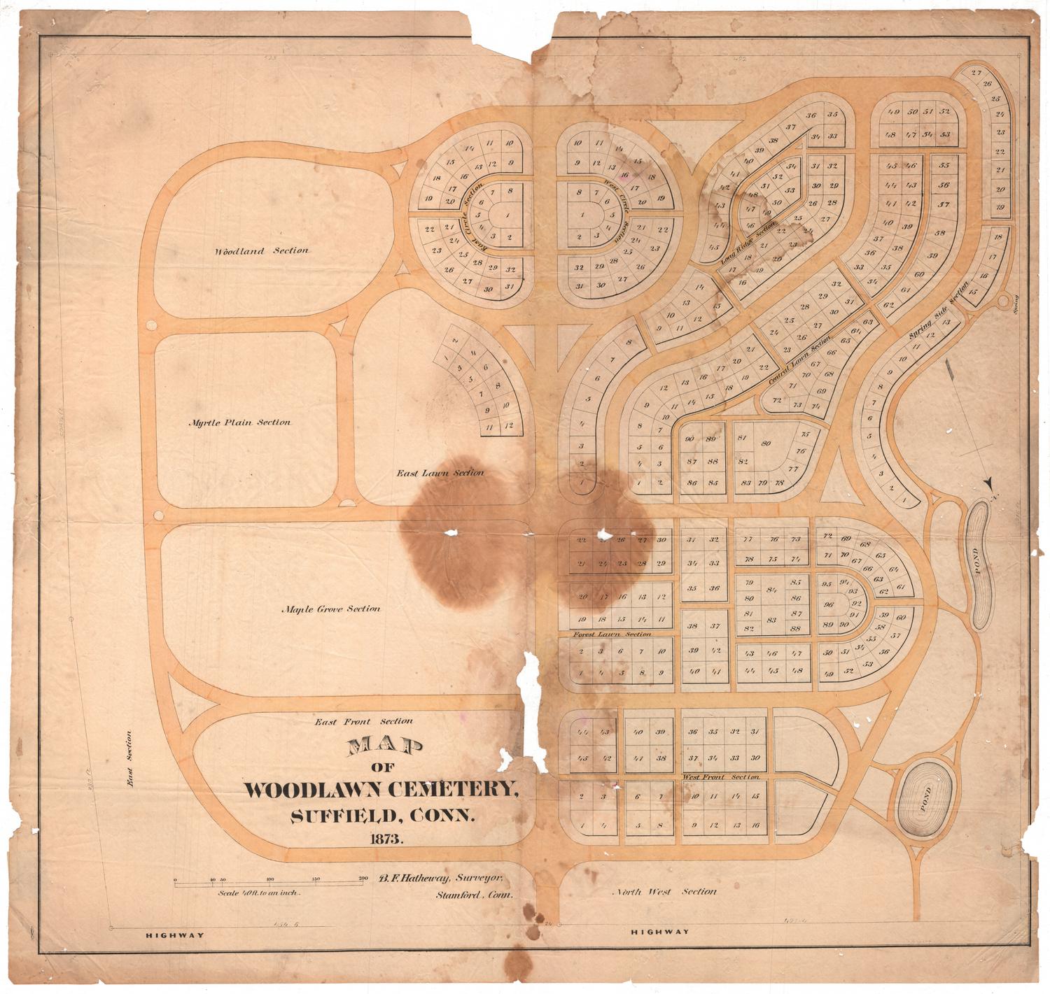
Map of Woodlawn Cemetery, Suffield, Connecticut
DesignerDesigned by
Benjamin F. Hatheway
(American, 1827 - 1906)
DraftsmanDrawn by
Benjamin F. Hatheway
(American, 1827 - 1906)
Date1873
MediumLithography; black printer's ink and watercolor on wove paper
DimensionsPrimary Dimensions (image height x width): 24 1/4 x 26 1/4in. (61.6 x 66.7cm)
Sheet (height x width): 25 5/8 x 27 1/4in. (65.1 x 69.2cm)
ClassificationsGraphics
Credit LineConnecticut Museum of Culture and History collection
Object number2012.312.45
DescriptionMap of Woodlawn Cemetery in Suffield Connecticut, oriented with north pointing toward the bottom right corner. The map shows numbered plots in each section, with the exception of Woodland, Myrtle Plain, Maple Grove and East Front Sections. The winding roads and paths are colored yellow, and there are two small ponds in the northwest part of the cemetery, on the right side of the map.
Label TextSome civil engineers specialize in land surveys, others in railroads. Benjamin F. Hatheway specialized in the design of cemeteries. He laid out cemeteries in Poughkeepsie, Fishkill, Hyde Park, New Paltz, and Auburn, New York, and in Pennsylvania and New Hampshire, as well as in the Connecticut towns of Suffield, where he was born, and Stamford, where he lived as an adult. Hatheway's plan for Woodlawn Cemetery in Suffield incorporates curving roads and ponds and to create a park-like setting for the graves. Only a portion of the cemetery is laid out in plots; the rest remained to be developed at the time Hatheway's map was made, about a year after the cemetery opened in 1872.
NotesCartographic Note: Scale: 1 inch equals 40 feetStatus
Not on view