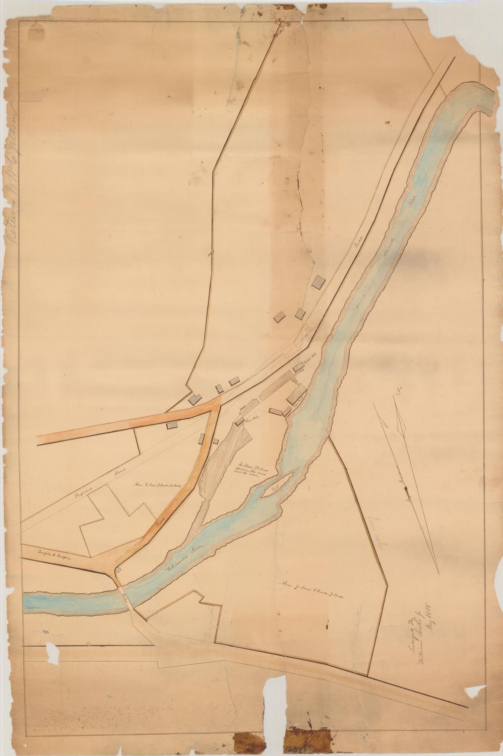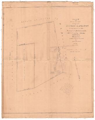
Survey of Sanford and Wiggin Lots, Mt. Tom Pond
SurveyorSurveyed by
Samuel Palmer Griffin
(American, 1862 - 1922)
Date1915
MediumDrawing; black ink on wove paper
DimensionsPrimary Dimensions (image height x width): 13 1/2 x 21in. (34.3 x 53.3cm)
Sheet (height x width): 15 1/8 x 22 1/4in. (38.4 x 56.5cm)
ClassificationsGraphics
Credit LineConnecticut Museum of Culture and History collection
Object number2012.312.43
DescriptionPlat map of the Sanford and Wiggins lots in Litchfield, Connecticut, showing the old and new lines, and including geographical bearings and measurements in feet and inches along all of the boundary lines. The Sanford property includes two structures, "Nokomis" and a piazza, and in the lower left corner, the edge of the lot is marked by the "north big rock or spilt rock." To the left of the map, the north arrows indicate true and magnetic north, and they show that the map is oriented east-west.
Label TextMount Tom Pond in Litchfield, Connecticut was the site of one of Connecticut's first state parks. In 1913, Charles H. Senff donated one hundred seventy-six acres overlooking the lake and including the summit of Mount Tom itself. The remainder of the property around the lake remained in private hands; an article that appeared in the Hartford Courant in 1915 claimed that it was "gradually becoming a highclass summer resort for a favored few." Messrs. Sanford and Wiggin were apparently among those fortunate enough to own land near this favorite fishing spot.
NotesCartographic Note: Scale: 1 inch equals 20 feetStatus
Not on view