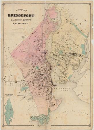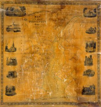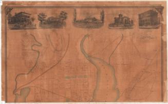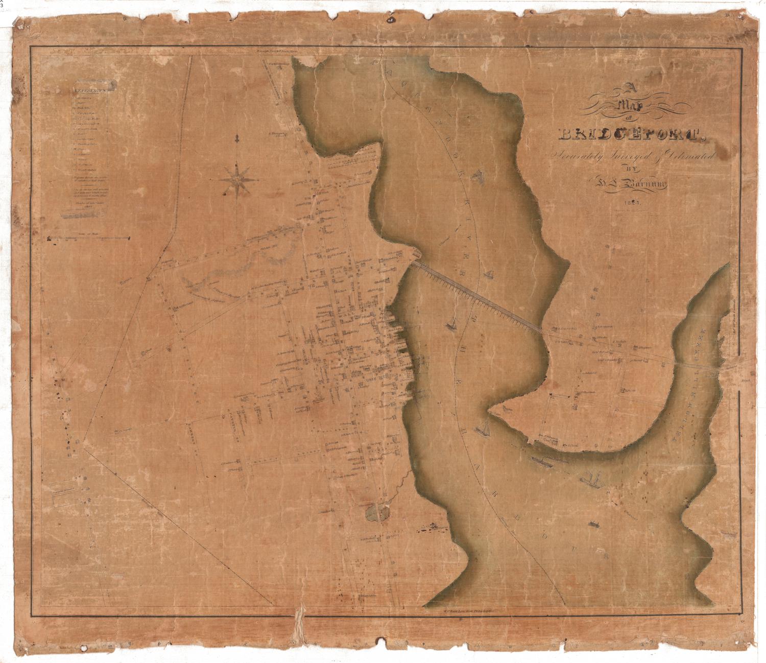
A map of Bridgeport Accurately Surveyed & Delineated
SurveyorSurveyed by
H. L. Barnum
(American, active 1824 - 1836)
DraftsmanDrawn by
H. L. Barnum
(American, active 1824 - 1836)
PrintmakerEngraved by
N. & S. S. Jocelyn
(American, founded 1818)
Date1824
MediumEngraving; black printer's ink and watercolor on laid paper, lined with linen
DimensionsPrimary Dimensions (image height x width): 17 3/16 x 21 3/16in. (43.7 x 53.8cm)
Sheet (height x width): 19 1/4 x 22 1/8in. (48.9 x 56.2cm)
Mount (height x width): 19 1/4 x 22 1/8in. (48.9 x 56.2cm)
ClassificationsGraphics
Credit LineConnecticut Museum of Culture and History collection
Object number2012.312.41
DescriptionStreet map of Bridgeport, Connecticut, extending from the turnpike to New Town and Litchfield to the north, Yellow-Mill Creek to the east, Captain Allen's residence to the south, and Stratfield Street to the west. The borough line is inscribed around the village in a broken solid and dotted line. The Paquanook (Poquonock) River and the Bridgeport harbor run through the center of the map, with the bridge spanning across the river from Beaver Street to an unnamed street, and sailboats and General LaFayette's steamship in the water. Residences and their owners, as well as churches, are depicted and labeled. Golden Hill is depicted in relief with hachure marks. In the top left, there is a list of references that provides the alphabetical abbreviations for the apothecary, baker, bookseller, cabinet maker, carriage maker, dry goods store, grocery store, hatter, lumber yard, printing office, plater, saddlery, tailor, toll house and watch maker. It also explains that the figures found on the map refer to fathoms at high water. An eight-point compass rose and north arrow appears on the left side of the map.
Label TextBridgeport was a brand new town in 1824 when this map was surveyed and drawn. In 1821, over the protests of its inhabitants, it was incorporated as a separate town at the urgings of the inhabitants of Stratford, the parent town of which Bridgeport previously formed the western part. Stratford residents feared that their town would be overshadowed by rapidly growing Bridgeport, fears that would be borne out in later years, when Bridgeport developed as a booming industrial center. In 1824, it still appears as quite a small town, the home of small merchants and craftsmen.
NotesCartographic Note: Scale: 1 inch equals about 18 milesStatus
Not on view