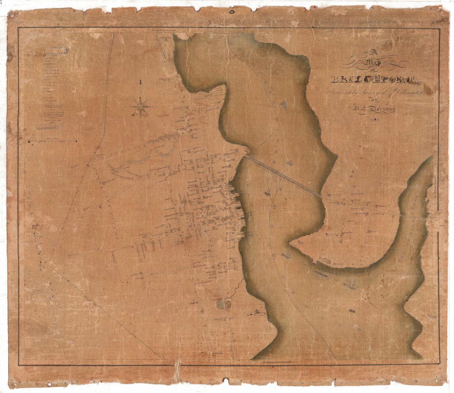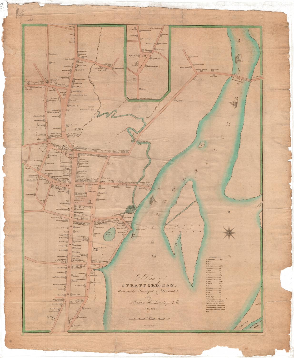
A Plan of Stratford, Connecticut
SurveyorSurveyed by
James Harvey Linsley
(American, 1787 - 1843)
DraftsmanDrawn by
James Harvey Linsley
(American, 1787 - 1843)
PrintmakerEngraved by
N. & S. S. Jocelyn
(American, founded 1818)
Date1824
MediumEngraving; printer's ink and watercolor on wove paper
DimensionsPrimary Dimensions (image height x width): 22 1/4 x 17 1/2in. (56.5 x 44.5cm)
Platemark (height x width): 23 3/8 x 17 7/8in. (59.4 x 45.4cm)
Sheet (height x width): 25 x 21in. (63.5 x 53.3cm)
Platemark (height x width): 23 3/8 x 17 7/8in. (59.4 x 45.4cm)
Sheet (height x width): 25 x 21in. (63.5 x 53.3cm)
ClassificationsGraphics
Credit LineConnecticut Museum of Culture and History collection
DescriptionMap of Stratford, Connecticut, extending from J. Frost's residence to the north, the Housatonic River to the east, James Blackman's residence to the south, and King Street to the west. Residences, churches and businesses are depicted, with the names of the owners inscribed next to the representation. In the Housatonic River (spelled "Housatonnick" on the map), there are several named ships: Wm., Tolerance, and Mary. Crossing the river at the top right is the Washington Bridge. In the bottom right corner, Milford Point crosses the Long Island Sound. Ferry Bridge Creek, Long Brook and Selby's Salt Pond are the other bodies of water named on the map.
Object number2012.312.38
NotesCartographic Note: Scale: 3/8" equals about 10 rodsOn View
Not on view