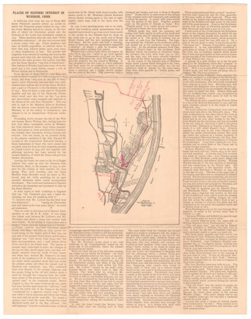
Map of Windsor, 1633-1650
PublisherPublished by
Connecticut Museum of Culture and History
(American, founded 1825)
Date1893
MediumOffset lithography; black printer's ink on wove paper
DimensionsPrimary Dimensions (image height x width): 8 1/2 x 6 3/8in. (21.6 x 16.2cm)
Sheet (height x width): 18 x 14 1/4in. (45.7 x 36.2cm)
Sheet (height x width): 18 x 14 1/4in. (45.7 x 36.2cm)
ClassificationsGraphics
Credit LineConnecticut Museum of Culture and History collection
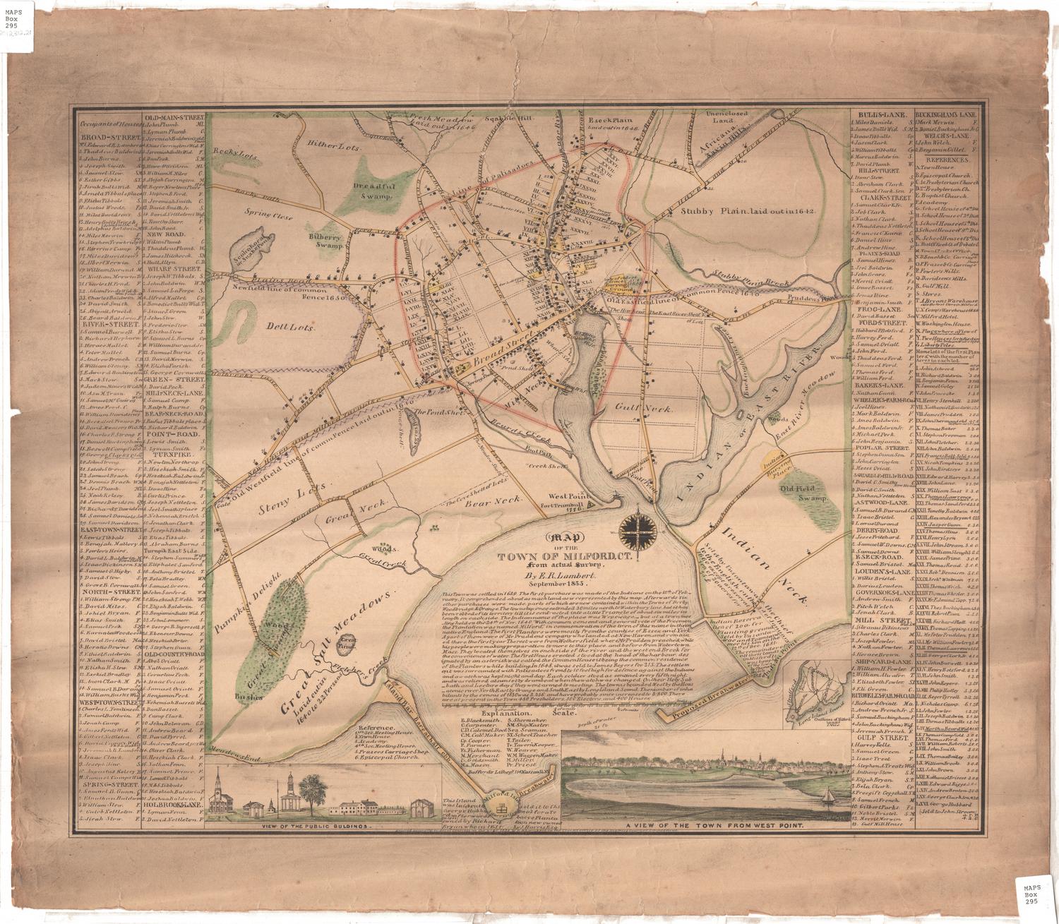
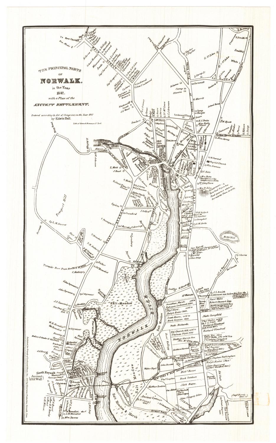
DescriptionMap of Windsor in the center of a sheet of text titled, "Places of Historic Interest in Windsor, Connecticut." The map depicts residential lots with squares representing houses and labeled with the owner's or occupant's name, as they appeared between 1633 and 1650. The settlement extends from the Farmington River to the north, the Connecticut River (called the Great River on the map) to the east, and residences to the south and west. Physical features include Hoyte's Meadow, Mr. Phelps Meadow, North West Field, Rocky Hill and the Great Meadow. Elevation is conveyed with hachure marks.
Object number2012.312.33
NotesCartographic Note: No scale
Classification Note: In terms of this project, "historical maps" refer to those made at a later date than the time period depicted.On View
Not on view


Silvermine Production
1973