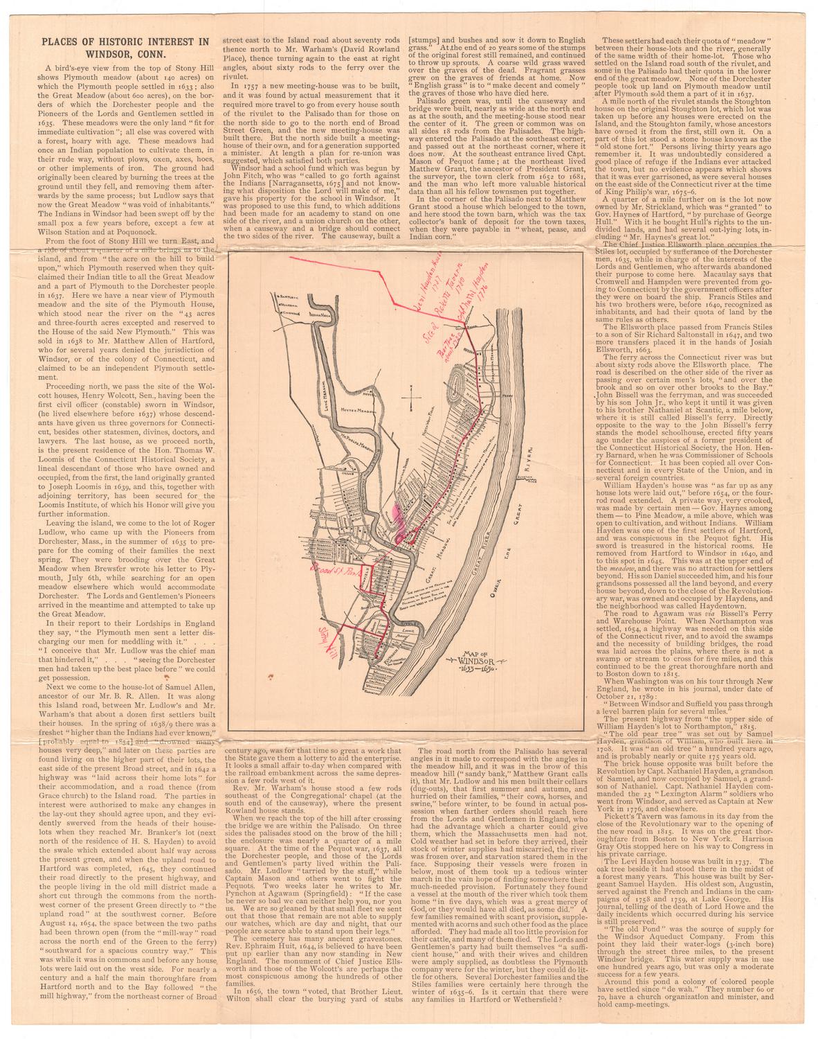
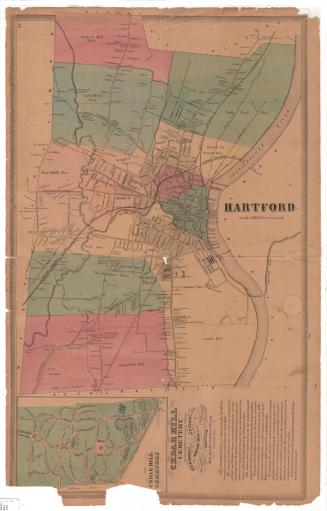
Map of Windsor, 1633-1650
PublisherPublished by
Connecticut Museum of Culture and History
(American, founded 1825)
Date1893
MediumOffset lithography; black printer's ink on wove paper
DimensionsPrimary Dimensions (image height x width): 8 1/2 x 6 3/8in. (21.6 x 16.2cm)
Sheet (height x width): 18 x 14 1/4in. (45.7 x 36.2cm)
ClassificationsGraphics
Credit LineConnecticut Museum of Culture and History collection
Object number2012.312.33
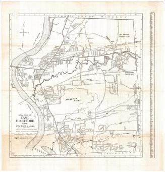
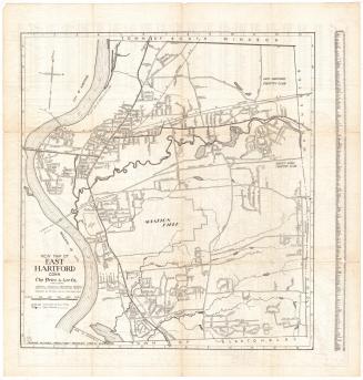
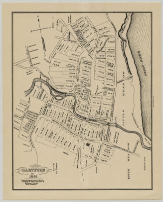
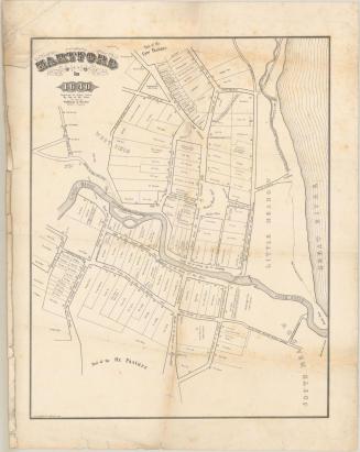
DescriptionMap of Windsor in the center of a sheet of text titled, "Places of Historic Interest in Windsor, Connecticut." The map depicts residential lots with squares representing houses and labeled with the owner's or occupant's name, as they appeared between 1633 and 1650. The settlement extends from the Farmington River to the north, the Connecticut River (called the Great River on the map) to the east, and residences to the south and west. Physical features include Hoyte's Meadow, Mr. Phelps Meadow, North West Field, Rocky Hill and the Great Meadow. Elevation is conveyed with hachure marks.
Label TextOn 14 June 1893, forty-eight members of the Connecticut Historical Society left Hartford in horse-drawn omnibuses and carriages to visit the historic old town of Windsor, Connecticut. This map, with its extensive text summarizing the town's history, served as a keepsake of that excursion. The route that the members of the society followed in the course of their tour is indicated in red on the map. Stops included the Island and Plymouth Meadows, where some of the earliest homes were located, and the Oliver Ellsworth Homestead. In the afternoon, the energetic party continued on to old Newgate Prison. Since the map represents only part of that busy day's activities, it seems possible that the imprint of the Connecticut Historical Society, which appears on the back of the map was added in 1893 to a pre-existing publication.
NotesCartographic Note: No scaleClassification Note: In terms of this project, "historical maps" refer to those made at a later date than the time period depicted.
Status
Not on view

Silvermine Production
1973