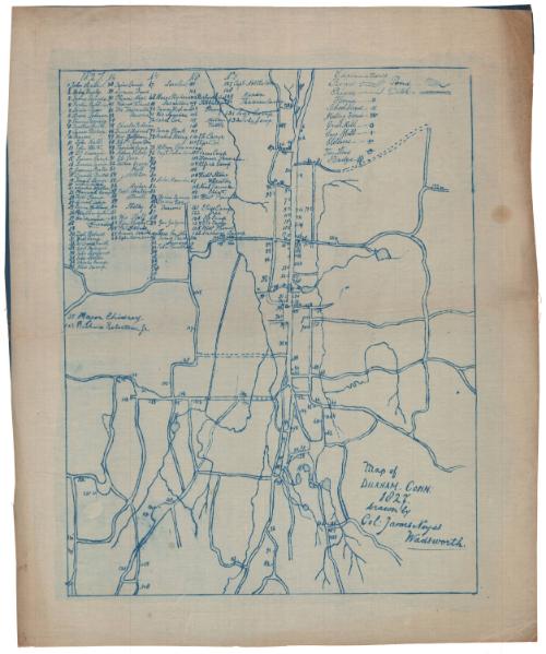
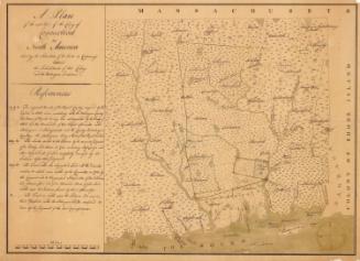
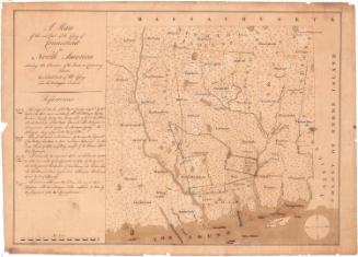
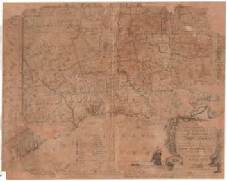
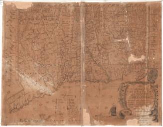
Map of Durham
DraftsmanDrawn by
Colonel James Noyes Wadsworth
(American)
Date1827
MediumBlueprints; cyanotype on linen-weave paper
DimensionsPrimary Dimensions (image height x width): 15 1/16 x 11 3/4in. (38.3 x 29.8cm)
Sheet (height x width): 18 1/4 x 15in. (46.4 x 38.1cm)
Sheet (height x width): 18 1/4 x 15in. (46.4 x 38.1cm)
ClassificationsGraphics
Credit LineConnecticut Museum of Culture and History collection
DescriptionMap of the town of Durham, Connecticut. A key at upper left references the names of property owners in 1827. An "explanation" at upper right provides a key to roads, rivers, ponds, ditches, houses, school houses, meeting houses, grist mills, sawmills, clothiers, the town house, and bridges.
Object number2012.312.25
NotesCartographic Note: No scaleOn View
Not on view

Joel Knott Allen
1791 or 1792
