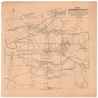
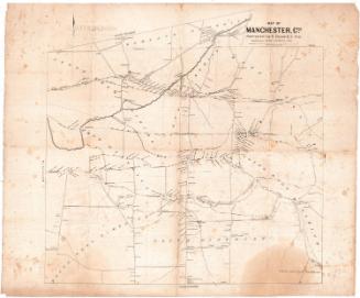
Map of the Town of Manchester
DraftsmanDrawn by
Herbert R. Fitch
(American, 1868 - 1958)
PrintmakerEngraved by
Edward F. Fisk
(American, 1857 - after 1915)
PublisherPublished by
Arthur E. Bowers
(American, 1855 - 1925)
Date1896
MediumLithography; black printer's ink on wove paper
DimensionsPrimary Dimensions (image height x width): 13 1/2 x 13 7/8in. (34.3 x 35.2cm)
Sheet (height x width): 17 x 16 7/8in. (43.2 x 42.9cm)
Sheet (height x width): 17 x 16 7/8in. (43.2 x 42.9cm)
ClassificationsGraphics
Credit LineConnecticut Museum of Culture and History collection
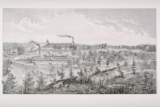
DescriptionMap of Manchester, Connecticut, extending to South Windsor to the north, Vernon and Bolton to the east, Glastonbury to the south, and East Hartford to the west. There are six concentric circles radiating out from the corner of Main and Centre Streets in half-mile increments. The Hockanum River runs northeast through the town. The New York and New England Railroad runs east-west through town and South Manchester Railroad runs north-couth between depots. Schools; mills, including Cheney Brothers and Waverley Mills; some businesses; churches and cemeteries are depicted with small rectangles and are labeled.
Object number2012.312.23
NotesCartographic Note: No scaleOn View
Not on view