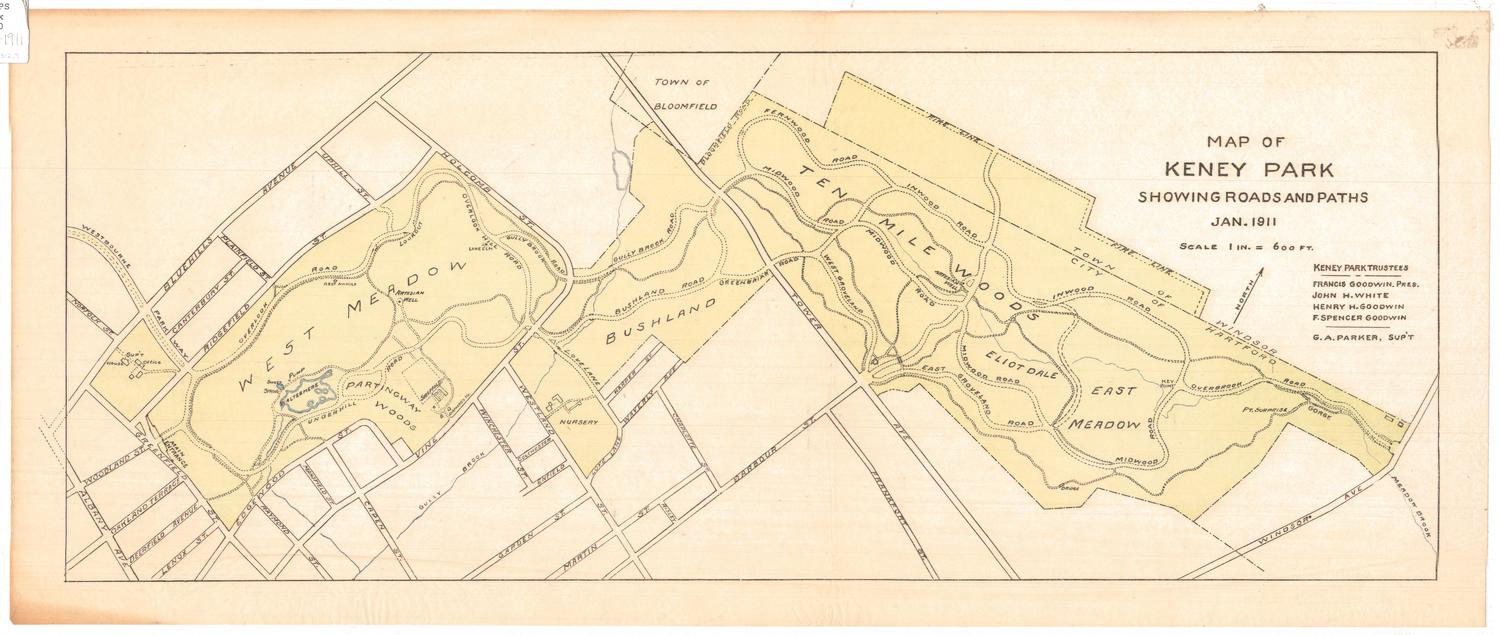
Map of Keney Park Showing Roads and Paths
MakerMade by
Unknown
PublisherPublished by
Board of Park Commissioners, City of Hartford
(American, founded 1860)
Date1911
MediumLithography; black, green and blue printer's ink on wove paper
DimensionsPrimary Dimensions (image height x width): 9 x 23 3/4in. (22.9 x 60.3cm)
Sheet (height x width): 10 1/2 x 25in. (26.7 x 63.5cm)
Sheet (height x width): 10 1/2 x 25in. (26.7 x 63.5cm)
ClassificationsEquipment
Credit LineConnecticut Museum of Culture and History collection
DescriptionStreet map of Keney Park and the surrounding neighborhood in Hartford, Connecticut, with the town line of Bloomfield to the north, Windsor Avenue and the town line of Windsor to the east, Barbour Street to the south, and Bluehills Avenue to the west. In the park, the West Meadow, Bushland, Ten Mile Woods, Eliotdale, East Meadow and other areas and features are named. Green is used to denote the park, and blue marks the locations of water, including Gully Brook and two lakes or reservoirs. Dotted and broken lines are used to denote roads and paths within the park.
Object number2012.312.9
NotesCartographic note: Scale: 1 inch = 600 feetOn View
Not on view