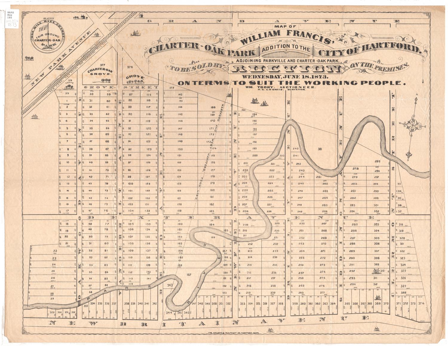
Map of William Francis' Charter-Oak Park Addition to the City of Hartford
SurveyorSurveyed by
Hiram G. Loomis
(American, 1834 - 1911)
PrinterPrinted by
Kellogg & Bulkeley
(American, 1867 - 1990)
Date1873
MediumLithography; printer's ink on wove paper
DimensionsPrimary Dimensions (image height x width): 20 11/16 x 26in. (52.5 x 66cm)
Sheet (height x width): 21 11/16 x 28in. (55.1 x 71.1cm)
ClassificationsGraphics
Credit LineConnecticut Museum of Culture and History collection
Object number2012.312.6
DescriptionMap of 374 lots in the city of Hartford in Charter Oak Park from Grand Avenue to the north, Clermont Street to the east, New Britain Avenue to the south, and Oakwood Avenue to the west. The Park River runs through the center of the addition; and the Hartford, Providence and Fishkill, and New York, New Haven and Hartford Rail Roads run across the top left corner of the map. The Hartford/West Hartford town line runs diagonally between Reed and Newfield Avenues. In the top left corner, there is a circular seal with the phrase "One Mile Race Course" around its outer edge, and an American flag and the words "Fair Ground Charter-Oak Park" inside.
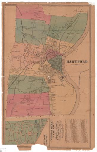
Label TextWilliam Francis was a Hartford real estate developer. After successfully developing Parkville in the early 1870s, he turned his attention to the area immediately to the west and in 1873 offered 400 house lots for sale in what was known as the Charter Oak Park addition. The land was previously a dairy farm and was located directly across from Charter Oak Park in West Hartford, which opened in 1873 as a popular venue for harness racing. Developments like Francis's Charter Oak Park addition illustrate the rapid growth of Hartford during the late 1800s as residential neighborhoods expanded outwards from the central city, reaching rapidly out towards the suburbs.
NotesCartographic note: No scaleSubject note: The streets that make up the Charter Oak Park addition are Grove Street, Dexter Avenue and New Britain Avenue running east-west, and Oakwood, Vanderbilt, Reed, Newfield, Brinley, and Giddings Avenues and Clermont Street running north-south.
Status
Not on view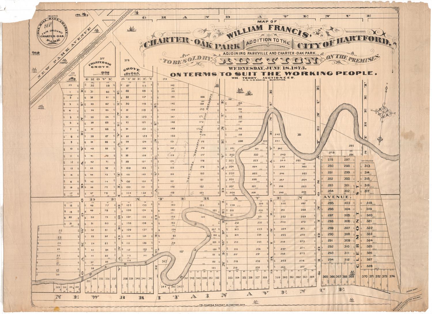


O.H. Bailey and Company