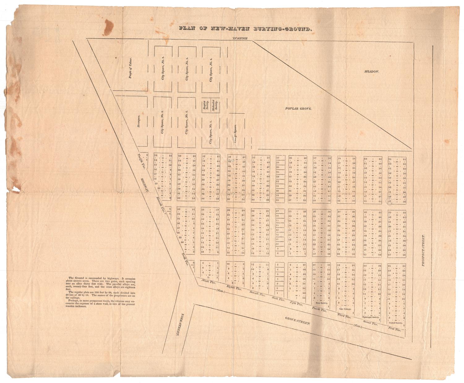
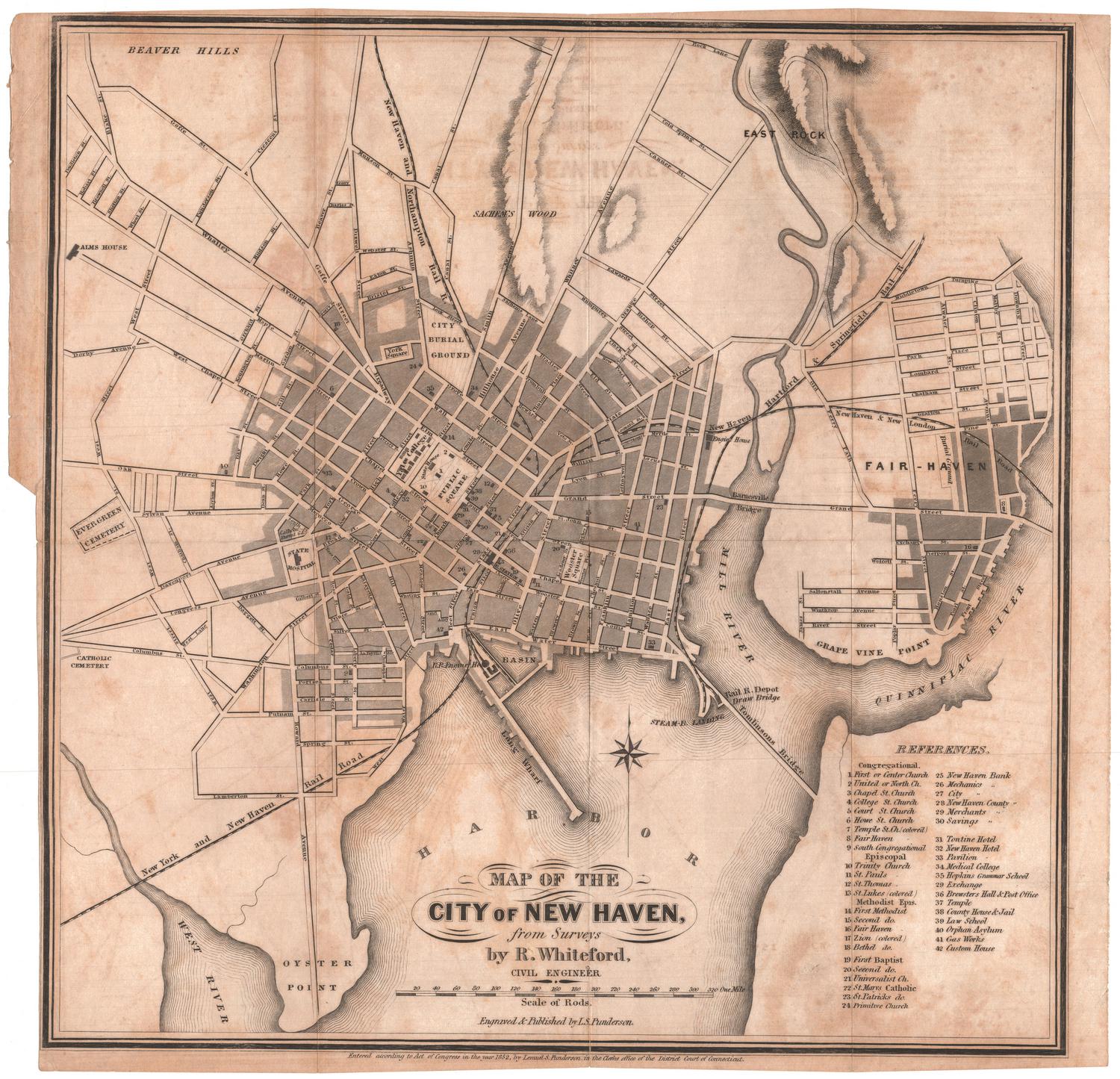
Plan of the New-Haven Burying-Ground
MakerMade by
Unknown
Datebefore 1839
MediumEngraving; printer's ink on wove paper
DimensionsPrimary Dimensions (image height x width): 13 1/2 x 15 1/4in. (34.3 x 38.7cm)
Sheet (height x width): 15 11/16 x 19 1/16in. (39.8 x 48.4cm)
Sheet (height x width): 15 11/16 x 19 1/16in. (39.8 x 48.4cm)
ClassificationsGraphics
Credit LineConnecticut Museum of Culture and History collection
DescriptionMap of the burial ground in New Haven, Connecticut, showing numbered plots in twelve vertically-oriented, numbered tiers. The first tier is labeled United Society; the second, Episcopal Society; the third, Yale College; and the fourth, First Society. Above the numbered tiers, on the left side of the map, are six city square plats, two smaller areas for Baptist and Methodist society, a college square plat, and two larger sections for "Strangers" and "People of Colour." To the right of this is a large rectange diagonally bisected into a meadow and a poplar grove. To the north is the highway; to the east, Prospect Street; to the south, Grove Street; and to the west, another highway.
Object number2012.312.4
NotesCartographic Note: No scale
Subject note: The New Haven Burying Ground is now known as the Grove Street Cemetery.
Related Note: This map is similar to 2012.312.3; this one appears to be an earlier rendering of the cemetery. The meadow and poplar grove that are shown in this map have been turned into more burial plots, and many of the plots that were available in the city squares have been numbered in 2012.312.4. (LAST NAME? DATE?)
On View
Not on view

Object/Object